Buenos Aires Province: Argentina's Economic and Demographic Powerhouse
The Province of Buenos Aires is the largest and most populous administrative division in Argentina. Covering approximately 11% of the national territory, it serves as the country's primary economic engine and a critical center for political influence. Home to nearly 38% of Argentina's total population, the province is a diverse region ranging from the bustling urban sprawl of Greater Buenos Aires to the serene Atlantic coast and fertile agricultural plains.
Key Facts
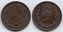
- Population: Approximately 17.5 million people (2022 census).
- Area: 307,571 km², making it the largest province in Argentina.
- Capital: La Plata.
- Economy: The nation's chief exporter, contributing significantly to the national GDP.
- Demonym: Residents are known as bonaerense.
- HDI: 0.842 (Very High), ranking 11th nationally.
Historical Evolution

The region's recorded history began in 1536 when Pedro de Mendoza founded Santa María del Buen Ayre. After an initial period of hostility with indigenous populations led to the settlement's evacuation in 1541, Juan de Garay re-founded the area in 1580 as Santísima Trinidad y Puerto Santa María de Los Buenos Aires.
Following independence from Spain in 1816, the province became a central flashpoint in the Argentine Civil Wars. Tensions between Federalists (who sought provincial autonomy) and Unitarians (who favored a strong central government) persisted for decades. Governor Juan Manuel de Rosas managed to maintain a tenuous unity through the Argentine Confederation starting in 1831.
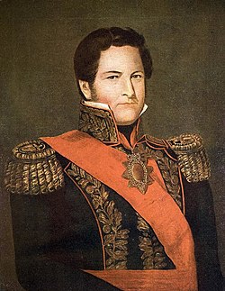
The province briefly existed as the independent State of Buenos Aires from 1852 to 1861 before reincorporating into the Argentine Republic. A pivotal shift occurred in 1880 when the city of Buenos Aires was federalized, separating the national capital administratively from the province.
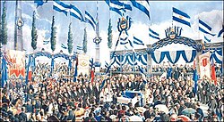
In 1882, Governor Dardo Rocha founded La Plata to serve as the new provincial capital. This era saw an explosion of growth fueled by British investment and European immigration, with the population doubling twice between 1895 and 1914.
Modern Development and Urbanization
While the 1929 Wall Street crash slowed agricultural exports, subsequent governments under the Concordance and Juan Perón invested heavily in public works, including schools, clinics, and infrastructure. By the mid-20th century, growth shifted toward the suburbs of Buenos Aires. To manage the resulting flooding in these wetland areas, the Roggero Reservoir was completed in 1971, facilitating the growth of the Greater Buenos Aires region, which now houses roughly two-thirds of the provincial population.
Geography and Climate
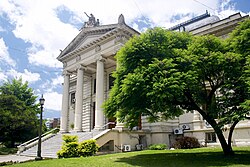
The landscape of Buenos Aires Province is predominantly flat, though it features two low mountain ranges: the Sierra de la Ventana and the Sierra de Tandil. The highest point in the province is Cerro Tres Picos, reaching 1,239 meters above sea level.
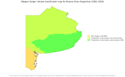
The climate varies significantly by region:
- Northern Region: Characterized by warm, humid summers and cool, drier winters.
- Delta Region: Slightly warmer and more humid, with frequent fog and higher annual precipitation.
- Southwestern Region: The driest area, experiencing the most extreme temperature swings and frequent frosts.
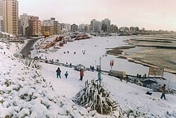
- Atlantic Region: Moderate weather influenced by the cold ocean, providing a cool refuge during summer months.
Administrative and Demographic Profile
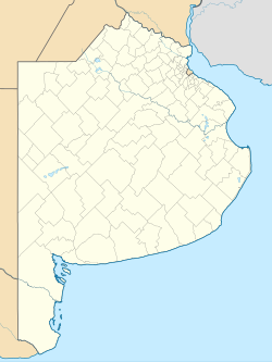
The province is divided into 135 partidos (municipalities), each governed by an elected mayor known as an intendente. The most recent partido, Lezama, was established in 2009.
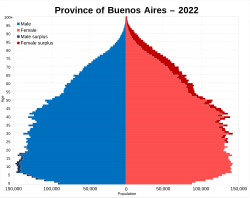
Demographically, the province is a melting pot. As of the 2010 census, over 33% of inhabitants were not born in the province, including millions of internal migrants from other Argentine provinces and hundreds of thousands of foreign-born residents.
Major Urban Centers
| Metropolitan Area | Population |
|---|---|
| Greater Buenos Aires | 13,588,171 |
| Greater La Plata | 787,294 |
| Mar del Plata | 618,989 |
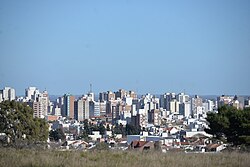
| Greater Bahía Blanca | 291,327 |
Economy and Infrastructure
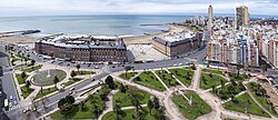
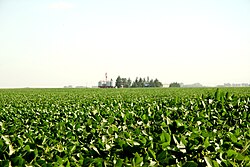
Buenos Aires Province maintains the largest economy in Argentina. It is the nation's leading exporter, with a heavy reliance on agricultural products, particularly soybeans.
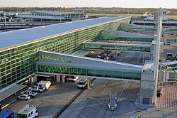
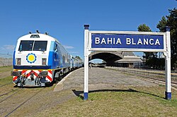
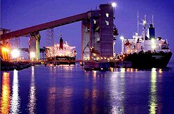
The province boasts a sophisticated transport network. This includes major international gateways like the Ministro Pistarini International Airport and a series of vital ports such as Puerto de Bahía Blanca and Puerto de Mar del Plata that facilitate global trade.
The railway system, including the General Roca and General San Martín lines, connects the provincial interior to the capital, supporting both passenger travel and the movement of freight.
Frequently Asked Questions
What is the difference between the city of Buenos Aires and the province?
The city of Buenos Aires is the national capital and is a federal district, while the Province of Buenos Aires is a separate administrative entity with its own governor and capital city, La Plata.
What is the capital of Buenos Aires Province?
The capital is La Plata, which was founded in 1882 specifically to serve as the provincial seat of government.
How many people live in the province?
According to the 2022 census, the population is approximately 17,569,053, representing about 38% of Argentina's total population.
What are the main economic activities in the region?
The province is a powerhouse of agricultural production and exports, while also maintaining significant industrial and commercial hubs in its metropolitan areas.
What is a 'partido' in the context of Buenos Aires?
A partido is an administrative and municipal division of the province. There are currently 135 partidos, each led by an elected mayor (intendente).