Broadway New York CityManhattan historyGreat White WayCanyon of HeroesUS Route 9

Broadway: The Historic Arterial Spine of New York and Westchester

Broadway: The Historic Arterial Spine of New York and Westchester

Broadway is more than just a street; it is a cultural icon and a vital transportation artery that stretches from the southern tip of Manhattan through the Bronx and into Westchester County. Originally following the Wickquasgeck Trail—an indigenous path used by the Lenape people—the route was later adopted by Dutch settlers as the Breede Weg (meaning "Broad Way") before being translated into English.

Today, Broadway serves as a complex blend of a local city street and a major highway, coinciding with US Route 9 from Washington Heights to Mount Pleasant. Its evolution reflects the growth of New York City, transitioning from a colonial trail to a bustling commercial hub and a modern pedestrian-friendly corridor.
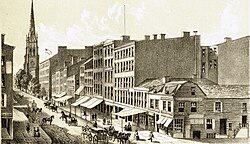
An 1834 illustration of Broadway. This site is currently occupied by the One Liberty Plaza.

Key Facts

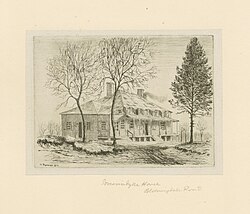
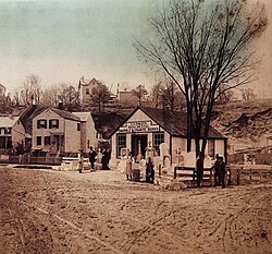
A mid-19th century illustration of Somerindyke House on Bloomingdale Road
  • Route Span: Starts at Battery Place in the Financial District and ends at US 9 / NY 117 / Kendal Way in Mount Pleasant.
  • Indigenous Roots: Based on the Wickquasgeck Trail used by the Lenape.
  • Major Designations: Includes the "Great White Way" (Theater District) and the "Canyon of Heroes" (ticker-tape parade route).
  • Modern Evolution: The "Broadway Vision" project has converted several blocks into shared streets and pedestrian plazas.
  • Highway Integration: Becomes concurrent with US 9 at 178th Street in Manhattan.

Route Description and Geography
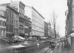
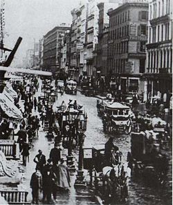
Broadway seen from the south at Broome Street, c. 1853–55

Lower and Midtown Manhattan

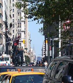
In Lower Manhattan, Broadway begins at Battery Place, passing through the Financial District. As it moves north into Midtown, it becomes the world-famous heart of the American theater industry. This section is famously known as the Great White Way due to the bright lights of the theaters.
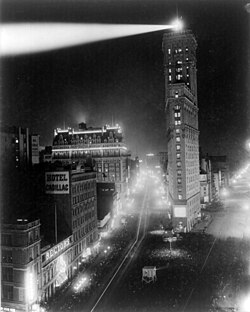
The Great White Way: Broadway south from 42nd street (1908)

One of the most recognizable landmarks in this stretch is Times Square, named after The New York Times, which operated offices at 239 West 43rd Street until June 15, 2007.
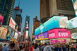
The segment of Broadway in Times Square in Midtown Manhattan

Upper West Side and Northern Manhattan

Continuing north, Broadway serves as the spine of the Upper West Side. In Washington Heights, it passes the NewYork-Presbyterian Hospital near 166th to 168th Streets. At 178th Street, the road merges with US Route 9, extending the route through the Bronx and into Westchester County.
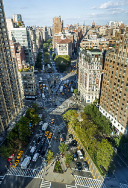
The X-shaped intersection of Broadway (from lower right to upper left) and Amsterdam Avenue (lower left to upper right), looking north from Sherman Square to West 72nd Street, and the treetops of Verdi Square

The Bronx and Westchester County

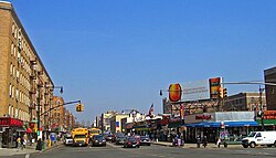
In the Bronx, Broadway runs beneath the elevated IRT Broadway–Seventh Avenue Line. Upon entering Westchester County, it passes through Yonkers and Irvington—where the Washington Irving Memorial is located—before reaching its northern terminus in Mount Pleasant.
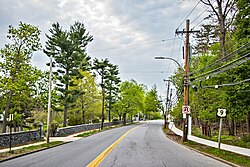
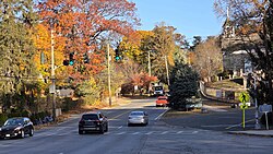
North Broadway (U.S. 9) in Yonkers

View of Broadway in 2025, near the Old Dutch Church of Sleepy Hollow, less than one mile from where Broadway ends

Transportation and Urban Evolution

Broadway in 1860
Broadway in 1860

Public Transit and Infrastructure

The IRT Broadway–Seventh Avenue Line (serving the 1, 2, and 3 trains) provides critical subway access, running both under and over Broadway from Times Square to 168th Street, and again from 218th Street to Van Cortlandt Park–242nd Street.
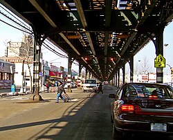
Broadway under the IRT Broadway–Seventh Avenue Line's elevated structure in The Bronx

While streetcars once dominated the route, they were replaced by bus routes in the 1930s and 1940s. Today, the street is served by numerous MTA bus routes, including the M104 and various Bronx-based lines like the Bx7 and Bx20.

The Shift to Pedestrian-Centric Design

Since the mid-20th century, Broadway has undergone significant traffic changes. In the 1960s, large sections were converted to one-way southbound traffic to alleviate congestion. More recently, the Broadway Vision initiative has prioritized pedestrians over cars.

  • 2008: Two traffic lanes between 35th and 42nd Streets were converted into public plazas.
  • 2019: Pedestrian space was expanded near Herald Square and Greeley Square.
  • 2020-2022: The "NoMad Piazza" was created as a temporary pedestrian-only street between 25th and 31st Streets.
  • 2021: Five blocks (including Golda Meir Square) were converted into shared streets.
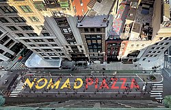
Aerial view of "NoMad Piazza", an Open Street on Broadway in NoMad, Manhattan

Architectural Landmarks

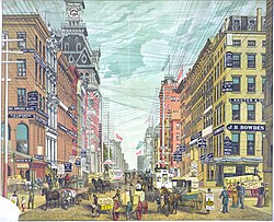
In 1885, the Broadway commercial district was overrun with telephone, telegraph, and electrical lines. This view was north from Cortlandt and Maiden Lane.

Broadway is lined with some of the most significant architecture in New York. From the Flatiron Building at the intersection of Fifth Avenue and Broadway to the Woolworth Building and the Alexander Hamilton U.S. Custom House, the street is a living museum of urban design.
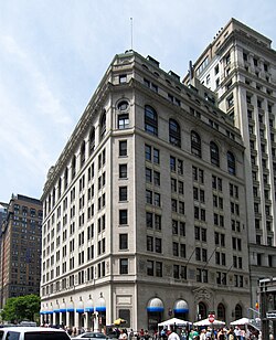
International Mercantile Marine Company Building

Notable Buildings Along Broadway
Building Name Significance/Location
Flatiron Building Iconic wedge-shaped building at 23rd Street
One Times Square Center of the New Year's Eve ball drop
Trinity Church Historic church at 79 Broadway
Ansonia Hotel Historic luxury hotel at 2109 Broadway
Woolworth Building Historic skyscraper at 233 Broadway

Frequently Asked Questions

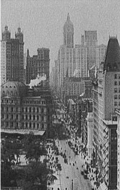
Downtown Broadway in 1909
A view of Broadway from Bowling Green with the Chrysler Building in the far background
Broadway at Dyckman Street in Inwood
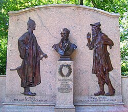
Washington Irving Memorial on North Broadway in Irvington, not far from Washington Irving's home in Sunnyside
Northernmost section of Broadway in North Tarrytown (now Sleepy Hollow) at the turn of the 20th century, before the road was improved with macadam surfacing
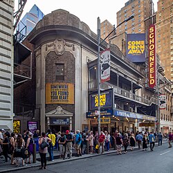
Schoenfeld Theater on the south side of 45th Street (2017)
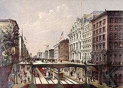
An 1868 plan for an arcade railway

Where does Broadway officially end?

Broadway ends in Mount Pleasant, New York, at the intersection of US 9, NY 117, and Kendal Way.

What is the "Canyon of Heroes"?

The Canyon of Heroes is the section of Broadway in Lower Manhattan used for ticker-tape parades to honor national and civic heroes, such as the 1969 Apollo 11 parade.
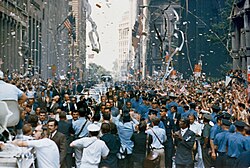
Canyon of Heroes during the 1969 ticker-tape parade for the Apollo 11

Why is it called the "Great White Way"?

This nickname refers to the brightly lit theater district in Midtown Manhattan, where the concentration of theaters and billboards creates a glowing white corridor.

How has Broadway's traffic flow changed recently?

Broadway has shifted from a vehicle-heavy thoroughfare to a more pedestrian-friendly environment through the "Broadway Vision" project, which has added bike lanes, shared streets, and public plazas.

References

  1. It is variously called the Albany Post Road and Highland Avenue, or both.
  2. There are four other streets named "Broadway" in New York City's remaining three boroughs: one each in Brooklyn (see main article) and Staten Island, and two in Queens (one running from Astoria to Elmhurst, and the other in Hamilton Beach). Each borough therefore has a street named "Broadway". See also from Forgotten NY: Broadway in the Bronx, Page 1 Archived November 11, 2014, at the Wayback Machine and Page 2 Archived November 11, 2014, at the Wayback Machine
  3. According to author Russell Shorto: "Broadway does not follow the precise course of the Indian trail, as some historians would have it. To follow the Wickquasgeck trail today, one would take Broadway north from the Customs House, jog eastward along Park Row, then follow the Bowery to Twenty-third Street. From there, the trail snaked up the east side of the island. It crossed westward through the top of Central Park; the paths of Broadway and the Wickquasgeck trail converge again at the top of the island. The trail continued into the Bronx; Route 9 follows it northward."[4]
  4. It is also claimed that the Dutch called it "Breede Weg", of which "Broadway" is a literal translation. See: Ellis, Edward Robb (1966). The Epic of New York City. Old Town Books. p. 26.
  5. The name of the Indian band has variously been spelled Wiechquaeskeck, Wechquaesqueck, Weckquaesqueek, Wecquaesgeek, Weekquaesguk, Wickquasgeck, Wickquasgek, Wiequaeskeek, Wiequashook, and Wiquaeskec. The meaning of the name, however spelled, has been given as "the end of the marsh, swamp or wet meadow", "place of the bark kettle", and "birch bark country". See: Trumbull, James Hammond (1881). Indian Names of Places, Etc., in and on the Borders of Connecticut: With Interpretations of Some of Them. Press of the Case, Lockwood & Brainard Company. p. 81. Archived from the original on March 17, 2024. Retrieved August 21, 2019.