Articles/Manhattan: The Economic and Cultural Heart of New York City
ManhattanNew York CityManhattan historyManhattan economyManhattan landmarks
Manhattan: The Economic and Cultural Heart of New York City
Manhattan: The Economic and Cultural Heart of New York City Manhattan, often referred to simply as "The City," is a borough of New York City that serves as a global epicenter for finance,...
Manhattan: The Economic and Cultural Heart of New York City
Manhattan, often referred to simply as "The City," is a borough of New York City that serves as a global epicenter for finance, culture, and commerce. From its origins as a Lenape settlement—likely named Manaháhtaan, meaning "the place where we get bows"—to its current status as one of the most densely populated places on Earth, Manhattan has undergone a profound transformation. Today, it stands as a towering testament to human engineering and urban complexity.
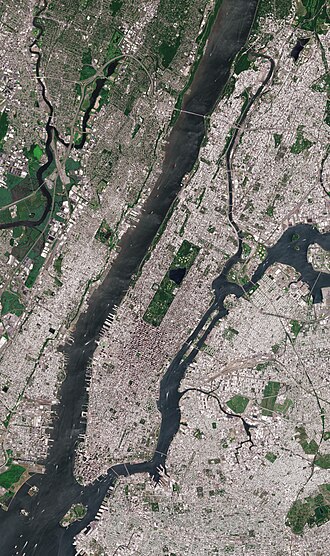
A satellite image of Manhattan, bounded by the Hudson River to the west, the Harlem River to the north, the East River to the east, and New York Harbor to the south, with rectangular Central Park prominently visible. Roosevelt Island, in the East River, belongs to Manhattan.: A satellite image of Manhattan, bounded by the Hudson River to the west, the Harlem River to the north, the East River to the east, and New York Harbor to the south, with rectangular Central Park prominently visible. Roosevelt Island, in the East River, belongs to Manhattan.
Key Facts
Statue of George Washington in front of Federal Hall on Wall Street, where in 1789 he was sworn in as the first U.S. president.[55]
Total Area: 33.859 sq mi (87.69 km), including 11.203 sq mi of water.
Population: Approximately 1.69 million (2020 Census).
Economic Power: A GDP of US$1.007 trillion (2024), the highest per capita in the U.S.
Density: 74,781.6 people per square mile.
Settlement: Established in 1624.
Geography and Landscape
Manhattan borough president Brad Hoylman-Sigal
Manhattan is an island characterized by its distinct boundaries. It is bordered by the Hudson River to the west, the Harlem River to the north, the East River to the east, and New York Harbor to the south. The island's topography is relatively low, with its highest elevation reaching only 265.05 feet (80.79 m).
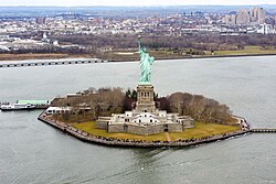
Within the surrounding waters, several notable islands exist. Liberty Island, an exclave of Manhattan, is surrounded by New Jersey waters. Other islands in the East River include Randalls and Wards Islands, Mill Rock, and U Thant Island (legally Belmont Island).
Liberty Island, an exclave of Manhattan, New York City, and the state of New York, that is surrounded by New Jersey waters: Liberty Island, an exclave of Manhattan, New York City, and the state of New York, that is surrounded by New Jersey waters
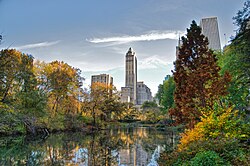
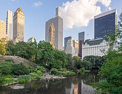
One of the most significant geographical features within the borough is Central Park, a massive rectangular green space that provides a vital respite from the urban density. The park experiences distinct seasonal changes, from lush summers to vibrant autumns.
Central Park in autumn: Central Park in autumn
Central Park: Central Park
Economic Might and Urban Density
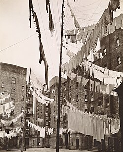
Tenement houses in 1936
Manhattan is a global financial powerhouse. In 2024, its total GDP reached US$1.007 trillion, making it the leading county in the United States by both total and per capita economic output. This economic vitality is driven by sectors including finance, the corporate sector, technology, biotech, media, and tourism.
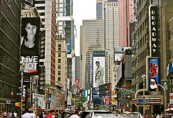
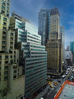
The borough is famously dense. As of the 2020 U.S. census, Manhattan was the most densely populated municipality in the United States. This density is reflected in its skyline, where many tall buildings feature setbacks—recessed sections of a building's facade—a design characteristic influenced by the 1916 Zoning Resolution.
Broadway in Midtown Manhattan. As of the 2020 U.S. census, Manhattan was the most densely populated municipality in the United States.: Broadway in Midtown Manhattan. As of the 2020 U.S. census, Manhattan was the most densely populated municipality in the United States.
Many tall buildings have setbacks on their facade due to the 1916 Zoning Resolution, exemplified at Park Avenue and 57th Street in Midtown Manhattan.: Many tall buildings have setbacks on their facade due to the 1916 Zoning Resolution, exemplified at Park Avenue and 57th Street in Midtown Manhattan.
Landmarks and Cultural Hubs
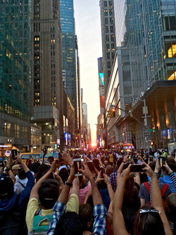
Tourists observing Manhattanhenge on 42nd Street on July 12, 2016
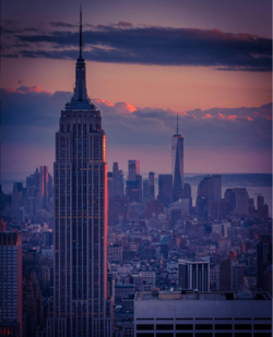
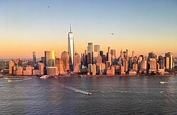
The architectural landscape of Manhattan is a blend of historic monuments and modern skyscrapers. From the Empire State Building to the One World Trade Center, the skyline is constantly evolving.
The Empire State Building in the foreground, looking south from the top of Rockefeller Center with One World Trade Center in the background: The Empire State Building in the foreground, looking south from the top of Rockefeller Center with One World Trade Center in the background
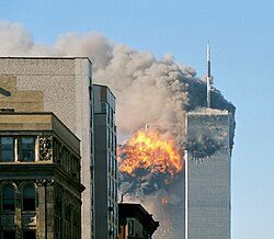
United Airlines Flight 175 hits the South Tower on September 11, 2001.: United Airlines Flight 175 hits the South Tower on September 11, 2001.
Cultural life is centered in areas like Times Square, which serves as the hub of the Broadway theater district and attracts 50 million tourists annually. Other major cultural institutions include:
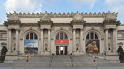
The Metropolitan Museum of Art
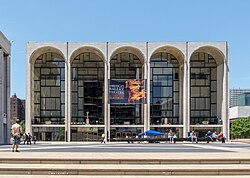
The Lincoln Center for the Performing Arts
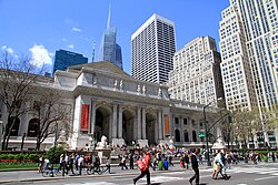
The New York Public Library Main Branch
The Museum of Modern Art (implied by cultural context)
Times Square is the hub of Broadway's theater district and a major Manhattan cultural venue with 50 million tourists annually, making it one of the world's most popular tourist destinations.[28]: Times Square is the hub of Broadway's theater district and a major Manhattan cultural venue with 50 million tourists annually, making it one of the world's most popular tourist destinations.
New York Public Library Main Branch at 42nd Street and Fifth Avenue: New York Public Library Main Branch at 42nd Street and Fifth Avenue
The Lincoln Center for the Performing Arts: The Lincoln Center for the Performing Arts
The Metropolitan Museum of Art: The Metropolitan Museum of Art
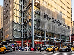
The headquarters of The New York Times at 620 Eighth Avenue: The headquarters of The New York Times at 620 Eighth Avenue
The notable architectural design of Butler Library at Columbia University, an Ivy League university in Manhattan[259]: The notable architectural design of Butler Library at Columbia University, an Ivy League university in Manhattan
Stuyvesant High School in Tribeca[255]: Stuyvesant High School in Tribeca
Transportation and Infrastructure
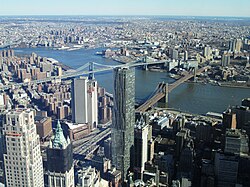
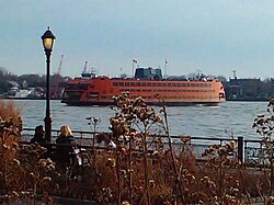
Connecting Manhattan to the rest of the region is a complex network of bridges, tunnels, and ferries. The Brooklyn Bridge and Manhattan Bridge are two of the three major bridges connecting Lower Manhattan with Brooklyn. For water travel, the Staten Island Ferry provides free public transportation between Staten Island and Manhattan.
The Brooklyn Bridge (on right) and Manhattan Bridge (on left), two of three bridges that connect Lower Manhattan with Brooklyn over the East River.: The Brooklyn Bridge (on right) and Manhattan Bridge (on left), two of three bridges that connect Lower Manhattan with Brooklyn over the East River.
The Staten Island Ferry, seen from the Battery, crosses Upper New York Bay, providing free public transportation between Staten Island and Manhattan.: The Staten Island Ferry, seen from the Battery, crosses Upper New York Bay, providing free public transportation between Staten Island and Manhattan.
Ferries departing Battery Park City Ferry Terminal and helicopters flying above Manhattan: Ferries departing Battery Park City Ferry Terminal and helicopters flying above Manhattan
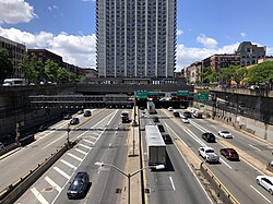
On land, the Port Authority Bus Terminal stands as the world's busiest bus station, while Interstate 95 serves as a primary highway through the borough via the Trans-Manhattan Expressway. The subway system remains the backbone of local movement.
The Port Authority Bus Terminal, at Eighth Avenue and 42nd Street, is the world's busiest bus station.[384][385]: The Port Authority Bus Terminal, at Eighth Avenue and 42nd Street, is the world's busiest bus station.
Interstate 95 is the most prominent highway serving Manhattan, known as the Trans-Manhattan Expressway between the George Washington and Alexander Hamilton bridges.: Interstate 95 is the most prominent highway serving Manhattan, known as the Trans-Manhattan Expressway between the George Washington and Alexander Hamilton bridges.
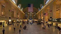
Grand Central Terminal, a National Historic Landmark: Grand Central Terminal, a National Historic Landmark
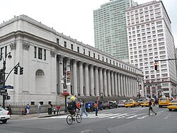
James A. Farley Post Office: James A. Farley Post Office
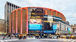
Madison Square Garden, home to the New York Rangers of the National Hockey League and the New York Knicks of the National Basketball Association: Madison Square Garden, home to the New York Rangers of the National Hockey League and the New York Knicks of the National Basketball Association
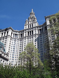
Manhattan Municipal Building: Manhattan Municipal Building
The Flatiron District, the birthplace and center of Silicon Alley[218]: The Flatiron District, the birthplace and center of Silicon Alley
Summary of Manhattan Statistics
Manhattan Overview
Category
Data
Total Area
33.859 sq mi
Land Area
22.656 sq mi
Water Area
11.203 sq mi
2020 Population
1,694,251
GDP (2024)
US$1.007 trillion
Highest Elevation
265.05 ft
Frequently Asked Questions
What is the population density of Manhattan?
As of recent data, Manhattan has a density of approximately 74,781.6 people per square mile, making it one of the most densely populated areas in the United States.
What is the economic significance of Manhattan?
Manhattan is a global economic leader with a GDP exceeding $1 trillion, ranking first among U.S. counties for both total and per capita economic output.
What are the main boundaries of Manhattan?
Manhattan is bounded by the Hudson River to the west, the Harlem River to the north, the East River to the east, and New York Harbor to the south.
Is Manhattan an island?
Yes, Manhattan is an island located within New York City, surrounded by various bodies of water including the Hudson and East Rivers.
What is the significance of the 1916 Zoning Resolution?
The 1916 Zoning Resolution influenced the architectural design of Manhattan by requiring many tall buildings to have setbacks on their facades to allow light and air to reach the streets.
How many tourists visit Times Square annually?
Times Square is a major cultural venue that attracts approximately 50 million tourists every year.
Mean monthly maxima and minima (i.e. the expected highest and lowest temperature readings at any point during the year or given month) calculated based on data at said location from 1991 to 2020.
Official weather observations for Central Park were conducted at the Arsenal at Fifth Avenue and 64th Street from 1869 to 1919, and at Belvedere Castle since 1919.[153]
The presidential election results for the years 1876–1912 are not strictly comparable with the earlier and later ones because New York County included the West Bronx after 1874 and all of what is now the Borough of the Bronx (Bronx County, New York) from 1895 until The Bronx became a separate borough in 1914.
![Statue of George Washington in front of Federal Hall on Wall Street, where in 1789 he was sworn in as the first U.S. president.[55]](/images/d1/23/d12375890d878d34bd872182ee5182a88e65d9eec397bdd3349770235c9e758f.jpg)

![Times Square is the hub of Broadway's theater district and a major Manhattan cultural venue with 50 million tourists annually, making it one of the world's most popular tourist destinations.[28]](/images/d1/eb/d1eb6121c46084b0e77e348a30c808634bae45e66ec8a7c49129f3c8e1484bd2.jpg)
![The notable architectural design of Butler Library at Columbia University, an Ivy League university in Manhattan[259]](/images/99/ce/99ced2a548222ca7f318f429cfbe1e2c69f2dbc9157979b352cbec11d2b67671.jpg)
![Stuyvesant High School in Tribeca[255]](/images/04/f5/04f57867a96a015156813c8d4ef77492230361ee5d652980635ce140e1b08309.jpg)
![The Port Authority Bus Terminal, at Eighth Avenue and 42nd Street, is the world's busiest bus station.[384][385]](/images/7f/1a/7f1a350b5c6f1c3c40c11783d50b25cdcd4b6aecf82bc7ecd3c68a5a9087cee8.jpg)
![The Flatiron District, the birthplace and center of Silicon Alley[218]](/images/b8/47/b847ae97f9002b75486287ac50ac76b7be309a3b1d1628952107f2984ec1ab1c.jpg)