Archaeological Excavation: Methods, Stratigraphy, and Site Recording
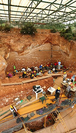
In the field of archaeology, excavation is the systematic process of exposing, processing, and recording archaeological remains. Often referred to as a "dig," an excavation site is the specific area under study. Depending on the scope of the project, these sites can range from a single small area to several expansive locations, with timelines spanning from a few weeks to several years.
Excavation is fundamentally a destructive science; once a layer of earth is removed, it cannot be replaced or excavated a second time. Therefore, the primary goal of modern archaeology is not merely to find objects, but to meticulously record the archaeological context—the spatial and temporal relationships between different types of data.
Archaeologists recover four primary types of data during a dig:
- Artifacts: Portable objects that were made or modified by humans.
- Features: Non-portable modifications to the site, such as hearths, burials, or post molds.
- Ecofacts: Organic remains that provide evidence of human activity, including charcoal, pollen, and animal bones.
- Context: The relationship between artifacts, features, and ecofacts.
Key Facts
- Excavation is considered a destructive process because the original evidence is removed to make observations.
- Stratigraphy allows archaeologists to establish a chronological timeline by removing layers in reverse order of their creation.
- Remote sensing, such as ground-penetrating radar, is often used to identify remains before digging begins.
- The Harris Matrix is a two-dimensional representation used to map the sequence of a site's formation.
- Modern recording emphasizes the Single Context Recording System to ensure every unique layer or feature is tracked.
Site Preparation and Initial Discovery
Before a shovel ever hits the ground, archaeologists often employ non-intrusive remote sensing. Tools like ground-penetrating radar can suggest the presence of remains without disturbing the soil. For more detailed preliminary information, augering (drilling small holes to extract soil cores) may be used to understand the site's development.
The Science of Stratification and Phasing
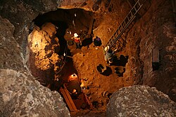
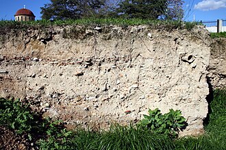
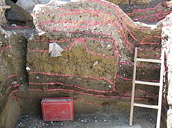
A central concept in excavation is stratification. By dividing a site into discrete units, archaeologists create a chronology of activity. Stratigraphic relationships describe the order in which contexts were created. For example, a ditch must be cut into the ground before it can be back-filled; therefore, the "fill" is stratigraphically "higher" (later) than the "cut" (earlier).
This sequence is often visualized using a Harris Matrix, which maps the site's formation in space and time. This helps archaeologists identify a phase—a near-contemporaneous archaeological horizon that represents a specific point in time, often identified by an "old ground level" or occupation surface.
Digging "In Phase" vs. "Out of Phase"
Good practice requires "digging in phase," which means removing remains in the reverse order of their deposition according to the law of superposition. When contexts are removed out of sequence, it is known as "digging out of phase," which is generally avoided as it compromises the chronological record. An intrusion occurs when a later object, such as a modern pipe, penetrates an earlier stratigraphic layer.
Excavation Methods and Tools
Stratigraphic Excavation
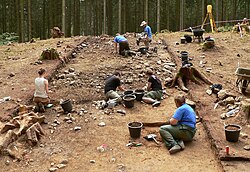
The goal of stratigraphic excavation is to remove all deposits and features in reverse order of creation. This involves "troweling back" the surface to isolate edges that are either completely separated from the surrounding surface or limited by the excavation boundary. Once a context is defined, it is recorded and removed until the site is reduced to "natural" (sterile soil with no man-made remains).
Development-Led Archaeology
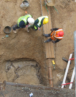
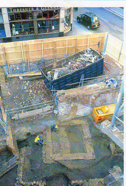
In many regions, such as the UK, archaeology is often driven by construction. Development-led archaeology occurs when sites are threatened by building projects. A common technique used here is "strip, map and sample," where machines strip the topsoil, features are plotted on a plan, and then only portions of those features are excavated due to time and funding constraints.
![A Victorian era railway turntable, discovered during upgrade works at Westbourne Park tube station in London. Archaeological excavations are often carried out during construction work in the UK to identify and study surviving remnants of prior structures underneath building sites.[11]](/images/8d/24/8d24e780b96701733ecd7f3984fac5f4cc91b18fdaf8dd08652ec499f36cdf19.jpg)
Mechanical vs. Manual Excavation
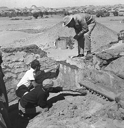
While hand-troweling is the gold standard for precision, mechanical excavation using backhoes or bulldozers is common in salvage or rescue archaeology. While faster, mechanical digging can be controversial because it is less discriminating and can potentially damage the archaeological sequence.
Recording and Processing Finds
To mitigate the destructive nature of digging, archaeologists use the Single Context Recording System. Each context is assigned a unique number and documented on a context sheet, often accompanied by plans, sections, and photographs. Heights are measured relative to a temporary benchmark (T.B.M) using a total station or dumpy level.
Modern digital tools have further enhanced this process, including:
- GPS and tablet computers for real-time mapping.
- 3D laser scanners and unmanned aerial vehicles (drones).
- Relational databases for data management.
Once artifacts are retrieved, they undergo finds processing. To ensure small items like seeds or flint flakes are not missed, archaeologists use sieving (screening) and flotation (using water to separate organic materials from soil).
Summary of Archaeological Data Types
| Data Type | Definition | Examples |
|---|---|---|
| Artifact | Portable human-made/modified objects | Pottery shards, flint tools, coins |
| Feature | Non-portable site modifications | Hearths, post molds, ditches |
| Ecofact | Organic evidence of human activity | Animal bones, pollen, charcoal |
| Context | The relationship between data types | The layer of soil surrounding a burial |
Frequently Asked Questions
Why is archaeology called a destructive science?
Archaeology is considered destructive because the act of excavation involves removing layers of earth to see what lies beneath. Once a layer is removed, the original physical relationship between artifacts and their environment is gone forever, making precise recording essential.
What is the difference between an artifact and a feature?
An artifact is a portable object, such as a piece of jewelry or a tool, that can be removed from the site. A feature is a non-portable modification to the land, such as a wall, a pit, or a burial trench, which must be recorded in place.
What is a Harris Matrix?
A Harris Matrix is a diagram used to represent the chronological sequence of a site. It shows the stratigraphic relationships between different contexts, illustrating which layers were deposited first and which came later, regardless of their physical depth.
What is the purpose of flotation in excavation?
Flotation is a technique used to recover tiny organic remains, such as seeds or small bones, that are too small to be seen during hand excavation or caught in standard sieves. By placing soil in water, the organic materials float to the surface for collection.
What is "strip, map and sample"?
This is a rapid excavation method used primarily in development-led archaeology. It involves removing the topsoil mechanically, mapping the visible features, and then excavating only a representative sample of those features to record the site's history before it is destroyed by construction.