A9 Road: The Spine of Scotland's Highland Route
The A9 is one of the most vital arteries in the United Kingdom, serving as the longest road in Scotland. Stretching approximately 268.5 miles (432.1 km), it connects the central lowlands near Falkirk to the rugged northern coast at Scrabster Harbour in Thurso. Often referred to as the "spine of Scotland," the A9 is one of three primary north-south trunk routes linking the Central Belt to the Highlands, alongside the A82 and A90.
From its origins as a strategic military network to its modern role as a critical transport link, the A9 has evolved significantly to meet the demands of modern traffic and the challenging geography of the Scottish landscape.
Key Facts
- Total Length: 268.5 miles (432.1 km).
- Route Termini: Starts at the M9 junction in Polmont and ends at Scrabster Harbour, Thurso.
- Major Hubs: Connects Stirling, Perth, and Inverness.
- Status: The longest road in Scotland and the fifth-longest A-road in the UK.
- International Link: Forms part of the Euroroute E15 between Perth and Inverness.
Historical Evolution
Military Origins and General Wade
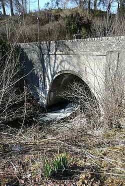
The foundations of the A9 were laid in the 18th century through a military roads building programme led by General Wade. These roads were designed to allow the rapid deployment of government forces across the Highlands. Between 1727 and 1730, a roadway was established between Dunkeld and Inverness. One of the most challenging feats of this era was the construction of Wade's Bridge over the River Tay at Aberfeldy, completed in 1733. At a cost of over £4,000, it was the most expensive project in Wade's entire programme.
The Telford Improvements
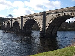
By 1802, civil engineer Thomas Telford surveyed the Highlands and concluded that the old military roads were inadequate for the general public, primarily due to a lack of bridges over major rivers. Telford designed a new bridge at Dunkeld, though costs escalated from an estimated £15,000 to roughly £40,000. To recover these costs, the 4th Duke of Atholl, who co-financed the project, implemented tolls on the bridge.
Formal Designation and Expansion
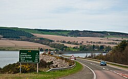
The A9 was formally designated on April 1, 1923. Originally, the route ran from Edinburgh to Inverness, but it was soon extended further north to John O'Groats. Over the decades, the route shifted; for example, the northern section was realigned following the construction of new bridges across the Moray, Cromarty, and Dornoch Firths, eventually shifting the northern terminus to Scrabster Harbour.
Route Analysis and Modern Infrastructure
The Southern Section
In the south, the A9's prominence has been partially eclipsed by the M9 and M90 motorways. The modern A9 now begins at the M9 junction 5 (Cadgers Brae) near Polmont. It passes through Larbert, Stirling, and Bridge of Allan before becoming a primary dual carriageway at the Keir Roundabout. At the Broxden Junction near Perth, it meets the M90, creating one of Scotland's most critical junctions with links to all eight Scottish cities.
The Highland Stretch: Perth to Inverness
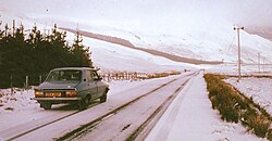
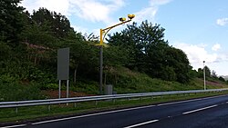
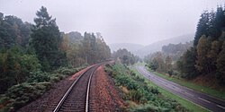
The section between Perth and Inverness is historically regarded as one of the most dangerous stretches of road in Scotland. While it consists mostly of single-carriageway, there are intermittent dual-carriageway sections and three-lane overtaking zones to improve safety and traffic flow. To curb speeding, average speed cameras were installed between the Keir Roundabout and Inverness in 2014.
The Far North
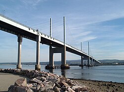
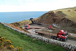
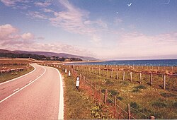
North of Inverness, the A9 crosses the Moray Firth via the Kessock Bridge, completed in 1982, which reduced the travel distance north of the city by 14 miles (23 km). The road continues through the Black Isle and Easter Ross, eventually reaching the far north of Caithness. One of the most notorious sections is the Berriedale Braes, known for its sharp hairpin turns. Following a series of accidents, including a fatal collision in 2014, these turns were improved and reopened in August 2020.
Ongoing Improvements and Future Outlook
A massive infrastructure project is currently underway to convert the remaining single-carriageway sections between Perth and Inverness into a full dual carriageway. Originally announced in 2011 and targeted for 2025, the project has faced delays and is now expected to be completed by 2035. As of December 2023, only 11 of the 80 miles had been converted. Recent works include a six-mile section between Tomatin and Moy, with construction slated for completion by 2028.
Route Summary
| Feature | Details |
|---|---|
| Southern Terminus | M9 Junction 5, Polmont |
| Northern Terminus | Scrabster Harbour, Thurso |
| Total Distance | 268.5 miles (432.1 km) |
| Key Cities | Stirling, Perth, Inverness |
| Major Bridges | Kessock Bridge, Dunkeld Bridge, Wade's Bridge |
| Current Project | Perth to Inverness Dualling (Target 2035) |
Frequently Asked Questions
Where does the A9 road end?
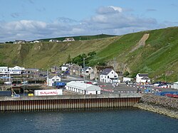
The A9 currently terminates at Scrabster Harbour in Thurso, where it provides access to ferry services to Stromness in Orkney.
Why is the A9 called the "spine of Scotland"?
It is called the spine of Scotland because it is the longest road in the country and serves as the primary north-south transport artery linking the Central Belt to the Highlands.
What is the status of the A9 dualling project?
The project to upgrade the section between Perth and Inverness to a dual carriageway is ongoing. Due to delays, the completion date has been moved from 2025 to 2035.
How did the Kessock Bridge change the route?
The completion of the Kessock Bridge in 1982 allowed the A9 to cross the Moray Firth directly, shortening the route north out of Inverness by 14 miles (23 km).
Who were the key figures in the A9's early construction?
General Wade established the initial military roads in the 18th century, and Thomas Telford later improved the network with critical surveys and bridge constructions, such as the Dunkeld Bridge.