Zulia State: The Cultural and Economic Powerhouse of Venezuela
Located in the northwestern region of Venezuela, Zulia State is a land of striking contrasts, where arid deserts meet lush rainforests and industrial oil hubs neighbor serene lagoons. As the most populous state in the country, Zulia serves as a critical economic engine and a bastion of unique cultural identity, most notably characterized by its distinct linguistic patterns and deep-rooted religious traditions.
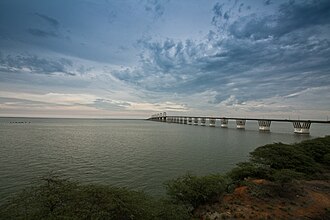
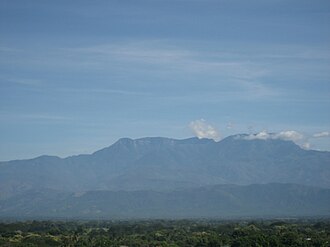
The state is centered around the massive Lake Maracaibo system, a geographical feature that has shaped the region's climate, economy, and history for centuries. From the towering peaks of the Perijá mountains to the shimmering waters of the Gulf of Venezuela, Zulia offers a diverse landscape that supports both rich biodiversity and heavy industry.
Key Facts
- Capital: Maracaibo
- Population: Most populous state in Venezuela (approx. 5.1 million by 2017 estimate).
- Geography: Dominated by the Lake Maracaibo Depression and the Sierra de Perijá.
- Linguistic Uniqueness: One of the few regions in Venezuela where voseo (using "vos" instead of "tú") is widespread.
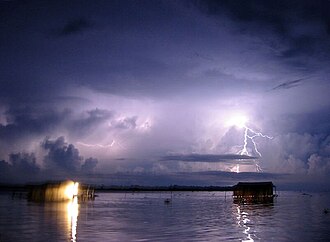
- Natural Wonder: Home to the world-famous Catatumbo lightning.
- Economic Pillar: Significant oil production concentrated in the Costa Oriental del Lago region.
History and Evolution
Early Contact and Colonization
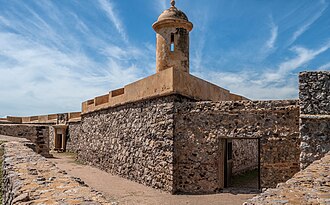
European contact with the indigenous peoples of the lake region began in earnest between 1528 and 1529, when Dalfinger led expeditions from Coro to Maracaibo and along the eastern shore of the lake. These early ventures were later immortalized in the epic poem Elegies of Illustrious Men of the Indies by Juan de Castellanos.
The Path to Statehood
The region's administrative boundaries shifted frequently during the colonial era. In 1785, the Province of Maracaibo saw the separation of Barinas but the incorporation of Trujillo. Following the struggle for independence, Maracaibo joined Gran Colombia on January 18, 1821. After the dissolution of Gran Colombia in 1830, the region became the Maracaibo Province, one of Venezuela's 11 original provinces.
The name was officially changed to Zulia State in 1874. Despite a brief merger with Falcón State between 1881 and 1890, Zulia regained its autonomy and finalized its current territorial boundaries in 1899.
Geography and Natural Environment
Diverse Landscapes
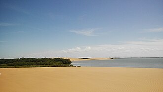
Zulia is divided into several distinct natural regions. The Cordillera de Perijá (western Andean range) covers nearly 13% of the state, providing rugged mountainous terrain. The Lake Maracaibo Depression is the most dominant feature, occupying over 75% of the territory. This tectonic basin contains sediments dating from the Cretaceous period to the Recent Cenozoic.
Climate and Hydrography
The climate varies significantly by latitude. The northern sector is semi-arid, with Maracaibo experiencing median temperatures of 28°C and irregular rainfall. Moving south, the environment shifts to a wet tropical savanna and eventually a tropical rainforest climate in the highlands of the Serrania de Perija, where annual precipitation can exceed 3,500 mm.
The Gulf of Venezuela serves as the oceanic gateway, while the Catatumbo River Basin is the most significant sub-basin within the lake system, covering over 32% of the total Maracaibo basin area.
Flora and Fauna
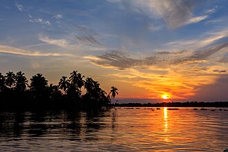
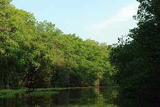
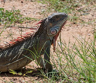
Zulia is home to extensive mangrove forests, covering approximately 116.3 km, particularly in the Sinamaica and Los Olivitos lagoons. Common species include red, black, pink, and white mangroves. The region's wildlife is equally diverse, featuring flamingos in the Ciénaga de Los Olivitos and iguanas along the Vereda del Lago.

Government and Administration
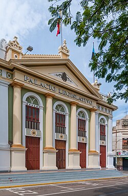
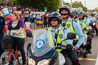
Zulia is governed by a state constitution promulgated in 2003. The executive power is led by the Governor, while the legislative functions are handled by the Legislative Council. Public security is managed by the Regional Police of Zulia, supplemented by municipal police forces.
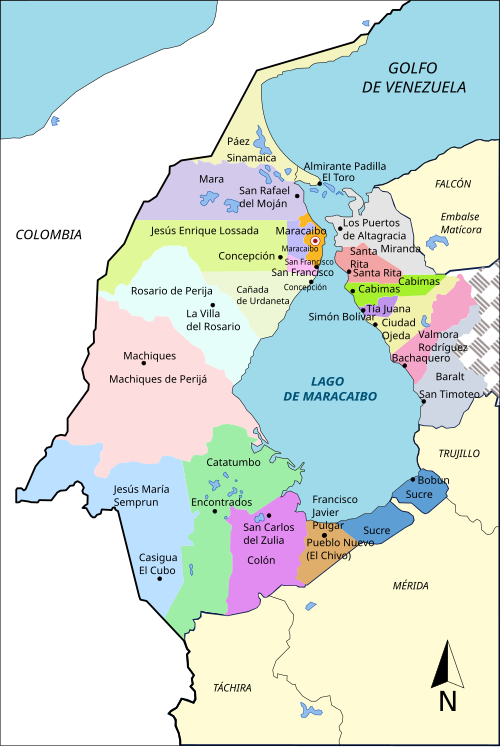
The state is divided into 21 municipalities. The largest by area is Machiques de Perijá, while Maracaibo remains the primary urban and administrative center.
Economy and Infrastructure
Oil and Industry
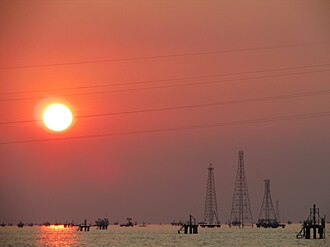
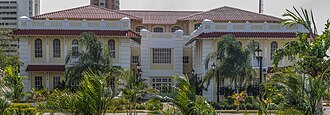
The economy of Zulia is heavily influenced by the petroleum industry, particularly in the Costa Oriental del Lago (Eastern Coast of the Lake) region, where numerous oil structures and former company headquarters, such as those of the Mene Grande Oil Company, are located.
Transportation and Urban Development
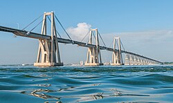
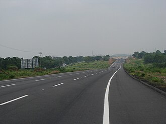
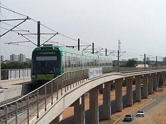
Infrastructure in Zulia is designed to connect its sprawling municipalities. Key features include the General Rafael Urdaneta Bridge, the Lara Zulia Highway, and the Metro de Maracaibo. These systems facilitate the movement of goods and people across the lake and toward the interior of Venezuela.
Culture and Society
Religion and Landmarks
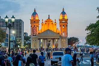
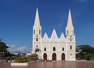
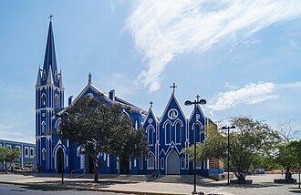
Faith plays a central role in Zuliano life. The Minor Basilica of Our Lady of the Rosary of Chiquinquirá (La Chinita) is the most iconic religious site in Maracaibo. Other historic structures include the San Rafael Arcangel Church (1843) and the Santa Barbara Church (1888).
Arts and Heritage
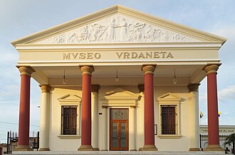
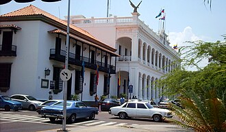
The state boasts a rich architectural heritage, including the Baralt Theatre (opened 1883), the Urdaneta Museum, and the Palace of the Condors, which has been the seat of executive power since 1868.

Language and Identity
Zulia is linguistically distinct due to the widespread use of voseo. While Spanish is the predominant official language, several endangered indigenous languages are spoken, including Yukpa, Bari, and Japreria.
Sports and Recreation
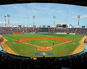
Baseball and football are highly popular. While Zulia Fútbol Club previously competed in the Primera División, the state is now represented by Deportivo Rayo Zuliano. In basketball, the Gaiteros del Zulia are a powerhouse, having won the professional league four times.
| Attribute | Detail |
|---|---|
| Total Area | 50,230 km² (6.92% of Venezuela) |
| Population Rank | 1st in Venezuela |
| Emblematic Tree | Coconut (Cocos nucifera) |
| HDI (2019) | 0.697 (Medium) |
| Time Zone | UTC−4 (VET) |
Frequently Asked Questions
What is voseo and why is it important in Zulia?
Voseo is the use of "vos" as the second-person singular pronoun instead of "tú." Zulia is one of the few states in Venezuela where this linguistic trait is widespread, making it a key part of the regional identity.
What is the significance of the Catatumbo lightning?
The Catatumbo lightning is a natural phenomenon occurring over the mouth of the Catatumbo River where it enters Lake Maracaibo, known for producing an extraordinary frequency of lightning strikes.
Which is the most populous city in Zulia?
Maracaibo is the capital and the most populous city, serving as the administrative, economic, and cultural hub of the state.
What are the primary economic activities in Zulia?
The state's economy is heavily driven by the oil industry, particularly along the Costa Oriental del Lago, as well as agriculture and fishing.
What are the natural symbols of Zulia?
The natural symbols include the coconut tree (Cocos nucifera), the Chinese rose (Hibiscus rosa-sinensis), and the brown pelican (Pelecanus occidentalis).