White River National Wildlife Refuge Expansion Proposal
The White River watershed represents a critical ecological corridor in the United States. In 2013, the federal government recognized this importance by designating the watershed as the nation's second National Blueway, a designation highlighting the river's value for recreation, conservation, and water-based travel.
Following this designation, the Fish and Wildlife Service introduced a proposal to significantly expand the White River National Wildlife Refuge (NWR) to better protect the region's diverse ecosystems and wildlife.
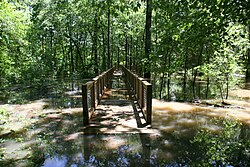
The Scope of the Expansion
The current footprint of the White River NWR covers 160,756 acres (650.56 km²). The expansion proposal seeks to increase this protected area to as much as 297,806 acres (1,205.18 km²). This growth would be achieved through the purchase of land from willing sellers, ensuring a cooperative approach to conservation.
Funding the Growth
To finance these land acquisitions, the Fish and Wildlife Service relies on several dedicated funding streams, including:
- Federal Duck Stamps: A program where hunters purchase stamps to fund wetlands conservation.
- Migratory Bird Conservation Fund: Dedicated resources for the protection of bird habitats.
- Land and Water Conservation Fund: A federal program providing grants to acquire land for public outdoor recreation and environmental protection.
Environmental Impact and Habitat Preservation
The proposed expansion focuses on critical waterways and forest types. Specifically, the plan aims to add the following to the refuge:
- 9 miles of the White River floodplain.
- 26 miles of the Arkansas River.
- 34 miles of the west bank of the Mississippi River.
These additions are vital for providing expanded habitats for various fish, birds, and other wildlife. A primary goal of the project is the preservation and restoration of the Big Woods, a unique Arkansas floodplain forest. Currently, less than 10 percent of the original Big Woods remains intact, making this expansion a critical step in preventing further loss of this rare ecosystem.
Regional Conservation Synergy
The White River NWR does not exist in isolation. The Fish and Wildlife Service has also proposed expanding the Cache River National Wildlife Refuge, which borders the White River NWR to the north. If both expansions are fully implemented, nearly 600,000 acres (2,400 km²) of land within the White River watershed would be preserved.
This federal effort is complemented by contiguous conservation lands owned by private conservation groups and the state of Arkansas, creating a massive, interconnected network of protected wilderness.
Key Facts
- Proposed Size: Increase from 160,756 acres to up to 297,806 acres.
- Waterway Additions: Includes portions of the White River, Arkansas River, and Mississippi River.
- Critical Ecosystem: Aims to save the "Big Woods" floodplain forest, of which <10% remains.
- Total Watershed Goal: Combined with the Cache River NWR expansion, nearly 600,000 acres could be preserved.
- Acquisition Method: Land is purchased from willing sellers using federal conservation funds.
| Metric | Current State | Proposed State |
|---|---|---|
| Total Acreage | 160,756 acres | Up to 297,806 acres |
| White River Floodplain | Existing | + 9 miles |
| Arkansas River | Existing | + 26 miles |
| Mississippi River (West Bank) | Existing | + 34 miles |
Frequently Asked Questions
How is the land for the expansion acquired?
The Fish and Wildlife Service acquires the land by purchasing it from willing sellers as funding becomes available.
What are the primary funding sources for this project?
The expansion is funded through Federal Duck Stamps, the Migratory Bird Conservation Fund, and the Land and Water Conservation Fund.
What are the "Big Woods"?
The Big Woods are a specific type of floodplain forest in Arkansas. They are critically endangered, with less than 10 percent of the original forest still intact.
How does this relate to the Cache River National Wildlife Refuge?
The Cache River NWR borders the White River NWR to the north. Both are subject to expansion proposals that, together, would protect nearly 600,000 acres in the watershed.
What is a National Blueway?
A National Blueway is a federal designation for a river or watershed that recognizes its importance for conservation, recreation, and ecological health.