US 18: A Journey Across the American Midwest
US 18 is a significant east-west highway that spans four states, connecting the rugged landscapes of Wyoming to the urban center of Milwaukee, Wisconsin. Stretching over 1,000 miles, this route serves as a vital artery through the heart of the American Midwest, traversing high plains, indigenous lands, and fertile river valleys.
Key Facts
- Total Distance: 1,046 miles (1,683 km).
- States Traversed: Wyoming, South Dakota, Iowa, and Wisconsin.
- Notable Designations: Includes the Oyate Trail in South Dakota and the Avenue of the Saints in Iowa.
- Major Termini: Begins in Wyoming and terminates in downtown Milwaukee, Wisconsin.
- Key Crossings: Crosses the Missouri River, Big Sioux River, and Mississippi River.
Route Breakdown by State
Wyoming
In Wyoming, US 18 covers approximately 100 miles (160 km). For much of its journey, it runs concurrently—meaning it shares the same roadway—with other highways. It starts concurrent with US 20 from I-25 to Lusk, where it then joins US 85. The only segment of US 18 in Wyoming that is not cosigned with another highway is a 10-mile (16 km) stretch from Mule Creek Junction in northeastern Niobrara County to the South Dakota border.
Drivers can expect a speed limit of 70 mph (110 km/h) for most of the Wyoming stretch, except when passing through Lusk and at its ending terminus at Orin.
South Dakota
Entering South Dakota west of Edgemont, US 18 travels 452 miles (727 km). This section is rich in cultural and geographical diversity, passing through Hot Springs, the Pine Ridge and Rosebud Indian Reservations, Winner, and Gregory. The route crosses the Missouri River near Pickstown via the Fort Randall Dam before heading east through Lake Andes and Tripp, with a brief concurrency with I-29 near Worthing and a passage through Canton.
A specific section from Maverick Junction to I-29 east of Vermillion is known as the Oyate Trail. Established in the late 1990s to promote tourism through Indigenous lands, this trail connects the Black Hills with the middle Missouri River urban areas, crossing the James River Valley and the High Plains.
Historically, portions of this road have been known by several names, including the Grant Highway, Black Hills Sioux Trail, Custer Battlefield Trail, and the Omaha, Rosebud and Black Hills Highway. Key locales of interest along this stretch include Wounded Knee and Rosebud, the capital of the Rosebud Sioux Tribe.
Iowa
US 18 enters Iowa northeast of Beloit via the Big Sioux River. Over its 312-mile (502 km) journey through the state, it overlaps with several other routes, including US 75 near Hull, US 59 near Sanborn, and US 71 through Spencer. The highway passes through Emmetsburg and intersects US 169 at Algona.
As it moves east through Garner, it meets I-35 in Clear Lake. Between Clear Lake and Charles City, US 18 is the designated route of the Avenue of the Saints. In this region, the road operates as a freeway to bypass Mason City to the south. After Charles City, it returns to a rural two-lane highway, with a brief concurrency with the US 63 bypass of New Hampton. The route eventually joins US 52 at Postville before crossing the Mississippi River into Wisconsin via the Marquette–Joliet Bridge.
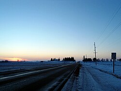
Wisconsin
The final 182-mile (293 km) leg begins in Prairie du Chien, where US 18 serves as the terminus for State Trunk Highway 60 (WIS 60). The two routes run together until Bridgeport, where US 18 crosses the Wisconsin River and turns east. It later joins the US 151 expressway in Dodgeville, remaining concurrent until reaching Madison.
South of Madison, US 18 follows US 12, passing through or around Cambridge, Jefferson, and Waukesha. The journey concludes in downtown Milwaukee at the junction of East Michigan Street and Lincoln Memorial Drive.
Route Summary Table
| State | Miles (mi) | Kilometers (km) |
|---|---|---|
| Wyoming | 100 | 160 |
| South Dakota | 452 | 727 |
| Iowa | 312 | 502 |
| Wisconsin | 182 | 293 |
| Total | 1,046 | 1,683 |
Frequently Asked Questions
What is the Oyate Trail?
The Oyate Trail is a section of US 18 in South Dakota, running from Maverick Junction to I-29 east of Vermillion. It was named in the late 1990s to encourage tourism through the lands of the Rosebud, Pine Ridge, and Yankton Sioux peoples.
Which major rivers does US 18 cross?
US 18 crosses three major rivers: the Missouri River (near Pickstown, SD), the Big Sioux River (entering Iowa), and the Mississippi River (via the Marquette–Joliet Bridge into Wisconsin).
Where is US 18 part of the Avenue of the Saints?
US 18 is the designated route for the Avenue of the Saints in Iowa between the cities of Clear Lake and Charles City.
Where does US 18 end?
The highway terminates in downtown Milwaukee, Wisconsin, at the intersection of East Michigan Street and Lincoln Memorial Drive.
Are there any sections of US 18 in Wyoming that are not shared with other highways?
Yes, there is a 10-mile (16 km) stretch from Mule Creek Junction in northeastern Niobrara County to the South Dakota border that is not cosigned with another highway.