U.S. Geological Survey: Mapping and Monitoring the Nation's Natural Resources
The United States Geological Survey (USGS) serves as a cornerstone of American scientific inquiry, providing the essential data needed to understand the Earth's complex systems. As a specialized agency within the U.S. Department of the Interior, the USGS is tasked with studying the nation's landscape, its natural resources, and the hazards that shape our environment.
From monitoring seismic activity to producing high-precision topographic maps, the agency's work spans across various scientific disciplines, ensuring that policymakers, scientists, and the public have access to reliable, data-driven insights.

Key Facts
- Established: March 3, 1879, via the Organic Act of 1879.
- Headquarters: John W. Powell National Center in Reston, Virginia.
- Parent Agency: United States Department of the Interior.
- Primary Mission: Classification of public lands and examination of geological structures, mineral resources, and national products.
- Core Expertise: Geology, water resources, natural hazards, and geospatial information.
A Legacy of Exploration and Creation
The roots of the USGS stretch back to the early 1800s, when state and private geological surveys were conducted to support agriculture following westward migration. The first federal survey was initiated in 1834 by George William Featherstonhaugh under the U.S. Army Corps of Engineers. As the era of Manifest Destiny progressed and precious minerals like gold were discovered in the West, the need for organized land surveys became critical.
Before the formal establishment of the USGS, several significant explorations took place, including the United States Exploring Expedition and various surveys led by figures such as Clarence King, Ferdinand Vandeveer Hayden, and John Wesley Powell. These disparate efforts eventually culminated in the signing of the Organic Act of 1879 by President Rutherford B. Hayes, which officially created the USGS.
The agency's early mission focused on surveying the 1.2 billion acres of land acquired through the Louisiana Purchase and the Mexican–American War. While only 200 million acres had been surveyed at the time of the agency's founding, the USGS worked to classify public lands and identify mineral resources to drive economic development.
Organizational Structure and Mission Areas
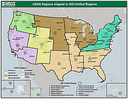
To manage its vast scientific responsibilities, the USGS is organized into specific mission areas and regional offices. The agency operates across seven distinct regions, covering everything from the Northeast to Alaska and the Pacific Islands.
Core Science Systems and Ecosystems
The Core Science Systems mission area focuses on fundamental research and data preservation. This includes programs for gap analysis, geophysical data preservation, and science synthesis. Key facilities include the National Ice Core Laboratory and the Center of Excellence for Geospatial Information Science.
Additionally, the agency addresses environmental health through its Ecosystems mission, which includes the National Wildlife Health Center and various Climate Adaptation Science Centers.
Natural Hazards and Water Resources
One of the most critical functions of the USGS is the monitoring of Natural Hazards. This includes specialized programs for:
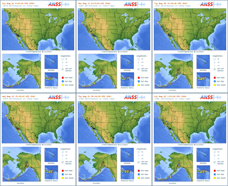
- Earthquake Hazards: Monitoring seismic activity and producing ShakeMaps.
- Volcano Hazards: Tracking volcanic activity and potential eruptions.
- Coastal and Marine Hazards: Studying the intersection of land and sea.
- Geomagnetism: Monitoring the Earth's magnetic field.
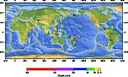
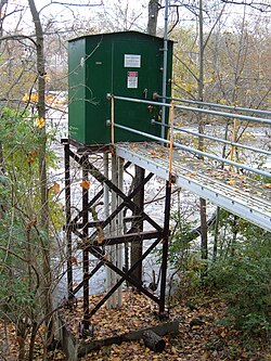
The agency also plays a vital role in managing Water Resources. Through the National Streamflow Information Program and various research institutes, the USGS tracks water availability, quality, and flow, which is essential for both human consumption and environmental stability.
The Evolution of Topographic Mapping
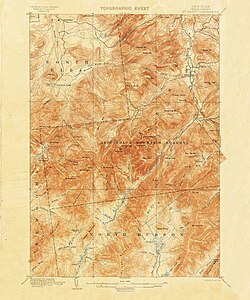
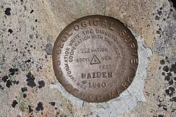
For over a century, the USGS has been the primary provider of topographic maps in the United States. These maps provide a detailed representation of the Earth's surface, including elevation and man-made features.
Mapping Scales and Series
The agency has utilized several different mapping scales over the years:
- 7.5-minute Quadrangle (1:24,000): The most common scale in the U.S., covering approximately 49 to 64 square miles depending on latitude.
- 15-minute Series (1:62,500): An older series used for the contiguous states before being discontinued.
- 1:250,000 Scale: A larger-scale series used for broader coverage.
In 2019, the traditional paper map era transitioned into The National Map. Modern mapping, known as U.S. Topo, utilizes automated processes and the National GIS Database to produce high-quality quadrangles rapidly. For historical research, the topoView website allows users to access a digitized collection of over 178,000 maps dating from 1884 to 2006.
Summary of USGS Agency Profile
| Category | Details |
|---|---|
| Founded | March 3, 1879 |
| Headquarters | Reston, Virginia |
| Parent Agency | Department of the Interior |
| Primary Mission | Geological, mineral, and water resource study |
| Key Mapping Tool | The National Map / U.S. Topo |
Frequently Asked Questions
What is the primary purpose of the USGS?
The USGS is tasked with studying the Earth's structure, mineral resources, and natural processes to provide scientific information for the benefit of the nation.
How has mapping changed at the USGS?
The USGS has moved from traditional field-checked paper maps to automated, digital processes using the National GIS Database, now primarily through The National Map and U.S. Topo products.
What kind of natural hazards does the USGS monitor?
The agency monitors earthquake, volcanic, coastal, marine, and geomagnetic hazards to help mitigate their impact on society.
Can I access old USGS maps online?
Yes, the topoView website provides an interactive way to view and download over 178,000 digitized maps from the agency's collection spanning 1884 to 2006.
Where is the USGS headquartered?
The agency is headquartered at the John W. Powell National Center in Reston, Virginia.