Surrey: A Comprehensive Overview of England's Historic and Vibrant County

Surrey: A Comprehensive Overview of England's Historic and Vibrant County

Located in the South East of England, Surrey is a non-metropolitan and ceremonial county that blends deep historical roots with modern vitality. Covering an area of 1,663 km², it serves as a vital part of the English landscape, characterized by its diverse topography, ranging from rolling hills to bustling urban centers.

From the ancient heights of Leith Hill to the industrial and cultural hubs like Woking and Guildford, Surrey offers a rich tapestry of experiences. Whether you are interested in its Roman origins, its role in the development of London's suburbs, or its status as a center for higher education and motorsport, Surrey remains one of the most significant counties in the United Kingdom.
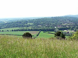
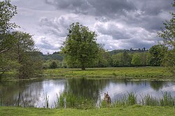
view of hills, trees and fields across a meadow
View from Box Hill
: View from Box Hill

Key Facts

wooden gate with field and low hill beyond
Runnymede, where Magna Carta was sealed
  • Largest Town: Woking (population approx. 105,367)
  • Highest Point: Leith Hill (295 m)
  • County Headquarters: Reigate
  • Total Population: Approximately 1,248,649 (2024 estimate)
  • Major Rivers: The River Wey is a notable feature of the landscape
  • Key Institutions: University of Surrey and Royal Holloway, University of London

Geography and Climate
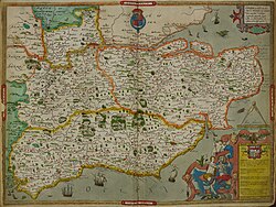
Hand-drawn map of Kent, Sussex, Surrey and Middlesex from 1575

The geography of Surrey is defined by its varied elevations. The highest point in the county is Leith Hill near Dorking, standing at 295 meters above sea level. This makes it the second-highest point in southeastern England, surpassed only by Walbury Hill in West Berkshire.
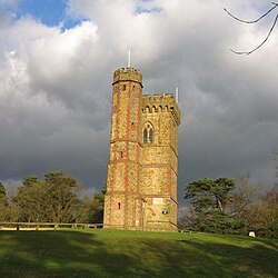
beige stone tower with cylindrical tower attached standing on a grassy hill
Leith Hill Tower
: Leith Hill Tower

The climate in the region, particularly around Wisley and Guildford, is temperate. Summers see mean daily maximum temperatures reaching approximately 23°C (73.4°F) in July, while winters see lows around 2°C (35.8°F) in January. Rainfall is distributed throughout the year, with October typically seeing the highest average precipitation.

Surrey Statistics Summary

Quick Reference Data for Surrey
Category Detail
Area 1,663 km²
Population (2024) 1,248,649
Population Density 751/km²
Time Zone UTC+0 (GMT) / UTC+1 (BST)

History and Heritage

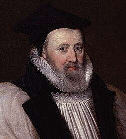
17th century middle-aged bearded man in black cap and jacket over a white shirt
George Abbot

Surrey's history stretches back through the Ancient British and Roman periods. Evidence of Roman presence is found in features such as the Stane or Stone Street, which runs through the county.
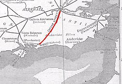
map of southeast England with red line from mid-south to northwest
The Roman Stane or Stone Street runs through Surrey
: The Roman Stane or Stone Street runs through Surrey

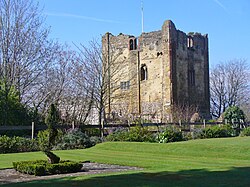
During the medieval period, the county saw the rise of significant structures and institutions. The Wey Navigation, opened in 1653, was one of England's earliest canal systems, facilitating trade and movement. The county has also been home to various religious and noble sites, including the ruins of Waverley Abbey and the historic Guildford Castle.
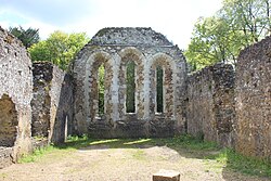
grey stone walls leading to an end wall with three tall window openings
Ruins of the monks' dormitory at Waverley Abbey
: Ruins of the monks' dormitory at Waverley Abbey
roofless stone castle keep in parkland
: roofless stone castle keep in parkland

In more recent history, Surrey's relationship with London has been dynamic. Following the London Government Act 1963, several areas that were historically part of Surrey, such as Croydon and Kingston, were transferred to the newly formed Greater London. Conversely, parts of Middlesex, such as Spelthorne, were added to Surrey.
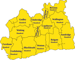
A map showing the traditional boundaries of Surrey (c. 800–1899) and its constituent hundreds
: A map showing the traditional boundaries of Surrey (c. 800–1899) and its constituent hundreds

Settlements and Economy

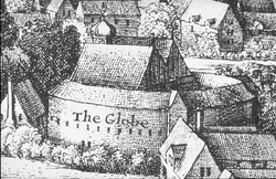
hand drawn view of buildings including a circular one with another building within
The second Globe theatre, built 1614

Surrey is home to several significant towns and cities. Woking is the largest town, followed by Guildford, which is often regarded as the historic county town, and Walton-on-Thames.
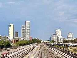
multiple rail tracks leading away between tall buildings under a blue-grey sky
The skyline of Woking, the most populous settlement in Surrey, as seen from the western approach by railway
: The skyline of Woking, the most populous settlement in Surrey, as seen from the western approach by railway
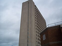
view upwards to tall pale multi-storey building under a cloudy sky
Export House in Woking, one of Surrey's tallest buildings
: Export House in Woking, one of Surrey's tallest buildings

The economy is supported by a robust transport network, including major motorways and rail lines. Major railway stations such as Guildford and Woking handle millions of passengers annually, connecting the county to the wider UK network.

Education and Innovation

The county is a hub for higher education, hosting institutions such as the University of Surrey in Guildford, the University for the Creative Arts (UCA), and Royal Holloway, University of London in Egham. This academic presence fosters a culture of research and innovation.

Culture, Sport, and Landmarks
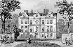
drawing of large seven bay three storey building
Kew Palace in 1835

Surrey offers a wealth of cultural and sporting attractions. Brooklands, located between Woking and Weybridge, holds the distinction of being the world's first purpose-built motorsport race circuit. Additionally, the county is well-known for its golf courses, with Wentworth being a notable international venue.
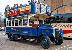
1924 Dennis open top double decker bus
: 1924 Dennis open top double decker bus

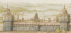
Architectural landmarks also define the Surrey landscape. From the modern Guildford Cathedral to the historic Nonsuch Palace, the county preserves a diverse range of building styles.
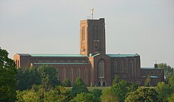
tall and long red brick cathedral with green roofs and square tower topped with gold angel
Guildford Cathedral, designed by Edward Maufe
: Guildford Cathedral, designed by Edward Maufe
watercolour of long building flanked by two large cylindrical towers with a clock on a smaller central tower
Nonsuch Palace
: Nonsuch Palace

For those interested in unique local history, Woking is even home to a statue of a Martian tripod, a nod to its place in science fiction history.
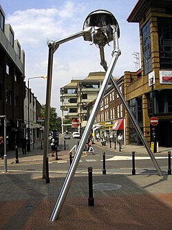
modern street scene with tall silver metal three-legged structure
Statue of a Martian tripod in Woking
: Statue of a Martian tripod in Woking

Frequently Asked Questions

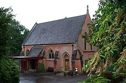
chapel-style red brick building with steep pitched slate roof
Britain's first crematorium, in the Borough of Woking
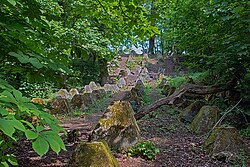
lines of concrete pyramids in woodland
"Dragon's teeth" antitank obstacles by the River Wey
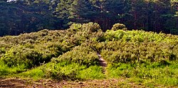
mound covered with bracken and heather with coniferous forest beyond
Bronze Age bell barrow on Horsell Common near Woking[88]
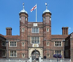
Abbot's Hospital, Guildford
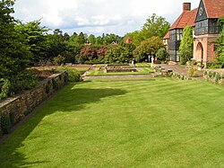
green lawn with trees to the left and a house on the right
Lawns at RHS Garden, Wisley
mid-nineteenth-century colour painting of race-course, racehorses and race-goers with buildings either side of the course under a partly-cloudy sky
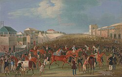
Epsom is famous for the Epsom Downs Racecourse which hosts the Epsom Derby; painting by James Pollard, c. 1835

What is the highest point in Surrey?

The highest elevation in Surrey is Leith Hill near Dorking, which reaches 295 meters (968 ft) above sea level.

Which is the largest town in Surrey?

Woking is the largest town in the county, with a population of approximately 105,367.

Where is the Surrey County Council based?

The administrative headquarters for the Surrey County Council is located at Woodhatch Place, Reigate.

Is Guildford the capital of Surrey?

While Guildford is often regarded as the historic county town, the administrative center has moved over time, currently being based in Reigate.

What major universities are located in Surrey?

Surrey hosts several higher education institutions, including the University of Surrey, Royal Holloway (University of London), and the University for the Creative Arts.

References

  1. Domesday Book valued the Surrey estates of Chertsey Abbey in 1066 at £189 a year, the abbey's only other holdings being £11 worth in Berkshire. Harold's lands in Surrey were valued at £175 a year, while another £15 worth were still entered under the name of his late father Earl Godwin. The revenues of King Edward's Surrey estates totalled £117, Queen Edith's £76, the Archbishopric of Canterbury's £66 and the Bishopric of Winchester's £55, all fractions of vast national holdings. The earl with jurisdiction over Surrey, Harold's brother Leofwine, held only £17 there, from a national total of £290, whose greatest concentrations were in Kent and Sussex, while his mother, Godwin's widow Gytha, held £16 from a total of £590, chiefly clustered in Devon, Wiltshire and Sussex. The other great landowners with Surrey estates were the thegns Ætsere, Ægelnoð and Osward. Ætsere held £61 in Surrey, from a total of £271 including £163 in Sussex, Ægelnoð held £40, from a total of £260 including £71 in Kent, £58 in Sussex and £50 in Oxfordshire, and Osward held £26, from a total of £109 including £65 in Kent, where he was also sheriff. Donald Henson, The English Elite in 1066: Gone but not forgotten (Hockwold-cum-Wilton 2001), pp. 20–23, 26–27, 32–34, 39, 49–50, 64–65, 70, 73, 85, 179–181.
  2. This was Oswald, whose brother Wulfwold, Abbot of Chertsey and Bath, died in 1084. Oswald was one of the small number of English landowners who managed to increase their holdings in the wake of the conquest: his estates, centred on Effingham, were valued at £18 a year in 1066, but the acquisition of additional manors raised this to £35 by 1086. His descendants, the de La Leigh family, relinquished the majority of their Surrey lands in the 12th century, but remained landowners in the county until the early 14th century. One of them, William de La Leigh, served as Sheriff of Surrey in 1267.
  3. Besides the castles built or rebuilt in stone, remains of Norman castles of earth and timber have been identified at Abinger, Cranleigh, Thunderfield, and Walton-on-the-Hill.[49]
  4. "High Sheriffs". The Privy Council Office. Retrieved 1 April 2026.
  5. "Population Estimates for 1997 Lieutenancy areas in England and Wales, June 2024". Office for National Statistics. 18 November 2025. Retrieved 19 November 2025.