Understanding Spatial Planning: Managing Space and Resources for the Future
At its core, spatial planning is the strategic management of space and resources. It involves creating and implementing plans that define how land can be used and developed. By setting these boundaries, planners aim to balance the competing demands placed upon land—mediating between the needs of the state, the pressures of the market, and the requirements of local communities.
While spatial planning is typically conducted by state actors at national, regional, or local levels, private sector entities sometimes participate in the process as well. To achieve policy goals, modern planning often utilizes three distinct mechanisms: involving stakeholders, integrating sectoral policies, and promoting specific development projects. These mechanisms drive transformative strategy, innovation, and performance within the field.
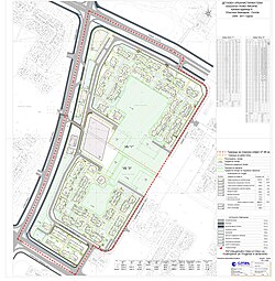
The Multidisciplinary Nature of Planning
Spatial planning is not a single isolated task but a collection of discrete professional disciplines. These include:
- Land use planning: Determining how specific parcels of land are designated (e.g., residential, industrial, or agricultural).
- Urban and Regional planning: Designing the physical form and functional organization of cities and larger geographic areas.
- Transport planning: Managing the movement of people and goods.
- Environmental planning: Protecting natural resources and ecosystems.
Other vital related fields include economic planning, community planning, and maritime spatial planning, which manages the use of ocean spaces.
Defining Spatial Planning
The concept of "spatial" has evolved significantly. Until the 1990s, planning often focused narrowly on zoning (the legal division of land) or the physical design of cities. However, modern spatial planning addresses the complex relationships between different activities, such as how employment hubs, residential areas, and leisure spaces interact.
A foundational definition was established in 1983 by the European Regional/Spatial Planning Charter (the Torremolinos Charter). It describes regional/spatial planning as:
"A scientific discipline, an administrative technique and a policy developed as an interdisciplinary and comprehensive approach directed towards a balanced regional development and the physical organization of space according to an overall strategy."
Why is Spatial Planning Necessary?
The primary rationale for spatial planning is the existence of competing demands. Space is a finite resource, and different sectors—such as the economy, social needs (like housing), and environmental protection—constantly vie for control over it. This is particularly critical in developing countries, where rapid urbanisation (the growth of cities) and industrialisation can place immense pressure on existing infrastructure.
Global Perspectives and Systems
There is no single global planning system. Instead, planning forms diverge and co-evolve alongside the unique governance systems of different societies. Every country possesses a unique institutional framework, shaped by different actors and perspectives that change over time.
Regional Variations
- China: Spatial planning in mainland China is referred to as territorial spatial planning.
- United Kingdom: In the UK, the practice is commonly known as town and country planning.
- European Union: While the EU has no formal authority over spatial planning, it influences policy through coordination. A key concept is territorial cohesion, which aims to reduce disparities between regions. Significant milestones include the 1999 European Spatial Development Perspective (ESDP) and the 2007 Territorial Agenda.
Data Summary: Spatial Planning Sources by Country
The following table provides a summary of various compendia and sources used to track spatial planning systems across different regions and organizations.
| Country/Region | COMMIN | COST C11 | ESPON | DG-REGIO | CEMAT | LEXALP |
|---|---|---|---|---|---|---|
| Albania | 2000 | - | - | - | - | - |
| Austria | 2007 | 1997 | 2008 | - | - | - |
| Belgium | 2007 | 1997 | 2008 | - | - | - |
| Denmark | 2007 | 2005 | 2007 | 1997 | 2008 | 2019 |
| Finland | 2007 | 2005 | 2007 | 1997 | 2005 | 2018 |
| Germany | 2007 | 2005 | 2007 | 1997 | 2008 | 2019 |
| Netherlands | 2005 | 2007 | 1997 | 2008 | 2007 | 2000 |
| North Macedonia | 2000 | - | 2002 | - | - | - |
| Spain | 2005 | 2007 | 1997 | 2008 | - | - |
| United Kingdom | 2005 | 2007 | 1997 | 2008 | 2007 | 2000 |
Key Facts
- Core Purpose: To balance competing demands for land between the state, the market, and local communities.
- Key Disciplines: Includes land use, urban, regional, transport, and environmental planning.
- Evolution: Modern planning has moved beyond simple zoning to address complex spatial relationships between employment, housing, and leisure.
- Global Context: Planning systems are unique to each country and evolve alongside their specific governance and social structures.
- EU Influence: While the EU lacks formal authority, documents like the ESDP influence regional policy and promote territorial cohesion.
Frequently Asked Questions
What is the difference between land use planning and spatial planning?
Land use planning is a specific discipline focused on how particular areas of land are designated for use. Spatial planning is a broader, more comprehensive approach that considers the relationships between different land uses, economic activities, and social needs across a wider geographic area.
Why is spatial planning more urgent in developing countries?
Developing countries often experience rapid urbanisation and industrialisation. This fast-paced growth puts significant pressure on existing urban infrastructure, making organized spatial planning essential to manage growth effectively.
Does the European Union have the power to mandate spatial planning?
No, the European Union does not have formal authority over spatial planning. However, it influences policy through coordination and frameworks like the European Spatial Development Perspective (ESDP) and the concept of territorial cohesion.
What are the main competing demands in spatial planning?
Planners must mediate between three primary interests: the economic needs of the market, the social requirements of the community (such as housing), and the necessity of environmental protection.
What is "territorial cohesion"?
Territorial cohesion is a concept used at the European level to describe the goal of reducing regional disparities and ensuring a balanced development across different geographic areas.