Spain-Andorra Border: Geography and Regional Connectivity
The border between Spain and Andorra is a 64-kilometer (40-mile) stretch of rugged terrain nestled within the Pyrenees Mountains. Connecting the southern edge of Andorra with the northern region of Spain—specifically the autonomous community of Catalonia—this boundary is defined by high altitudes and deep cultural ties. Because both nations share the same watershed, the infrastructure and roads on the Spanish side are generally more accessible than those leading toward France.
Culturally, the region is unified by language, as Catalan is the sole official language of Andorra.
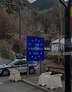
Key Facts
- Total Length: 64 km (40 mi).
- Location: Pyrenees Mountains, bordering Catalonia, Spain.
- Official Language: Catalan (Andorra).
- Highest Point: Passes near Coma Pedrosa, Andorra's highest peak.
- UNESCO Site: Borders the Madriu-Perafita-Claror Valley.
Geographic Course and Landmarks
The border begins in the west at the tripoint where Andorra, France, and Spain meet (42°36′13″N 1°26′30″W). From this point, the boundary moves in a generally south-eastern direction before curving northeast to reach the eastern tripoint shared with France (42°30′09″N 1°43′34″W).
Much of the dividing line traverses high-altitude mountain terrain, frequently exceeding 2,000 meters (6,600 ft). This high-elevation path brings the border close to Coma Pedrosa, the highest peak in Andorra. Additionally, the border encompasses the Madriu-Perafita-Claror Valley, which holds the distinction of being Andorra's only UNESCO World Heritage Site.
Regional Access and Infrastructure
Travel between the two nations is facilitated by specific access points. For instance, the border point at Os de Civís in Spain is exclusively accessible via Sant Julià de Lòria in Andorra.
Environmental Cooperation
Recognizing the ecological importance of the Pyrenees, the European Commission adopted a cooperation program in May 2015. This initiative is specifically designed to enhance the protection of the environment across the borders shared between Spain and Andorra, as well as Andorra and France.
| Feature | Detail |
|---|---|
| Total Length | 64 km (40 mi) |
| Mountain Range | Pyrenees |
| Spanish Region | Catalonia |
| Average High Altitude | Over 2,000 meters (6,600 ft) |
| Official Language of Andorra | Catalan |
Frequently Asked Questions
How long is the border between Spain and Andorra?
The border spans a total of 64 kilometers, which is approximately 40 miles.
Which Spanish region borders Andorra?
Andorra borders the autonomous community of Catalonia in northern Spain.
What is the official language of Andorra?
The sole official language of Andorra is Catalan.
Are there any UNESCO World Heritage Sites along the border?
Yes, the border passes the Madriu-Perafita-Claror Valley, which is the only UNESCO World Heritage Site in Andorra.
How is the environment protected in this border region?
In May 2015, the European Commission adopted a cooperation program to improve environmental protection at the borders between Spain, Andorra, and France.
Which town in Spain is only accessible via Sant Julià de Lòria?
The border point at Os de Civís in Spain can only be accessed through Sant Julià de Lòria in Andorra.