São PauloBrazilGreater São PauloPaulistanoSampa

São Paulo: The Pulsing Heart of Brazil's Urban Landscape

São Paulo: The Pulsing Heart of Brazil's Urban Landscape Known by nicknames such as Sampa, the "Concrete Jungle" (Selva de Pedra), and the "Drizzle Land" (Terra da Garoa), São Paulo is mo...

São Paulo: The Pulsing Heart of Brazil's Urban Landscape

Known by nicknames such as Sampa, the "Concrete Jungle" (Selva de Pedra), and the "Drizzle Land" (Terra da Garoa), São Paulo is more than just a city; it is a global megacity. As the largest city in Brazil and the Americas, it serves as a critical financial, cultural, and industrial hub. Guided by the motto "Non ducor, duco" (I am not led, I lead), São Paulo embodies a spirit of leadership and relentless growth.

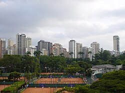
From its humble beginnings as a Jesuit mission to its current status as a sprawling metropolis, the city is a tapestry of diverse ethnicities and architectural styles. Whether it is the high-rise luxury of Paulista Avenue or the vibrant street life of the Liberdade district, São Paulo offers a glimpse into the complexity of modern Latin American urbanism.
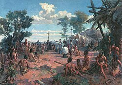
Founding of São Paulo, 1909 painting by Oscar Pereira da Silva

Key Facts

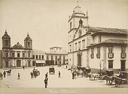
Cathedral Square of São Paulo in 1880, during the reign of Emperor Pedro II by Marc Ferrez
  • Founded: January 25, 1554, by Manuel da Nóbrega and Joseph of Anchieta.
  • Population: Approximately 11.9 million in the municipality and over 21.5 million in the Greater São Paulo metro area.
  • Economic Power: A nominal municipal GDP of US$207.238 billion (2024).
  • Geography: Located at an elevation of 760 meters, with the highest point being Jaraguá Peak at 1,135 meters.
  • Climate: Humid subtropical climate (Cfa), characterized by significant rainfall and occasional drizzle.
  • HDI: 0.821, categorized as very high.

A Journey Through History
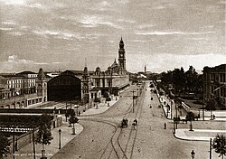
Luz Station in 1900
Luz Station in 1900

The city was founded in 1554 and named after Paul the Apostle. Its early years were shaped by the Jesuits, with the Pátio do Colégio serving as the site of its inception.
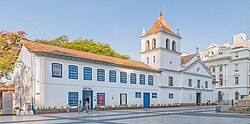
Courtyard of the college, Pátio do Colégio, in the Historic Center of São Paulo. At this location, the city was founded in 1554. The current building is a reconstruction made in the late 20th century, based on the Jesuit college and church that were erected at the site in 1653.

During the colonial era, the Bandeirantes—explorers and frontiersmen—played a pivotal role in expanding Brazil's borders, leaving a lasting legacy on the city's identity.
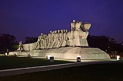
The Monument to the Bandeiras commemorates the 17th-century bandeiras.

As Brazil transitioned through the Imperial and Old Republican periods, São Paulo evolved from a small town into a commercial powerhouse. The 19th and early 20th centuries saw rapid urbanization, fueled by the coffee boom and a massive influx of immigrants.
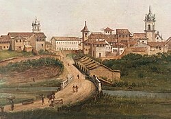
East entrance of the city of São Paulo in 1821, by Arnaud Julien Pallière (1784–1862)

The city's political significance grew over time, marked by events such as the proclamation of Independence by Prince Pedro and the Constitutionalist Revolution of 1932.
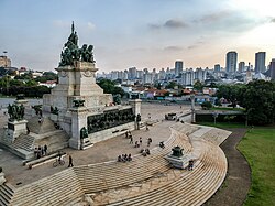
Monument to Independence in Independence Park, located at the place where then-Prince Pedro proclaimed the Independence of Brazil

Geography and Climate

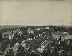
Paulista Avenue in 1902

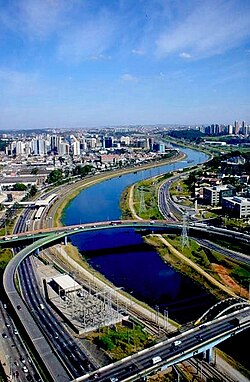
São Paulo is situated on a plateau in the Southeast region of Brazil. Its landscape is a mix of dense urban fabric and remaining natural biodiversity. The city is known for its complex hydrography and the presence of major expressways like Marginal Tietê and Marginal Pinheiros that navigate its river systems.

Jaraguá Peak is the highest point in the city, at 1,135 meters (3,724 ft).[55]

The climate is classified as humid subtropical. While it experiences warm temperatures year-round, it is famous for its sudden weather shifts and high frequency of lightning incidents compared to other Brazilian capitals.

Heavy rain and lightning in São Paulo, which has one of the largest number of lightning incidents amongst Brazilian state capitals[84]

Climate Data Summary

Average Weather Conditions in São Paulo
Metric Summer (Jan/Dec) Winter (Jun/Jul) Annual Average/Record
Mean Daily Max Temp ~26-28°C ~23-24°C Record High: 38.4°C
Mean Daily Min Temp ~18-19°C ~13°C Record Low: -2.1°C
Average Precipitation High (230-290mm) Low (48-60mm) Total: 1,658.3mm

Demographics and Cultural Diversity

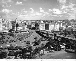
Viaduto do Chá and Anhangabaú Valley in the 1920s

São Paulo is a melting pot of global cultures. The population is predominantly White (54.3%) and Mixed (33.4%), with significant Black (10.1%) and Asian (2.1%) communities. This diversity is most visible in its distinct neighborhoods.

The city has welcomed waves of immigrants, including Italians, Portuguese, and Jews, who have shaped the local economy and social fabric.
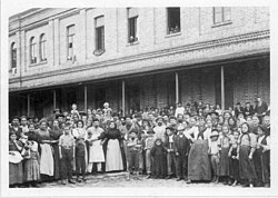
Italian immigrants in the Immigrant Inn, c. 1890

The Liberdade district stands as a testament to the Japanese community, while Bom Retiro reflects the history of Jewish immigration.
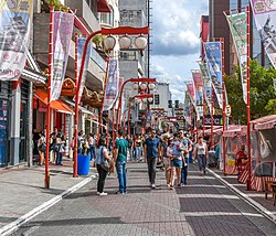
The Liberdade district is a Japantown of São Paulo.

Urban Infrastructure and Governance

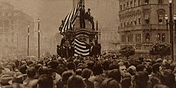
Demonstration in Patriarca Square shortly before the Constitutionalist Revolution of 1932

The municipality is governed by a mayor-council system, currently led by Mayor Ricardo Nunes. Administratively, the city is divided into 32 subprefectures to manage its vast urban area.
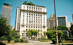
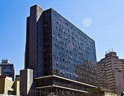
Matarazzo Building, the São Paulo city hall

The city's infrastructure is a blend of historic landmarks and cutting-edge modernity. From the Altino Arantes Building to the Octávio Frias de Oliveira Bridge, the skyline reflects its economic ambition.
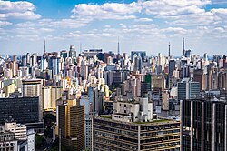
The city view from Altino Arantes Building

Despite its wealth, the city faces significant social challenges, evidenced by the existence of large favelas (slums) such as Paraisópolis and Heliópolis, which contrast sharply with the luxury high-rises of the Jardins region.
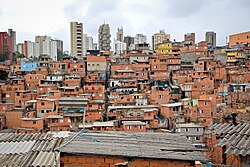
Paraisópolis, the largest slum (favela) in the city, with residential buildings in the background

Culture, Education, and Health

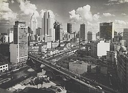
São Paulo in the 1960s, with the Martinelli, Altino Arantes and Mirante do Vale buildings

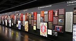
São Paulo is the cultural capital of Brazil. It hosts world-class institutions like the University of São Paulo (USP) and the Museum of the Portuguese Language. The city is also a leader in healthcare, housing the Institute of Cancer of São Paulo, the largest oncology center in Latin America.
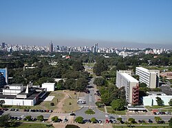
University of São Paulo

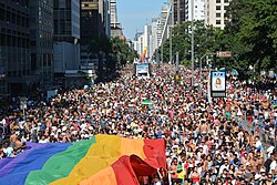
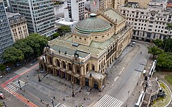
The city is a hub for the arts, featuring the Municipal Theatre and the São Paulo State Symphony at Sala São Paulo. It is also known for its inclusive spirit, hosting one of the world's largest Gay Pride Parades.
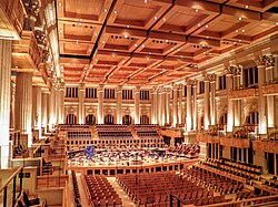
Sala São Paulo, the home of the São Paulo State Symphony

Frequently Asked Questions

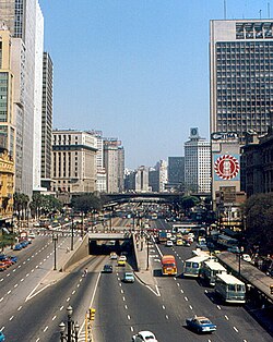
Prestes Maia Avenue in 1974
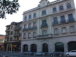
Casa de Portugal in São Paulo headquarters
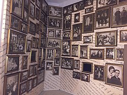
Photos of Jewish immigrants at the Jewish Immigration Memorial in Bom Retiro
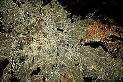
Satellite view of Greater São Paulo at night
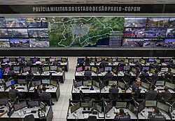
Tactical operations center of the Military Police of São Paulo State in São Paulo
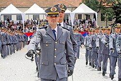
Training of soldiers of the Military Police of São Paulo State at the Military Police Academy of Barro Branco
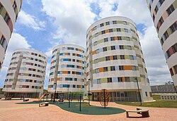
Public housing in Heliópolis
Museum of the Portuguese Language interior
The 18th edition of the São Paulo Gay Pride Parade in 2014
Institute of Cancer of São Paulo, the largest oncology center in Latin America[168][169]
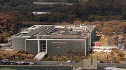
Municipal Chamber of São Paulo
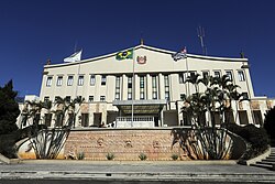
Bandeirantes Palace, the seat of state government
Legislative Assembly of São Paulo
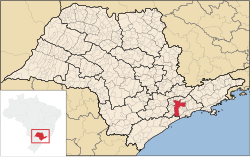
Location on a map of municipalities of the state of São Paulo
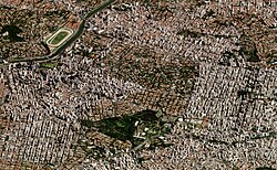
Changes in urban fabrics in the region of Jardins: side by side, vertical areas and low houses
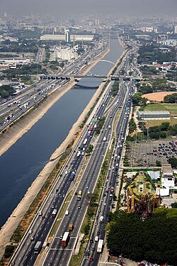
Marginal Tietê, the main expressway of the city
Marginal Pinheiros
Marginal Pinheiros
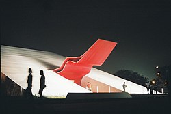
Ibirapuera Auditorium
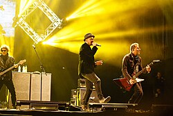
Titãs live at the Montevideo Rock 2018
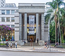
Mário de Andrade Library
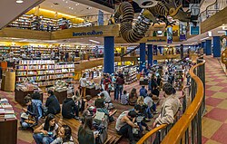
Livraria Cultura
Livraria Cultura
Municipal Theatre of São Paulo
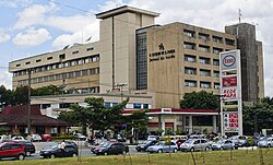
Headquarters of the newspaper O Estado de S. Paulo on the Marginal Tietê
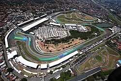
Formula One São Paulo Grand Prix is held at the Autódromo José Carlos Pace in Interlagos.
The Esporte Clube Pinheiros is an important multi-sports and social club.
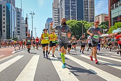
Saint Silvester Road Race in 2018

What is the population of São Paulo?

As of 2025, the municipality has a population of approximately 11,904,961, while the Greater São Paulo metropolitan area reaches about 21,518,955 people.

Why is São Paulo called the "Concrete Jungle"?

The nickname "Selva de Pedra" refers to the city's immense density of skyscrapers and urban infrastructure, which often overshadows the natural landscape.

What is the significance of Paulista Avenue?

Paulista Avenue is the city's primary financial and cultural artery, serving as the headquarters for numerous financial institutions and cultural centers.

What is the climate like in São Paulo?

The city has a humid subtropical climate. It is characterized by warm summers with heavy rainfall and milder winters, often accompanied by a persistent light drizzle (garoa).

Which is the highest point in the city?

The highest point in the city of São Paulo is Jaraguá Peak, which reaches an elevation of 1,135 meters (3,724 ft).

References

  1. "População estimada do país chega a 213,4 milhões de habitantes, divulga IBGE | Agência de Notícias". Agência de Notícias - IBGE (in Brazilian Portuguese). 28 August 2025. Retrieved 16 April 2026.
  2. "São Paulo, São Paulo § informações completas" (in Portuguese). ibge.gov.br. Archived from the original on 21 September 2018. Retrieved 2 January 2020.
  3. "Sobre a RMSP". EMPLASA (in Portuguese). Archived from the original on 3 January 2017. Retrieved 1 January 2017.
  4. S.A, Empresa Paulista de Planejamento Metropolitano. "Região Metropolitana de São Paulo". EMPLASA. Archived from the original on 3 January 2017. Retrieved 3 January 2017.
  5. S.A, Empresa Paulista de Planejamento Metropolitano. "Macrometrópole Paulista". EMPLASA (in Brazilian Portuguese). Archived from the original on 12 October 2019. Retrieved 12 October 2019.