Route 116: A Journey Through Western Massachusetts
Route 116 serves as a vital artery through the heart of Western Massachusetts, connecting the urban centers of the Pioneer Valley with the scenic landscapes of the Berkshires. Spanning multiple counties, this route transitions from busy city streets and university hubs to winding rural roads and mountain vistas.
Key Facts
- Starting Point: Route 20A in Springfield.
- Ending Point: Route 8 in downtown Adams.
- Counties Traversed: Hampden, Hampshire, Franklin, and Berkshire.
- Major Water Crossings: The Chicopee River and the Connecticut River.
- Key Institutions: Mount Holyoke College, Hampshire College, Amherst College, and UMass Amherst.
From Springfield to Holyoke
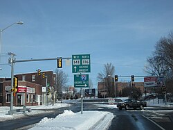
The journey begins in Springfield at Route 20A, shortly before that road terminates at its parent route and I-91. After officially junctioning with the interstate at Exit 11, Route 116 enters Chicopee. The road navigates a complex urban landscape, crossing I-91 and meeting I-391 twice on opposite sides of the Chicopee River. After passing under the Massachusetts Turnpike (I-90) and winding through Chicomansett Village, the route becomes concurrent with Route 141 in the northwest corner of Chicopee.
Continuing into Holyoke, the route crosses the Willimansett Bridge and traverses the downtown area via two one-way streets. After Route 141 diverges, Route 116 crosses a canal and the Vietnam Memorial Bridge, marking the transition into South Hadley and Hampshire County.
Navigating the Academic Hubs of Hampshire County
In South Hadley, Route 116 features a cloverleaf interchange with U.S. Route 202. As it heads north, it meets the end of Route 33 and passes Mount Holyoke College, the starting point for Route 47. The road then turns northeast, clipping the corner of Granby before entering Amherst.
The route passes through the academic heart of the region, skirting Hampshire College and Amherst College before reaching Route 9 in the center of town. Here, Route 116 shares a concurrency—where two route numbers designate the same stretch of road—with Route 9 heading southwest into Hadley.
Upon leaving Route 9, Route 116 transforms into a four-lane divided freeway. This section passes the western edge of UMass Amherst, running behind Warren McGuirk Alumni Stadium. An interchange with North Hadley Road provides direct access to the university campus. As the road continues, it narrows back to a two-lane undivided road, meeting Route 63 and Sunderland Road before entering Franklin County.
Crossing the Connecticut River into the Berkshires
Entering the town of Sunderland, the route passes west of Bull Hill and the Green Swamp. After crossing Route 47 in the town center, Route 116 crosses the Connecticut River for the third time via the Sunderland Bridge, entering Deerfield.
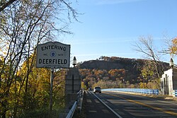
Just over the Whately town line and north of I-91 Exit 24, the route joins U.S. Route 5 and Route 10 for approximately one mile. It then diverges westward, crossing I-91 at Exit 25 and passing through the Mill River area before entering Conway.
The landscape shifts significantly in Conway, where the road becomes winding. After passing through the town center, it enters Ashfield, where it becomes Main Street. In Ashfield, the route experiences a wrong-way concurrency with Route 112 for nearly 1.5 miles—a rare occurrence where two routes share the same road but are signed for opposite cardinal directions.
Turning westward, the route passes Spruce Corner and re-enters Hampshire County in the town of Plainfield. It serves as the primary thoroughfare for the town before meeting Route 8A near the Dubuque Memorial State Forest.
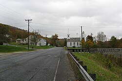
The final leg of the journey takes the route into Berkshire County. In Savoy, Route 8A splits south, while Route 116 continues west into Cheshire. After passing through the northeast corner of Cheshire, the route enters Adams, finally terminating at Route 8 in the southern end of downtown Adams.
Route 116 Summary Table
| Region/Town | Key Landmark or Junction | Road Characteristic |
|---|---|---|
| Springfield/Chicopee | I-91, I-391, Mass Pike | Urban/Interstate Junctions |
| Holyoke | Vietnam Memorial Bridge | One-way downtown streets |
| Amherst/Hadley | UMass Amherst, Route 9 | Four-lane divided freeway |
| Sunderland/Deerfield | Sunderland Bridge, US Route 5/10 | River crossing/Rural |
| Ashfield/Plainfield | Route 112 Concurrency | Winding/Main Street |
| Savoy/Adams | Dubuque Memorial State Forest | Mountainous/Rural |
Frequently Asked Questions
Where does Route 116 begin and end?
Route 116 begins at Route 20A in Springfield and terminates at Route 8 in the southern end of downtown Adams.
Which colleges are located along Route 116?
The route passes Mount Holyoke College, Hampshire College, Amherst College, and UMass Amherst.
What is a "wrong-way concurrency" on this route?
In Ashfield, Route 116 and Route 112 share the same stretch of road for nearly a mile and a half, but they are signed for opposite directions.
How many times does Route 116 cross the Connecticut River?
Route 116 crosses the Connecticut River three times, with the final crossing occurring via the Sunderland Bridge into Deerfield.
Which counties does Route 116 pass through?
The route travels through Hampden, Hampshire, Franklin, and Berkshire counties.