Rahway River: Geography, Basin, and Ecosystems of New Jersey
The Rahway River is a vital waterway in northeastern New Jersey, serving as a central geographic feature across three different counties. Its drainage basin—the area of land where all surface water converges to a single point—covers approximately 41 square miles, spanning Union, Essex, and Middlesex counties.
The River's Course and Tributaries
The Rahway River is formed by the convergence of four distinct branches. The system begins with the West Branch, the longest of the four, which travels 24 miles starting from Verona. The East Branch originates in the West Orange and Montclair areas, eventually merging with the West Branch in Springfield to create the river's main stem.
As the river continues its journey, it is joined by two additional tributaries: the South Branch, which begins in Woodbridge, and the Robinson's Branch, which starts in Scotch Plains. These branches all converge in the city of Rahway, after which the river flows as a single waterway until it reaches its mouth at the Arthur Kill.
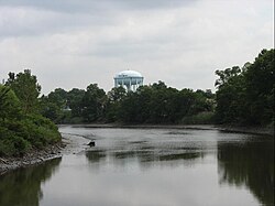
Environmental Characteristics and Landscapes
The Rahway River exhibits a diverse range of ecosystems that shift as the water moves toward the coast. The upper portion of the river, located above Rahway, is characterized by woodlands, floodplains, and freshwater marshes. These areas are critical for managing runoff and supporting local wildlife.
As the river approaches the Arthur Kill, the landscape transitions into saltwater marshes and tidal flats. Notably, the river remains tidal—meaning its water level is influenced by the ocean's tides—for approximately five miles upstream from its mouth.
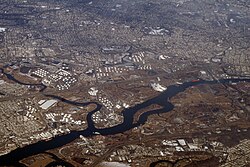
The Rahway River Parkway
Beyond its natural geography, the river is integrated into the local infrastructure through the Rahway River Parkway. This greenway follows the banks of the river and features numerous crossings constructed during the late 19th and early 20th centuries, preserving a piece of the region's architectural and transit history.
Key Facts
- Total Basin Area: Approximately 41 square miles.
- Counties Covered: Union, Essex, and Middlesex.
- Longest Branch: West Branch (24 miles, starting in Verona).
- Tidal Reach: Approximately 5 miles upstream from the mouth.
- Termination Point: The Arthur Kill.
| Branch Name | Origin Point | Convergence Point |
|---|---|---|
| West Branch | Verona | Springfield (joins East Branch) |
| East Branch | West Orange / Montclair | Springfield (joins West Branch) |
| South Branch | Woodbridge | Rahway |
| Robinson's Branch | Scotch Plains | Rahway |
Frequently Asked Questions
How large is the Rahway River drainage basin?
The drainage basin encompasses approximately 41 square miles across Union, Essex, and Middlesex counties in New Jersey.
Where does the Rahway River eventually empty?
The river flows as a single waterway from Rahway to its mouth at the Arthur Kill.
Which branch of the Rahway River is the longest?
The West Branch is the longest, coursing for 24 miles from its start in Verona.
What are the different ecosystems found along the river?
The upper portion consists of woodlands, floodplains, and freshwater marshes, while the lower portion features tidal flats and saltwater marshes.
How far upstream is the Rahway River tidal?
The river is tidal for approximately five miles upstream from its mouth.