Exploring the Majestic Ports de Tortosa-Beseit
Nestled at the northeastern edge of the Sistema Ibérico—a complex network of mountain ranges in the center of the Iberian Peninsula—lies the stunning Ports de Tortosa-Beseit. Known locally as Els Ports, Lo Port, or Ports de Beseit, this limestone mountain massif offers a dramatic landscape of jagged peaks, deep valleys, and steep cliffs. Whether you are a hiker, a nature enthusiast, or a history buff, this region provides a unique glimpse into the rugged beauty of Spain.
Geography and Landscape
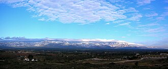
The Ports de Tortosa-Beseit is characterized by its karstic geology, meaning the landscape has been shaped by the dissolving action of water on soluble rocks like limestone. This process has created a complex terrain filled with shafts, caves, and rocky outcrops. The massif is home to several mountain ranges, including the Muntanyes de Benifassà, Serra de les Falconeres, and Serra de l'Espina, the latter of which connects the massif to the Catalan Pre-Coastal Range.
The region serves as a vital watershed, with rivers such as the Matarranya and the Cenia finding their sources within these mountains. At the heart of the massif stands Mont Caro, the highest peak, reaching an elevation of 1,441 meters (4,728 ft).
A Historical Crossroads
The mountains hold significant historical importance. At the 1,350-meter-high Tossal dels Tres Reis (Peak of the Three Kings), a cairn marks the ancient meeting point of the three kingdoms of the Crown of Aragon: Valencia, Catalonia, and Aragon. Beyond its ancient roots, the area also served as one of the final strongholds for the Spanish Maquis—guerrilla fighters—during the 1940s and 1950s.
Biodiversity and Ecology
Despite being mostly uninhabited, save for a few small villages, the Ports de Tortosa-Beseit is a thriving sanctuary for wildlife. The mountains host one of the largest colonies of griffon vultures in Europe. Visitors may also spot Spanish Ibex, Roe Deer, Wild Boar, European badgers, and common genets roaming the slopes.
The aquatic ecosystems are equally diverse, featuring trout in the rivers and amphibians like the Marbled newt in various mountain ponds. The vegetation is a rich tapestry that blends Mediterranean species with Alpine flora and temperate plants found in the higher altitudes and protected valleys.
Key Facts
- Highest Peak: Mont Caro (1,441 m).
- Geology: Karstic limestone formed during the Alpine orogeny.
- Location: Spans the communities of Aragon, Catalonia, and Valencia.
- Major Rivers: Matarranya and Cenia.
- Protected Areas: Parc Natural dels Ports (Catalonia) and Parc Natural de la Tinença de Benifassà (Valencia).
Summary of Regional Data
| Feature | Details |
|---|---|
| Highest Point | Mont Caro (1,441 m) |
| Rock Type | Karstic Limestone (Cretaceous age) |
| Coordinates | 40°48′28″N 0°19′07″E |
| Primary Ranges | Iberian System (Eastern zone) |
| Key Wildlife | Griffon vultures, Spanish Ibex, Roe Deer |
Visiting the Massif
For those looking to explore the area by vehicle, the easiest routes involve driving from Roquetes on the western side or from Beseit on the eastern side. The landscape is divided into several administrative regions (comarcas), including Matarranya, Baix Ebre, Montsià, and Baix Maestrat.
Notable Peaks
The massif boasts an impressive list of summits for climbers and hikers, including:
- Tossal dels Tres Reis
- Castell de l'Airosa
- Tossal d'en Cervera
- Mola del Boix
- Punta de l'Àliga
- Tossa Blanca
Frequently Asked Questions
What are the main protected areas in the Ports?
The massif contains two primary natural parks: the Parc Natural dels Ports on the Catalan side and the Parc Natural de la Tinença de Benifassà on the Valencian side. There is currently no protected area designated on the Aragonese side.
What kind of terrain can I expect to hike?
Expect a rugged, karstic landscape. This includes steep cliffs, jagged peaks, deep valleys, and various caves and shafts formed by limestone erosion.
Is the area inhabited?
The mountains are mostly uninhabited, with the exception of a few small villages scattered throughout the region.
What is the best way to access the mountains?
The most accessible routes for driving are from the western side via Roquetes or from the eastern side via Beseit.
What makes the Tossal dels Tres Reis special?
It is a significant historical site where a cairn marks the intersection of the ancient borders of the Kingdoms of Valencia, Catalonia, and Aragon.