Orange River: Southern Africa's Longest Waterway
The Orange River is the longest river in South Africa, serving as a vital lifeline for the arid regions of the south. Stretching 2,432 km (1,511 mi), this massive waterway originates in the highlands of Lesotho and flows westward across South Africa before emptying into the Atlantic Ocean. Known by various names including the Gariep and the Senqu, the river is central to the region's economy, providing essential water for irrigation and hydroelectric power.
The river's naming history reflects the diverse cultures of the region. It was named the Orange River by Dutch explorer Robert Jacob Gordon in honor of the House of Orange. However, indigenous names such as !Garib (Khoekhoegowab) and iGqili (isiZulu and isiXhosa) highlight its deep ancestral roots. In Lesotho, it is referred to as the Senqu River, derived from the Khoemana word for "Black".
![The course and watershed of the Orange River, Caledon River and Vaal River (ǀHaiǃarib). This map shows a conservative border for the watershed. Specifically, the Kalahari basin is excluded, as some sources say it is endorheic.[7] Some other sources using computational methods show a basin which includes parts of Botswana (and hence of the Kalahari).[8]](/images/ac/d3/acd3dd386cd96d7040298673f6255e2cdf44e79daffeeb1098addab7f27052e2.webp)
Key Facts
- Total Length: 2,432 km (1,511 mi).
- Basin Size: 973,000 km², covering approximately 77% of South Africa's land area.
- Source: Mont-aux-Sources in the Drakensberg mountains, Lesotho (3,350 m elevation).
- Mouth: Alexander Bay, Atlantic Ocean.
- Major Tributaries: Vaal River, Caledon River, and Fish River (Namibia).
- Economic Value: Critical for hydroelectric power, commercial irrigation, and diamond mining.
Course and Geography
The Upper Reaches and Lesotho
The river begins at Mont-aux-Sources in the Maloti Mountains of Lesotho. In this high-altitude region, the river is known as the Senqu. Due to the extreme elevation, parts of the river can freeze during winter, which occasionally leads to downstream droughts that impact livestock production for goats and cattle.
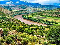
Flow Through South Africa
As it enters South Africa, the river forms the southwestern boundary of the Free State province. In its early stages, the river bed is deeply incised, flowing through major reservoirs including the Gariep Dam and the Vanderkloof Dam. As the terrain flattens, the river becomes a primary source for extensive irrigation projects.
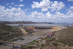
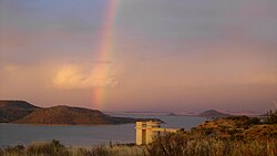
A pivotal point in the river's course occurs southwest of Kimberley, where it meets its largest tributary, the Vaal River. From there, it traverses the arid landscapes of the southern Kalahari and Namaqualand in the Northern Cape.
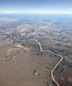
The Border and the Atlantic Mouth
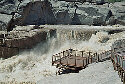
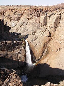
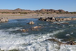
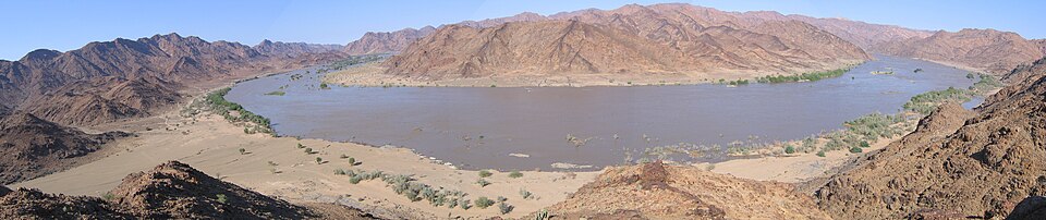
For 550 km (340 mi), the Orange River serves as the international border between South Africa and Namibia's ǁKaras Region. In its final 800 km, the river is fed by intermittent streams and wadis, though these contribute little volume due to the surrounding Namib Desert. A highlight of this section is the Augrabies Falls, where the river drops 56 m (184 ft) over an 11-mile stretch.
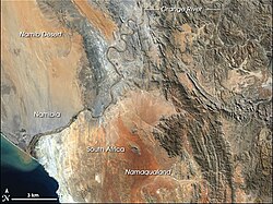
The river finally reaches the Atlantic Ocean between Oranjemund, Namibia, and Alexander Bay, South Africa. This mouth is a recognized Ramsar site—a wetland of international importance—supporting high biodiversity, including dozens of bird species.
Hydrology and Environment
The Orange River basin experiences extreme precipitation gradients. At its source, annual rainfall reaches 2,000 mm (79 in), but this drops to less than 50 mm (2.0 in) at the mouth. During the summer wet season, the river transforms into a brown torrent, carrying heavy sediment loads that can challenge engineering infrastructure.
Tributary Systems
The upper basin is fed by the Maloti Mountains, with the Caledon and Senqunyane rivers providing significant discharge. The Vaal River is the most substantial tributary, extending 1,458 km (906 mi).
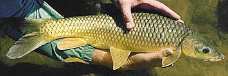
The river's wildlife is relatively limited. While hippopotami were once common, they were hunted to extinction in the 19th century. The system is now best known for its endemic fish species, including the smallmouth yellowfish, a favorite for sport fishing.
Economic Impact and Infrastructure
The Orange River Project (ORP)
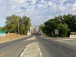
The ORP was a massive engineering effort designed to stabilize river flow, generate hydroelectric power, and ensure a reliable water supply for the basin. The Gariep Dam serves as the central storage hub, distributing water westward to the Vanderkloof Dam and southward via the Orange-Fish Tunnel to the Eastern Cape.
Irrigation and Water Transfer
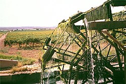
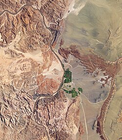
The river is essential for agriculture in arid zones, supporting everything from large-scale irrigation projects to specialized vineyards.
Additionally, the Lesotho Highlands Water Project supplements the Vaal River system by transferring water from Lesotho through a series of tunnels to meet the high water demands of Gauteng.
Alluvial Diamonds
The Orange River is historically linked to the diamond industry. The first South African diamond, the Eureka Diamond, was found near Hopetown in 1867. Today, commercial diamond mining continues along the river's final stretch and at its mouth, where diamonds are recovered from alluvial gravel deposits.
Tourism and Recreation
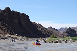
The river's dramatic topography makes it a destination for adventure tourism. Rafting and canoeing are popular activities, particularly in the lower reaches, with many expeditions departing from the border town of Vioolsdrif during the temperate months of March and April.
Summary of River Characteristics
| Feature | Detail |
|---|---|
| Total Length | 2,432 km (1,511 mi) |
| Basin Area | 973,000 km² |
| Primary Source | Mont-aux-Sources, Lesotho |
| Primary Mouth | Atlantic Ocean (Alexander Bay) |
| Key Dams | Gariep, Vanderkloof, Katse, Mohale |
| Endemic Fish | Smallmouth and Largemouth Yellowfish |
Frequently Asked Questions
Why is the river called the Orange River?
It was named by Dutch explorer Robert Jacob Gordon in 1779 in honor of William V of Orange. A common misconception is that it was named for the color of the water; however, the name is purely dynastic.
What is the significance of the Augrabies Falls?
The Augrabies Falls are a major geographical feature where the river descends 56 meters over a short distance, creating a spectacular waterfall and a deeply incised river bed.
How does the river support the economy of South Africa?
The river provides critical water for irrigation in arid regions, generates hydroelectric power through dams like Gariep and Vanderkloof, and supports a commercial diamond mining industry.
What is the Lesotho Highlands Water Project?
It is a large-scale water transfer scheme that diverts water from the highlands of Lesotho into the Vaal River system to support the industrial and urban water needs of Gauteng.
Are there any unique animals in the Orange River?
While it lacks large mammals like hippos or crocodiles, it is home to several endemic fish species, such as the Orange River Mudfish and the Maluti redfin.