North Region of Brazil: The Heart of the Amazon
The North Region (Região Norte) is the largest geographical area of Brazil, encompassing a staggering 45.27% of the national territory. Spanning an area of 3,853,676.9 km², it is slightly larger than India and slightly smaller than the European Union. Despite its massive size, it has the lowest population density in the country, with only 4.5 inhabitants per square kilometer, and the second-lowest total population of any Brazilian region.
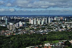
The region is composed of seven states: Acre, Amapá, Amazonas, Pará, Rondônia, Roraima, and Tocantins. While much of the land is characterized by dense wilderness, 75.6% of the population resides in urban centers, with Manaus and Belém serving as the primary metropolitan hubs.
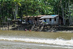
Key Facts
- Total Area: 3,853,676.9 km² (Ranked 1st in Brazil).
- Population: 17,354,884 (Ranked 4th in Brazil).
- GDP: R$ 564.064 billion (US$ 104.634 billion).
- HDI: 0.730 (High category).
- Biodiversity: Home to over one-third of all known species in the world.
- Climate: Predominantly equatorial, characterized by high heat and humidity.
History and Settlement
Long before European arrival, the region was inhabited by diverse tribes of Native Brazilians. Early European exploration was led by the Spaniards, including Francisco de Orellana, who charted the Amazon River. By the 17th century, the Portuguese established military strongholds to defend the territory, leading to the foundation of Belém do Pará in 1616.
The Portuguese Crown was drawn to the richness of the Amazon Rainforest, and Catholic missionaries established "missions" to catechize indigenous peoples, many of which evolved into modern cities like Borba and Óbidos. Later, the rubber boom between 1840 and 1910 drew migrants from Brazil's Northeast and Japanese agricultural colonists to the region.
In the mid-to-late 20th century, military governments sought to integrate the North with the rest of Brazil. This era saw the construction of major highways, such as the BR-010, and the 1967 creation of the Free Economic Zone of Manaus to stimulate industrial growth.
Geography and Biodiversity
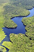
The North Region is defined by the Amazon, the world's largest and most species-rich tract of tropical rainforest. This biome is unparalleled in its biodiversity; it is estimated that a single square kilometer can contain over 75,000 types of trees and 150,000 species of higher plants.
Scientifically classified species in the region include at least 40,000 plants, 3,000 fish, 1,294 birds, 427 mammals, 428 amphibians, and 378 reptiles. Approximately 2.5 million insect species call this region home.
Climate and the "Friagem" Phenomenon
The region is dominated by an equatorial climate, with average temperatures ranging from 24°C to 26°C. However, some areas in Amazonas, Rondônia, and Acre experience friagem. This occurs when La Niña activity allows cold air masses from the South Atlantic to penetrate the interior, causing temperatures to drop rapidly for about a week during the winter.
![Climate classification for Northern Brazil.[5]](/images/c9/32/c932e2f2f95d24ba652847ba0aae41d9e29f6f7d7c6257dad8012c3d24836893.webp)
Economy and Infrastructure
The economy relies heavily on extraction and agriculture. Key vegetal products include latex, açaí, timber, and Brazil nuts. Mineral extraction is also vital, with gold, precious stones, cassiterite, and tin being primary exports. The Carajás Mountain Range in Pará is a major source of iron, while the Navio Mountain Range in Amapá provides manganese.
Transportation is primarily conducted via boat or airplane due to the dense terrain. Key air hubs include Belém International Airport and Eduardo Gomes International Airport in Manaus. While highways are few, the BR-364 and the Interoceanic Highway (connecting Acre to Peru) are critical for land trade.
| City | Population |
|---|---|
| Manaus | 2,063,689 |
| Belém | 1,303,403 |
| Ananindeua | 478,778 |
| Porto Velho | 460,434 |
| Macapá | 442,933 |
| Boa Vista | 413,486 |
| Rio Branco | 364,756 |
Culture and Demographics
The population is largely composed of Caboclos—descendants of Native Brazilians and Europeans (primarily Portuguese, French, and Spanish). According to 2022 data, 67.2% of the population identifies as multiracial.
The region's culture is a vibrant blend of Indigenous, African, and Portuguese influences. This is evident in its gastronomy, featuring dishes like duck in tucupi sauce, maniçoba, and tacacá, as well as a wide array of fish such as pirarucu and tambaqui. Local fruits like açaí, cupuaçu, and guaraná are staples of the diet.
Cultural highlights include the Parintins Folklore Festival and the Círio de Nazaré. The region also boasts architectural landmarks such as the Amazon Theatre in Manaus and the Peace Theatre in Belém.
Frequently Asked Questions
Which is the largest city in the North Region?
Manaus is the most populous city in the region, with a population of 2,063,689 as of 2022.
What is the "friagem" phenomenon?
Friagem is a weather event occurring in winter where cold air masses from the South Atlantic penetrate the Amazonian states of Amazonas, Rondônia, and Acre, causing a rapid drop in temperature.
What are the primary economic drivers of the region?
The economy is based on vegetal extraction (latex, açaí, Brazil nuts), mineral mining (iron, gold, manganese), and the industrial activities of the Free Economic Zone of Manaus.
How do people primarily travel within the North Region?
Due to the geography, most transportation is conducted by boat or airplane, although a few key highways like the BR-364 and BR-010 provide essential land connections.
What is a Caboclo?
A Caboclo is a person of mixed ancestry, specifically the descendants of Native Brazilians and Europeans, who make up a large portion of the region's population.