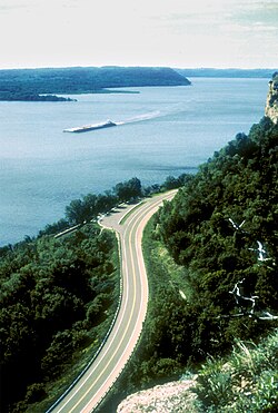
Mississippi RiverLake ItascaGulf of MexicoMississippi River basinUpper Mississippi River

Mississippi River: The Mighty Waterway of North America

Mississippi River: The Mighty Waterway of North America Known by many as "Old Man River," "The Mighty Mississippi," or the "Father of Waters," the Mississippi River is one of the world's ...

Mississippi River: The Mighty Waterway of North America

Known by many as "Old Man River," "The Mighty Mississippi," or the "Father of Waters," the Mississippi River is one of the world's most significant river systems. Its name originates from the Ojibwe word Misi-ziibi, which translates to "Great River." Flowing through the heart of the United States, it serves as a vital artery for commerce, ecology, and history, connecting the northern forests of Minnesota to the tropical shores of the Gulf of Mexico.

The river's immense scale is reflected in its basin, which drains a vast portion of the North American continent. This watershed encompasses a diverse array of landscapes, supporting countless communities and a rich variety of wildlife.
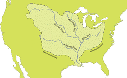
Map of the Mississippi River watershed

Key Facts

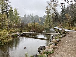
A log bridge over a very small river on an autumnal, cloudy day with flurries of snow
The first bridge (and only log bridge) over the Mississippi, about 25 feet south of its source at Lake Itasca
  • Total Length: 2,340 miles (3,766 km).
  • Source: Lake Itasca in Itasca State Park, Minnesota.
  • Mouth: Gulf of Mexico at Pilottown, Louisiana.
  • Basin Size: Approximately 1,151,000 square miles (increasing to 1,245,000 square miles when including the Atchafalaya).
  • States Traversed: Minnesota, Wisconsin, Iowa, Illinois, Missouri, Kentucky, Tennessee, Arkansas, Mississippi, and Louisiana.
  • Major Hubs: Minneapolis–Saint Paul, St. Louis, Memphis, New Orleans, and Baton Rouge.

Geography and Physical Characteristics
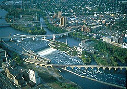
St. Anthony Falls
De facto head of navigation, St. Anthony Falls, Minneapolis, Minnesota

The Journey from Source to Sea

The Mississippi begins its journey at an elevation of 1,475 feet at Lake Itasca. From this modest start, it flows southward, gradually gaining volume and power as it collects water from numerous tributaries.
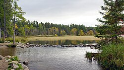
The source of the Mississippi River at Lake Itasca

The river is traditionally divided into three primary sections:

  1. Upper Mississippi: Extending 493 miles from the source to Saint Anthony Falls in Minneapolis, Minnesota.
  2. Middle Mississippi: The central stretch where the river continues to expand.
  3. Lower Mississippi: The final reach, demarcated from the Middle Mississippi at the confluence of the Ohio River at Cairo, Illinois.
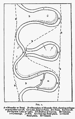
Visual guide to Mississippi River nomenclature

Hydrology and Discharge

The discharge—the volume of water flowing through the river per unit of time—varies significantly depending on the location and season. For example, at Vicksburg, the average discharge is approximately 738,500 cubic feet per second (cu ft/s), though it has reached maximums of 2,340,000 cu ft/s. In contrast, the discharge at St. Paul is much lower, averaging around 13,040 cu ft/s.
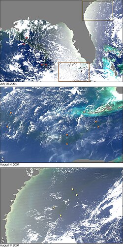
Sequence of NASA MODIS images showing the outflow of fresh water from the Mississippi (arrows) into the Gulf of Mexico (2004)

Navigation and Infrastructure

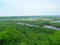
Confluence of the Wisconsin and Mississippi rivers, viewed from Wyalusing State Park in Wisconsin

Commercial Importance

The Mississippi is a cornerstone of American transport. Large towboats and barges move massive quantities of goods across the interior of the country. However, navigation is not without challenges; shifting sandbars historically made travel difficult, and extreme weather can cause significant disruptions.
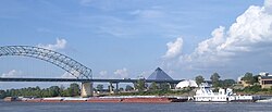
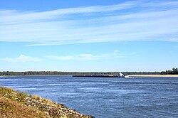
Towboat and barges at Memphis, Tennessee

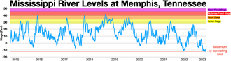
In late 2022, low river levels caused backups on the Lower Mississippi, stalling over 100 towboats and 2,000 barge units, which led to a surge in barge rates.

Downbound barge rates In late 2022 there was low river levels that caused two backups on the Lower Mississippi River that held up over 100 tow boats with 2,000 barge units and caused barge rates to soar[75][76]

Engineering and Flood Control

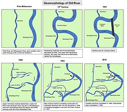
To manage the river's volatile nature, the U.S. Army Corps of Engineers has implemented extensive flood control measures, including levees and the Old River Control Structure. This complex is critical in preventing the Mississippi from naturally diverting its course into the Atchafalaya River.
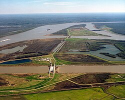
The Old River Control Structure complex. View is to the east-southeast, looking downriver on the Mississippi, with the three dams across channels of the Atchafalaya River to the right of the Mississippi. Concordia Parish, Louisiana is in the foreground, on the right, and Wilkinson County, Mississippi, is in the background, across the Mississippi on the left.

Historical and Cultural Significance
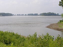
The Upper Mississippi River at its confluence with the Missouri River north of St. Louis

Exploration and Colonization

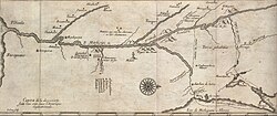
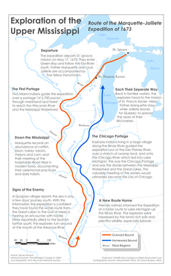
The river has been a focal point for exploration for centuries. Spanish conquistador Hernando de Soto is credited with one of the first European sightings of the river in 1541. Later, French explorers Marquette and Jolliet mapped the river in 1673, leading to the establishment of various French settlements across North America by 1750.
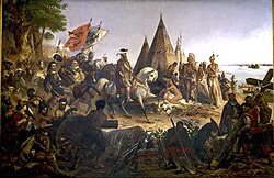
Discovery of the Mississippi by De Soto A.D. 1541 by William Henry Powell depicts Hernando de Soto and Spanish Conquistadores seeing the Mississippi River for the first time.

Conflict and Commerce

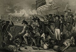
The river played a strategic role in the War of 1812 and the American Civil War. The Battle of Vicksburg, for instance, was a pivotal moment in the Civil War, as control of the river was essential for dividing the Confederacy.
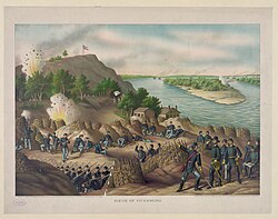
Battle of Vicksburg (ca. 1888)

Ecology and Environment

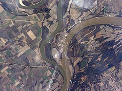
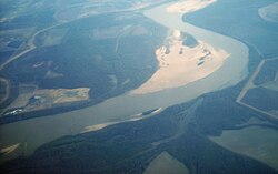
The confluence of the Mississippi (left) and Ohio (right) rivers at Cairo, Illinois, the demarcation between the Middle and the Lower Mississippi River

The Mississippi River basin is a biodiversity hotspot. It is home to unique species such as the American paddlefish, an ancient relict species. The river's ecosystem supports a wide array of fish and fauna, though it faces ongoing challenges from pollution and invasive species.
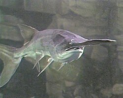
The American paddlefish is an ancient relict from the Mississippi

Mississippi River Summary Table
Feature Detail
Length 2,340 miles
Source Lake Itasca, MN
Mouth Gulf of Mexico, LA
Basin Area 1.15 - 1.24 million sq miles
Primary Divisions Upper, Middle, and Lower Mississippi
Key Tributaries Missouri River, Ohio River

Frequently Asked Questions

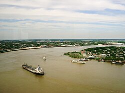
Lower Mississippi River at Algiers Point in New Orleans
Reconstructed and historical courses of the Lower Mississippi River (sheet 7/15)[57]
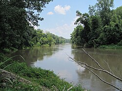
View along the former riverbed at the Tennessee/Arkansas state line near Reverie, Tennessee (2007)
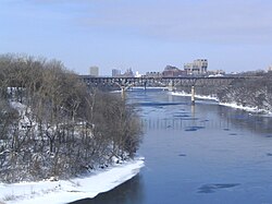
In Minnesota, the Mississippi River runs through the Twin Cities (2007)
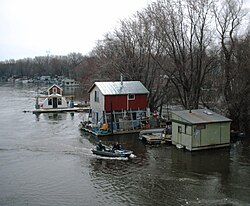
Community of boathouses on the Mississippi River in Winona, MN (2006)
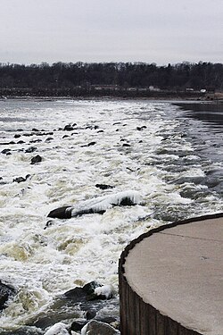
The Mississippi River at the Chain of Rocks just north of St. Louis (2005)
A low-water dam deepens the pool above the Chain of Rocks Lock near St. Louis (2006)
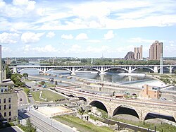
The Stone Arch Bridge, the Third Avenue Bridge and the Hennepin Avenue Bridge in Minneapolis (2004)
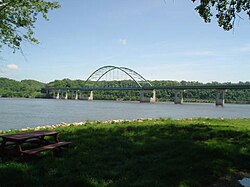
The Dubuque-Wisconsin Bridge (2004)
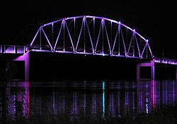
Norbert F. Beckey bridge at Muscatine, Iowa, with LED lighting
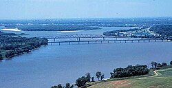
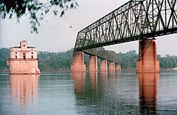
The Chain of Rocks Bridge at St. Louis, Missouri
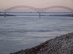
The Hernando de Soto Bridge in Memphis, Tennessee (2009)
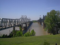
Vicksburg Bridge
Vicksburg Bridge
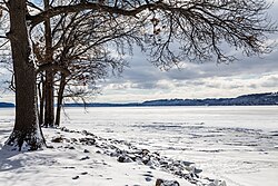
The Mississippi River frozen over near Potosi, Wisconsin
Mississippi River levels at Memphis, Tennessee Major flood stage Moderate flood stage Flood stage Action stage River levels Minimum operating limit (−12 feet)
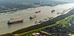
Ships on the lower part of the Mississippi
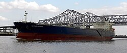
Oil tanker on the Lower Mississippi near the Port of New Orleans
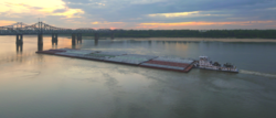
Barge on the Lower Mississippi River
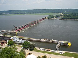
Lock and Dam No. 11, north of Dubuque, Iowa (2007)
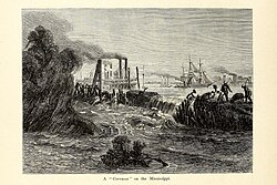
Laborers fighting a "crevasse" in a riverfront levee that will flood the adjacent agricultural land if not repaired (Picturesque America, 1872)
Formation of the Atchafalaya River and construction of the Old River Control Structure.
Project design flood flow capacity for the Mississippi river in thousands of cubic feet per second.[85]
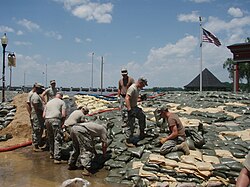
Soldiers of the Missouri Army National Guard sandbag the River in Clarksville, Missouri, June 2008, following flooding.
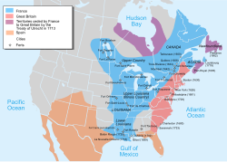
Map of the French settlements (blue) in North America in 1750, before the French and Indian War (1754 to 1763).
c. 1681 map of Marquette and Jolliet's 1673 expedition.
Route of the Marquette-Jolliete Expedition of 1673
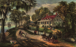
A Home on the Mississippi (1871)
The United States used a motley crew to defend the mouth of the Mississippi River in 1815; forces included Tennessee and Kentucky militiamen, free men of color, French Creoles, Choctaw Indians, slave-trading privateers based out of Galveston, and Mississippi plantation slaves recruited to dig earthworks for "Line Jackson"
Shifting sand bars made early navigation difficult.
Mississippi River from Eunice, Arkansas, a settlement destroyed by gunboats during the Civil War.
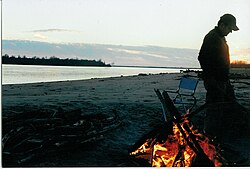
Campsite at the river in Arkansas
Great River Road in Wisconsin near Lake Pepin (2005)

Where does the Mississippi River start and end?

The river traditionally begins at Lake Itasca in Itasca State Park, Minnesota, and ends at the Gulf of Mexico in Pilottown, Louisiana.

What is the Old River Control Structure?

It is a complex of dams and engineering works designed to prevent the Mississippi River from changing its course and flowing primarily into the Atchafalaya River.

Which cities are the largest along the river?

The largest metropolitan areas along the river include Minneapolis–Saint Paul, St. Louis, Memphis, New Orleans, and Baton Rouge.

How does the river affect the Gulf of Mexico?

The river delivers a massive volume of fresh water into the Gulf of Mexico, creating a distinct outflow plume that affects the salinity and ecology of the coastal waters.

What is the difference between the Upper and Lower Mississippi?

The Upper Mississippi runs from the source to Saint Anthony Falls in Minneapolis. The Lower Mississippi begins at the confluence of the Ohio River in Cairo, Illinois, and extends to the Gulf of Mexico.

References

  1. The United States Geological Survey recognizes two contrasting definitions of a river's source.[9] By the stricter definition, the Mississippi would share its source with its longest tributary, the Missouri, at Brower's Spring in Montana. The other definition acknowledges "somewhat arbitrary decisions" and places the Mississippi's source at Lake Itasca, which is publicly accepted as the source,[9] and which had been identified as such by Brower himself.[16] However, the river continues for several miles upstream from Lake Itasca to Nicolet Lake and its feeder stream.
  2. Ojibwe: Misi-ziibi,[17] Dakota: Mníšošethąka,[18] Myaamia: Mihsi-siipiiwi,[19] Cheyenne: Ma'xeé'ometāā'e,[20] Kiowa: Xósáu,[21] Arapaho: Beesniicie,[22] Pawnee: Kickaátit[23]
  3. The largest riverine basin, the Mississippi basin is the second-largest drainage system in North America after the Hudson Bay drainage system, although Hudson Bay may rather be considered an arm of the ocean.
  4. Shaffer, James L.; Tigges, John T. (2000). The Mississippi River: Father of Waters. Chicago, Ill.: Arcadia Publishing.
  5. The Upper Mississippi River Basin: A Portrait of the Father of Waters As Seen by the Upper Mississippi River Comprehensive Basin Study. Chicago, Ill.: Army Corps of Engineers, North Central Division. 1972.