Los Roques Archipelago: Venezuela's Pristine Caribbean Paradise
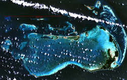
Located 128 km (80 mi) north of the port of La Guaira in the Caribbean Sea, the Los Roques Archipelago is a breathtaking collection of approximately 350 islands, cays, and islets. Spanning a total area of 40.61 km², this federal dependency of Venezuela is renowned for its crystalline waters, vibrant coral reefs, and unique atoll structures.
The archipelago is more than just a scenic destination; it is a vital ecological sanctuary. Its geography is defined by two external coral barriers that protect an inner lagoon and sandy shallows, creating a haven for some of the Caribbean's most diverse marine life.
Key Facts
- Total Islands: Approximately 350 islands, cays, and islets.
- Major Island: Gran Roque serves as the primary settlement and administrative center.
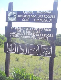
- Conservation Status: Designated as a National Park in 1972 and a Ramsar Wetland on September 4, 1996.
- Biodiversity: Home to 280 species of fish and four types of threatened sea turtles.
- Climate: Warm and dry, with an average annual temperature of 27.3°C (81.1°F).
History and Administration
The history of Los Roques is marked by shifting colonial interests and eventual Venezuelan integration. In the 19th century, the Dutch claimed the islands as part of their Curaçao territory due to their proximity to Bonaire. However, the Spanish Sociedad Mercantil Real Compañía Guipuzcoana established a presence in the 18th century, naming several islands including Gran Roque and Carenero.
Venezuela formally organized the area in 1871 when President Antonio Guzmán Blanco created the Territorio Colón. By 1910, the town of Gran Roque began to grow as fishing families from Margarita Island settled there. The islands were officially integrated into the Federal Dependencies of Venezuela on July 20, 1938.
To ensure sustainable development, the government created the Single Authority of Los Roques Area in 1990. In 2011, the archipelago was integrated into the Miranda Insular Territory (Territorio Insular Francisco de Miranda), a subdivision of the Federal Dependencies with its capital at Gran Roque.
Geography and Ecosystems
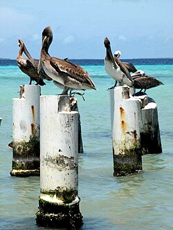
The archipelago's structure is primarily that of an atoll. It features 1,500 km (580 sq mi) of coral reefs and 42 coral cays surrounding a shallow central lagoon of 400 km². The islands vary significantly in size, from the expansive Cayo Grande (15.1 km²) to the administrative hub of Gran Roque (1.7 km²).
The highest point in the archipelago is Cerro El Cabezón, reaching an elevation of 120 m (390 ft). The climate remains consistently warm, with peak temperatures reaching 34°C in July and August, and minimal rainfall occurring in April.
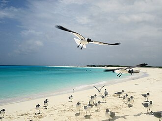
Marine Biodiversity
The waters of Los Roques are an immense reservoir of biological richness. The region supports:
- Fish and Invertebrates: 280 species of fish, 200 species of crustaceans, 140 species of mollusks, and 60 species of sponges.
- Corals: 61 species of corals, including nine types of octocorals.
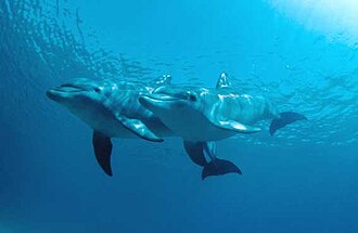
- Mega fauna: Abundant populations of dolphins, whales, manta rays, and sea urchins.
- Threatened Turtles: Regular nesting grounds for loggerhead, green, leatherback, and hawksbill sea turtles.
National Park Zoning and Conservation
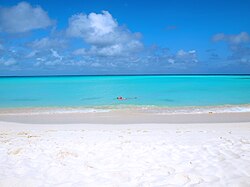
Since its declaration as a National Park in 1972, a strict zoning plan has been implemented to protect fragile ecosystems. This system limits human activity based on the ecological importance of the area.
| Island/Cayo | Area (ha) | Zoning Category |
|---|---|---|
| Cayo Grande | 1510 | Integral Protection Zone |
| Gran Roque | 180 | Recreation and Service Zone |
| Cayo de Agua | 69 | Primitive Marine Zone |
| Cayo Madrisquí | 19.3 | Managed Natural Environment Zone |
| Cayo Crasquí | 92 | Recreation and Service Zone |
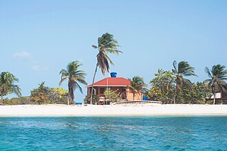
The Los Roques Scientific Foundation (Fundación Científica de Los Roques) operates laboratories on the island of Dos Mosquises, conducting critical research in oceanography, archaeology, and the study of corals and mollusks.
Tourism and Infrastructure
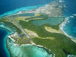
Tourism became a primary economic driver after 1990. Today, the island of Gran Roque serves as the tourism hub, hosting over 60 hostels (posadas), 50 travel agencies, and six airlines. Approximately 95% of visitors arrive by plane, with a new airport inaugurated in September 2019 to handle increased national and international traffic.
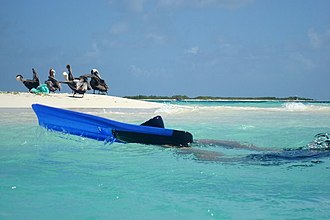
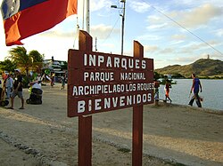
Visitors typically stay in posadas (96%) or on sailboats (3%), with a small minority camping in designated INPARQUES areas. To explore the surrounding cays, tourists use small traditional boats known as peñeros, which operate daily from the port of Gran Roque.
Frequently Asked Questions
What is the main settlement in the Los Roques Archipelago?
The main settlement is the island of Gran Roque, which serves as the administrative capital and the primary hub for tourism, hosting the majority of the archipelago's hostels and airlines.
How is the Los Roques National Park protected?
The park uses a zoning system that categorizes areas into Integral Protection, Primitive Marine, Managed Natural Environment, and Recreation and Service zones. This ensures that the most fragile ecosystems have the fewest permitted human activities.
Which animals can be found in the archipelago?
The area is rich in marine life, including dolphins, whales, manta rays, and 280 species of fish. It is also a critical nesting site for four threatened sea turtle species: loggerhead, green, leatherback, and hawksbill.
How do tourists typically reach the islands?
The vast majority (95%) of tourists arrive via plane at the Los Roques airport. Once on Gran Roque, they use small boats called peñeros to visit the various cays and islets.
Who manages the archipelago today?
The archipelago is part of the Miranda Insular Territory, a subdivision of the Federal Dependencies of Venezuela.