Lake Titicaca: The Highest Navigable Lake in the World
Nestled high within the Andes mountains on the border of Bolivia and Peru, Lake Titicaca stands as a geographical marvel. Renowned as the highest navigable lake in the world for commercial craft, it is the largest lake in South America by both surface area and water volume. While often categorized as a freshwater lake, its waters are slightly brackish, creating a unique ecosystem at a staggering elevation of 3,812 meters (12,507 feet).
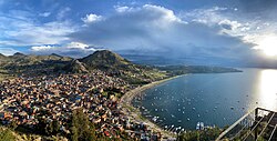
Key Facts
- Elevation: 3,812 meters (12,507 feet) above sea level.
- Size: Largest lake in South America; 18th largest globally.
- Geography: Shared between Bolivia and Peru.
- Water Type: Slightly brackish (salinity 5.2-5.5 parts per 1000).
- Key Feature: Divided into two sub-basins: Lago Grande and Wiñaymarka.
Geography and Hydrology
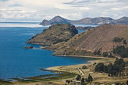
Lake Titicaca is composed of two nearly separate sub-basins linked by the Strait of Tiquina, which narrows to just 800 meters (2,620 feet). The larger section, Lago Grande (or Lago Chucuito), reaches a maximum depth of 284 meters (932 feet). In contrast, the smaller sub-basin, Wiñaymarka (the "little lake"), is much shallower, with a maximum depth of 40 meters (131 feet).
The lake is monomictic, meaning its waters circulate fully only once a year. Its water balance is primarily maintained by evapotranspiration—water loss caused by intense high-altitude sunlight and strong winds—which accounts for 90% of the loss. The remaining 10% exits via the Desaguadero River, which flows south into Bolivia toward Lake Poopó.
| Feature | Measurement |
|---|---|
| Surface Area | 8,372 km² (3,232 sq mi) |
| Maximum Length | 190 km (118 mi) |
| Maximum Width | 80 km (50 mi) |
| Average Depth | 107 m (351 ft) |
| Maximum Depth | 281 m (922 ft) |
| Water Volume | 896 km³ (215 cu mi) |
| Shore Length | 1,125 km (699 mi) |
Ecology and Biodiversity
The lake's environment is characterized by widespread aquatic vegetation. Totora sedges—sturdy reeds used for construction and crafts—grow in waters shallower than 3 meters. Other macrophytes (aquatic plants), such as Chara and Potamogeton, can be found at depths of up to 10 meters.
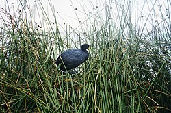
The lake is home to specialized wildlife, including the Andean coot and two species of Telmatobius frogs: the smaller marbled water frog and the larger Titicaca water frog, which is adapted for deep-water environments.
![Two Telmatobius species occur in the lake, the smaller, more coastal marbled water frog (pictured, at Isla del Sol) and the larger, more deep-water Titicaca water frog.[29]](/images/49/61/496122a719ee4da631feee5f098dcea94757313e1a98a71422c9e2316cb0607f.jpg)
Islands and Human History
Lake Titicaca is dotted with over 42 islands, many of which hold immense cultural and archaeological significance.
The Uros Floating Islands
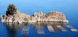
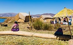
The Uros people are famous for creating artificial islands made from totora reeds. While historically located further from the shore, many were rebuilt closer to the city of Puno after a major storm in 1986. Today, approximately 1,200 Uros live on about 60 artificial islands, supporting themselves through fishing, hunting, and tourism.
Isla del Sol and Isla de la Luna
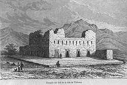
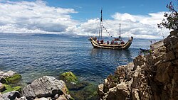
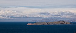
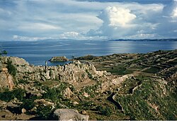
Isla del Sol is a site of great spiritual importance, once housing the Templo del Sol where the mummified body of Manco Cápac rested. Isla de la Luna features ruins built by the Inca (circa 1450–1532) directly atop earlier structures created by the Tiwanaku people between 650 and 1000 AD.
Taquile and Amantani
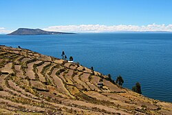
Taquile Island, located 45 km east of Puno, is inhabited by the Taquileños, who speak southern Quechua. The island features agricultural terraces and pre-Inca ruins. It served as a prison during the Spanish Colony before becoming the property of its inhabitants in 1970.
Climate and Geology
The lake maintains a cool surface temperature between 10 and 14 °C (50 to 57 °F). Geological drilling has recovered sediment cores dating back 370,000 years, revealing that the lake's levels fluctuated in tandem with global glacial periods; the lake was typically fresher and deeper during periods of expanded regional glaciation.
Transport and Navigation
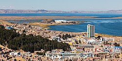
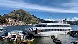
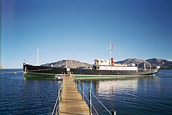
Due to its size and depth, the lake has supported significant maritime activity. Historically, large vessels like the SS Inca and the 2,200-ton SS Ollanta were transported in kit form by rail to the port of Puno. Today, the Manco Capac train barge links the standard gauge rail line in Peru with the meter gauge line in Bolivia.

Frequently Asked Questions
Is Lake Titicaca the highest lake in the world?
No, it is often called the highest navigable lake in the world, referring to its ability to support commercial craft. There are smaller lakes at higher elevations, such as the crater lake of Ojos del Salado in Chile.
What are the Uros islands made of?
The Uros islands are artificial islands constructed from totora sedges, a type of reed that grows in the shallow waters of the lake.
Is the water in Lake Titicaca fresh?
While often listed as a freshwater lake, it is actually slightly brackish, with salinity levels ranging from 5.2 to 5.5 parts per 1000.
Which countries share Lake Titicaca?
The lake is located on the border between Bolivia and Peru.
What is the significance of Isla del Sol?
Isla del Sol is an important archaeological and spiritual site, notably associated with the Inca and the resting place of Manco Cápac.