La Pampa: Argentina's Heart of the Pampas
Located in the center of Argentina, La Pampa is a sparsely populated province that embodies the spirit of the vast plains from which it takes its name. Known for its wide-open horizons and agricultural productivity, the province serves as a critical link between the humid east and the arid west of the country. With a population of 366,022 as of the 2022 census, it remains one of the most tranquil regions of Argentina, offering a unique blend of natural beauty and economic resilience.
Key Facts
- Capital: Santa Rosa
- Total Area: 143,440 km² (larger than Ireland or Greece)
- GDP Per Capita: US$ 13,500
- HDI: 0.861 (Very High)
- Primary Economy: Cattle ranching and agriculture
- Demonym: Pampeano
History and Evolution
European exploration of the region began in 1604 with Hernando Arias de Saavedra, followed by Jerónimo Luis de Cabrera in 1662. However, permanent Spanish settlements did not take hold until the 18th century, as indigenous resistance limited colonial expansion.
The landscape shifted significantly in the 19th century during Julio Roca's "conquest of the desert," which led to the establishment of the first Argentine settlements. In 1884, the Territorio Nacional de La Pampa Central was created. By 1915, the population had grown to 110,000 residents, signaling a period of rapid migration. The territory officially became a province in 1945.
The province's identity saw a brief change in 1952 when it was renamed after Eva Perón. Following a change in government in 1955 and the exile of the Peróns, the province reverted to its original name, La Pampa.
Geography and Natural Landscapes
La Pampa is characterized by its immense scale and varied terrain. The province is primarily a plain that tilts gently toward the east, dissected by transverse valleys (valles transversales). These NE-SW oriented valleys act as an ecotone—a transition zone—between the Dry and Humid Pampas and occasionally house large fossil inland dunes.
Water sources are limited to two major rivers: the Colorado (Red River) on the border with Río Negro and the Salado (Salty River). The Salado has seen declining water levels due to irrigation diversions in the neighboring Mendoza province.
While predominantly flat, the province features the Sierra de Lihuel Calel. This mountainous area is composed largely of ignimbrite (a volcanic rock formed from violent eruptions) and showcases diverse geological forms, including inselbergs, tors, and gnammas.
Protected Areas and Landmarks
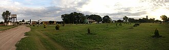
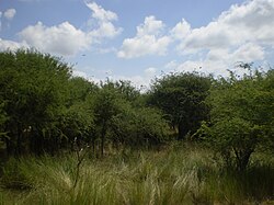
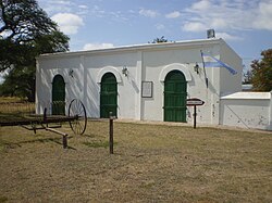
The province is home to significant natural preserves, including the Lihué Calel National Park and the Parque Luro Natural Prairie Preserve, which protect the region's unique biodiversity and geological history.
Climate and Temperature
La Pampa possesses a cool temperate climate with distinct continental characteristics, meaning it experiences large thermal amplitudes (the difference between the highest and lowest temperatures). The climate is split between a temperate east and a semi-arid west.
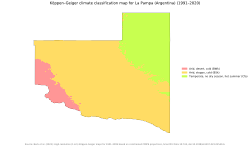
Precipitation is highly seasonal, occurring mostly from October to March. Rainfall decreases as one moves from the northeast (up to 820 mm) to the southwest (as low as 260 mm). This pattern is driven by the interaction of the South Atlantic High and the South Pacific High during the summer, while the Andes mountains act as a barrier to winter precipitation.
Annual mean temperatures range between 14 and 16 °C. Summer peaks in January can reach 24 °C in the north, while absolute maximums can hit 45 °C. Conversely, winter lows in July can drop to 6 °C, with record lows reaching −17 °C in the southwest.
Economy and Infrastructure
Historically an agricultural powerhouse, La Pampa's economy is heavily reliant on the land. Cattle ranching is the dominant activity, with over 3.6 million head of cattle recorded in 2002. The province also raises sheep, goats, and pigs.
The fertile northeast produces significant portions of Argentina's national output, including 13% of its sunflowers and 10% of its wheat, alongside maize, alfalfa, and barley. Other economic drivers include a robust dairy industry, honey production, and salt extraction.
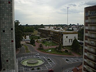
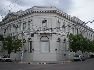
Beyond agriculture, the province possesses mineral wealth, including oil and gas wells, as well as deposits of copper, sodium chloride, and sodium sulfate. While tourism remains underdeveloped, visitors often explore the capital, Santa Rosa, or visit traditional estancias (large estates) for agritourism.
Provincial Overview Summary
| Category | Detail |
|---|---|
| Administrative Divisions | 22 Departments |
| Population Density | 2.55 inhabitants/km² |
| Major Rivers | Colorado and Salado |
| Key Crops | Sunflower, Wheat, Maize |
| Climate Type | Cool temperate / Semi-arid |
Government and Administration
The provincial government operates under three branches: the executive (led by the Governor), the legislative, and the judiciary (headed by the Supreme Court). The province is divided into 22 departments, with Santa Rosa serving as the administrative heart.
Frequently Asked Questions
What is the primary economic activity in La Pampa?
Cattle ranching is the most important economic activity, supported by a strong agricultural sector producing wheat, sunflowers, and maize, as well as oil and gas extraction.
How does the climate vary across the province?
The province transitions from a temperate climate in the east to a semi-arid climate in the west, with precipitation generally decreasing from the northeast to the southwest.
What are the "transverse valleys"?
These are NE-SW oriented valleys that cut through the plains, serving as an ecotone between the Dry and Humid Pampas and containing fossil inland dunes.
Who is the current governor of La Pampa?
The current governor is Sergio Ziliotto.
What is the significance of the Sierra de Lihuel Calel?
It is a mountainous region composed of volcanic ignimbrite, featuring unique geological landforms such as inselbergs and tors, and is the site of a National Park.