Kladovo: A Historic Gateway on the Danube
Perched on the right bank of the Danube river in the Bor District of eastern Serbia, Kladovo is a town and municipality where ancient history meets natural beauty. From its roots as a Roman strategic point to its role as a modern hub for cycling and river tourism, Kladovo offers a unique glimpse into the multicultural heritage of the Balkans.
The town is known by various names across different languages and eras. While called Kladovo in Serbian, it is known as Cladova in Romanian and was referred to as Zanes during the Roman Empire. Theories regarding the origin of its current name vary, ranging from the Celtic word for cemetery (kladiff) to Slavic terms for a well (kladenac) or a tree stump (klada).
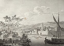
Key Facts
- Location: Bor District, Eastern Serbia, on the right bank of the Danube.
- Population: 8,171 in the town; 17,435 in the municipality (2022 census).
- Climate: Humid subtropical (Cfa).
- Key Landmarks: Fetislam Fortress, Trajan's Bridge remnants, and Tabula Traiana.
- Economy: Historically famous for sturgeon caviar; currently driven by manufacturing, trade, and tourism.
A Journey Through History
The region's human history stretches back to the Early Bronze Age, with pottery from the Kostolac-Kocofeni culture found in Donje Butorke. The area gained significant strategic importance under the Roman Empire when Emperor Trajan commissioned the construction of Trajan's Bridge, once the largest bridge ever built, spanning 1,200 meters with 20 pillars.
Following the Roman era, Slavs established a settlement called Novi Grad, which was later razed by Hungarians in 1502. The Ottomans rebuilt the town in 1524, renaming it Fethülislam. By 1666, the town was a linguistic melting pot where inhabitants spoke Slavic, Turkish, and Romanian languages.
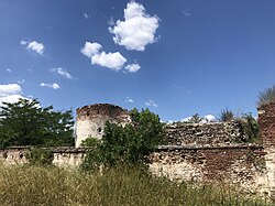
The Fetislam Fortress
Located just 300 meters from the town center, the Fetislam fortress (meaning "Gate of Islam") was constructed in 1524. Designed with a "Big Town" and "Little Town" for tiered defense, it dominated the Iron Gate gorge. While it served as a military structure until the end of World War I, it was converted into a sports complex in 1968, now featuring soccer fields, tennis courts, and an amphitheater.
Geography and Nature
Kladovo is surrounded by diverse landscapes, including the sandy Kladovski Peščar region and the black locust forests. A highlight for nature lovers is the Kladovski Rit, a marshy area that serves as a sanctuary for 140 bird species, including white-tailed eagles, pygmy cormorants, and herons.
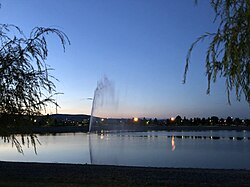
The creation of the artificial Đerdap Lake (between 1967 and 1972) for the Iron Gate I Hydroelectric Power Station significantly altered the landscape. This project inundated the old Roman coastal road, though the Tabula Traiana—a Roman memorial plaque—was meticulously lifted 25 meters to save it from the rising waters.
Economy and Local Culture
Historically, Kladovo was world-renowned for its sturgeon caviar. In the 1960s, the town exported up to 3 tons of caviar annually to Western Europe and the United States, utilizing a unique dry method of production. Today, the economy is more diversified, with manufacturing and retail trade being the primary employers.
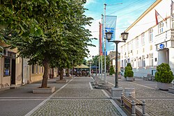
The town is also a growing destination for active tourism. It sits on the European bicycle path, welcoming thousands of cyclists annually. Visitors can enjoy the 3-kilometer quay, the Đerdap Archaeology Museum, and the local wine region of the Negotin Valley.
| Category | Town Data | Municipality Data |
|---|---|---|
| Area | 29.13 km² | 627.25 km² |
| Population (2022) | 8,171 | 17,435 |
| Elevation | 45 m | N/A |
| Primary Language | Serbian | Serbian (with Romanian presence) |
Frequently Asked Questions
What is the significance of Trajan's Bridge?
Trajan's Bridge was a Roman engineering marvel and the largest bridge in the world until the 16th century. Though mostly demolished or swept away, its entrance pillars remain visible on the banks of the Danube.
What is the Tabula Traiana?
The Tabula Traiana is a Roman memorial plaque. To prevent it from being submerged by the creation of the Đerdap Lake, it was raised 25 meters between 1966 and 1969 and is now observable from the lake.
Is Kladovo a good destination for cyclists?
Yes, Kladovo is located on the European bicycle path. It is highly accessible for cyclists, and the bus line from Belgrade to Kladovo is notably the only one in Serbia equipped with bicycle carriers.
What was the "Caviar of Kladovo"?
It was a high-quality sturgeon caviar produced using a dry method. The roe was considered particularly ripe because the fish traveled 850 km upstream from the Black Sea to reach this area.
What can visitors do at the Fetislam Fortress today?
The fortress has been repurposed into a sports and recreation complex. Visitors can find children's playgrounds, soccer, handball, volleyball, and tennis courts within its historic walls.