Fortaleza: The Vibrant Coastal Capital of Ceará
Perched on the northeastern coast of Brazil, Fortaleza is a city where urban energy meets the serenity of the Atlantic Ocean. Known by nicknames such as "Miami Brasileira" (Brazilian Miami) and "Terra da Luz" (Land of Light), this bustling municipality serves as the capital of the state of Ceará. From its colonial origins as a military stronghold to its current status as a major economic and cultural hub, Fortaleza offers a diverse blend of history, nature, and modernity.
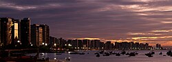
The city is defined by its stunning coastline, high-rise skylines, and a welcoming atmosphere that draws millions of visitors and residents alike. Whether it is the white sands of its urban beaches or the intellectual rigor of its universities, Fortaleza stands as a pillar of development in the Northeast region.

Key Facts
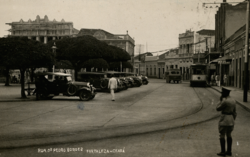
- Founded: April 13, 1726, named after the "Fort of Our Lady of the Assumption."
- Population: Approximately 2,578,483 in the municipality (2025), ranking it as the 4th most populous city in Brazil.
- Geography: A coastal city with an average elevation of 16 meters (52 ft).
- Economy: A metropolitan GDP (PPP) of $39.6 billion as of 2023.
- Climate: Tropical, characterized by high sunshine hours and a distinct rainy season from February to May.
- Education: Home to the Federal University of Ceará, ranked as the best in the state and 1st in the North and Northeast regions in 2016.
History and Evolution
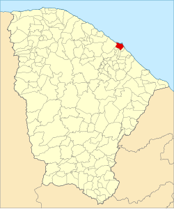
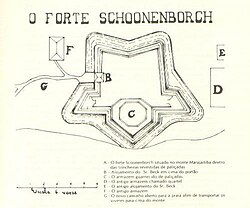
The roots of Fortaleza trace back to the colonial period, specifically to the construction of military fortifications to protect the territory. The city's name itself means "fortress," reflecting its origins as a defensive outpost.
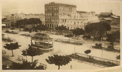
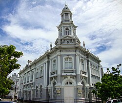
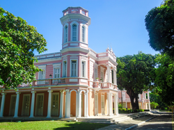
Over the centuries, the city transitioned through the Imperial and Republican periods, evolving from a small settlement into a sprawling metropolis. This growth is evident in its architecture, where historic palaces and cathedrals stand alongside contemporary skyscrapers.
Geography and Climate
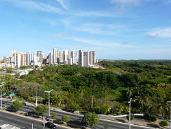
Fortaleza is located at coordinates 03°43′39″S 38°31′39″W. The city's environment is a mix of urban development and vital green spaces. Cocó Park is one of the most significant urban parks in Latin America, providing a critical ecological lung for the city.
The climate is consistently warm. The highest recorded temperatures reach around 35.2°C (95.4°F), while the lowest typically hover around 17.7°C (63.9°F). Precipitation is concentrated in the first half of the year, with April being the wettest month, averaging 385 mm of rainfall.
Demographics and Society
The population of Fortaleza is a rich tapestry of ethnicities. According to data, the majority of the population identifies as Pardo (multiracial) at 60%, followed by White (32.7%) and Black (7%).
Religion plays a central role in the community's social fabric. The 2022 census indicates that Catholicism remains the dominant faith at 60.03%, with Protestantism following at 26.31%.
Economy, Infrastructure, and Education
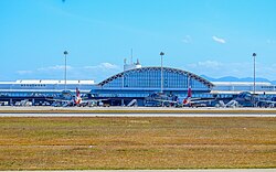
Fortaleza is a powerhouse in the Northeast, with a high Human Development Index (HDI) of 0.754. The economy is supported by tourism, services, and trade. The city is well-connected via the Pinto Martins International Airport (FOR) and the BR-116, the longest highway in Brazil.
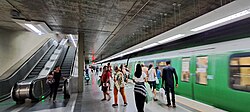
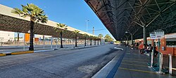
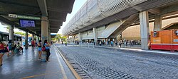
The transportation network includes a comprehensive metro system consisting of the South Line and two diesel Light Rail Vehicle (VLT) lines serving the West and Northeast corridors.
In terms of education, the city is a regional leader. The Federal University of Ceará is highly regarded, having been classified as the 10th best university in Brazil in 2016.
Culture, Tourism, and Leisure
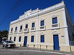
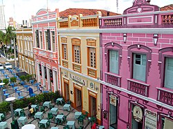
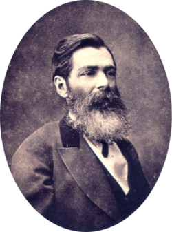
Culture in Fortaleza is vibrant and eclectic. The Dragão do Mar Center of Art and Culture and the Theatre José de Alencar are landmarks of the city's artistic spirit. The city is also known for its contributions to literature, notably through the works of José de Alencar and Rachel de Queiroz.
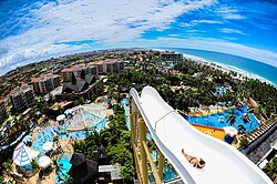
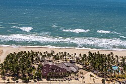
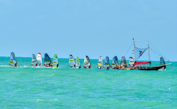
For leisure, the city's beaches are world-famous. Futuro Beach is a popular spot for locals and tourists, while the nearby Beach Park stands as the largest water park in Latin America.
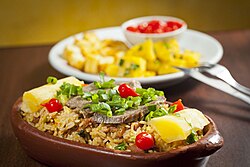
Gastronomy is another highlight, with traditional dishes like Baião de dois (a regional bean and rice dish) being staples in local restaurants.
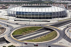
Sports are also a major draw. The Estádio Governador Plácido Castelo (Castelão) is the fourth largest stadium in Brazil and hosted matches for the 2013 FIFA Confederations Cup and the 2014 FIFA World Cup.
City Overview Summary
![BR-116 in Fortaleza, Ceará, the longest highway in the country, with 4,385 km (2,725 mi) of extension.[120]](/images/77/59/77591dff802e18e72372b227153f9e702606feb3a2afb195793892ec8d616bb8.jpg)
| Category | Detail |
|---|---|
| State | Ceará |
| Population (Municipality) | 2,578,483 (2025) |
| Area (Municipality) | 312.353 km² |
| Metro GDP (PPP) | $39.6 Billion (2023) |
| HDI (2010) | 0.754 (High) |
| Main Airport | Pinto Martins International (FOR) |
Frequently Asked Questions
![Mausoleum of Marshal Castelo Branco, former dictator[154] of Brazil.](/images/e3/44/e344146be9c50afc451f851fcf221d3b761afe2af58eda0d6570da6a33dffe89.jpg)
What is the best time to visit Fortaleza based on weather?
The best time to visit is generally during the drier months from July to December, as the heaviest rains occur between February and May.
What are the most famous tourist attractions in the city?
Key attractions include the Dragão do Mar Center of Art and Culture, Cocó Park, Futuro Beach, and the massive Beach Park water park.
How is the public transportation system in Fortaleza?
The city utilizes a mix of urban buses, a metro system (South Line), and Light Rail Vehicles (VLT) on the West and Northeast lines.
What is a typical dish from the Fortaleza region?
Baião de dois, a traditional dish of Ceará origin, is very common and highly recommended in local restaurants.
Which university is the most prominent in the city?
The Federal University of Ceará (UFC) is the most prominent, recognized as the best university in the state and a top institution in the North and Northeast regions of Brazil.