Craig Phadrig: The Ancient Pictish Hill Fort of Inverness
Perched on the western edge of Inverness, Scotland, Craig Phadrig (Scottish Gaelic: Creag Phàdraig, meaning "Rock of Patrick") stands as a silent witness to the early medieval history of the Highlands. This forested hill, rising 172 metres (564 ft) above sea level, offers a commanding view of the Beauly Firth to the north and the mouth of the River Ness to the northeast.
Today, the site is managed by Forestry and Land Scotland, preserving a location that likely served as a seat of power for the Picts, the ancient people of northern and eastern Scotland.
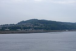
Key Facts
- Location: Western edge of Inverness, Scotland.
- Elevation: 172 metres (564 ft) AOD.
- Fort Type: Vitrified hill fort.
- Primary Periods: Iron Age and Pictish.
- Key Figure: Associated with King Bridei mac Maelchon.
- Status: Scheduled monument.
The Architecture of the Fort
The summit of Craig Phadrig is occupied by a vitrified fort. Vitrification is a process where stone structures are subjected to intense fire, causing the rock to melt and fuse into a glass-like material.
The fortifications consist of multiple layers of defense:
- Inner Wall: Defines an area approximately 75 metres (246 ft) long by 23 metres (75 ft) wide, with surviving sections reaching a height of 1.2 metres (3 ft 11 in).
- Outer Wall: A second defensive perimeter surrounding the inner core.
- Hornwork: Evidence of a third wall or hornwork (a defensive earthwork) located to the east.
Archaeological Findings
Radiocarbon dating conducted in the 1970s indicates that the inner wall was constructed during the 4th century. Further excavations revealed that the site remained active into the 7th century, uncovering evidence of Pictish occupation. Notable finds include metal-working implements and pottery imported from France, suggesting the inhabitants were engaged in long-distance trade.
The Legend of Bridei and St Columba
Craig Phadrig is widely believed to have been the royal base of the Pictish king Bridei mac Maelchon, who ruled approximately between 554 and 584 AD.
Historical tradition, specifically recorded in Adomnán's Life of Columba, describes several encounters between King Bridei and St Columba around 565 AD. While Craig Phadrig is the most commonly assumed site for these meetings, the identification is not universally accepted by historians. Other potential locations suggested include Inverness Castle and Urquhart Castle.
Site Specifications Summary
| Feature | Detail |
|---|---|
| Coordinates | 57°28′37″N 4°16′08″W |
| Materials | Stone and Earth |
| Inner Wall Dimensions | 75m x 23m |
| Max Height (AOD) | 172 metres (564 ft) |
| Construction Date | 4th Century (Inner Wall) |
| Occupation Evidence | 7th Century (Pictish) |
Frequently Asked Questions
What does the name Craig Phadrig mean?
The name comes from the Scottish Gaelic Creag Phàdraig, which translates to "Rock of Patrick."
What is a vitrified fort?
A vitrified fort is a stone-built structure that has been exposed to such extreme heat—either through accidental fire or intentional attack—that the stones have melted and fused together into a glass-like substance.
Who was Bridei mac Maelchon?
Bridei mac Maelchon was a Pictish king who ruled from approximately 554 to 584 AD and is famously associated with the visits of St Columba.
What evidence of trade was found at the site?
Excavations revealed French pottery dating from the 7th century, indicating that the residents of the fort had trade links extending to mainland Europe.
Is Craig Phadrig open to the public?
The hill is currently owned and managed by Forestry and Land Scotland and is recognized as a scheduled monument.