Cochabamba: The Garden City of Bolivia
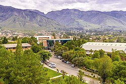
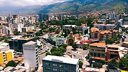
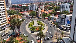
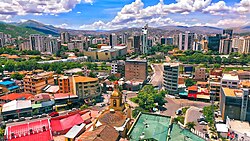
Nestled within a lush valley of the Andes mountain range in central Bolivia, Cochabamba (known in Aymara and Quechua as Quchapampa) is a vibrant hub of culture, agriculture, and history. Often referred to as the "City of Eternal Spring" or "The Garden City," its name is derived from the Quechua words qucha (lake) and pampa (open plain). As the fourth largest city in Bolivia and the capital of the Cochabamba Department, it serves as a vital link between the highlands and the lowlands.
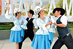
The city is characterized by its welcoming atmosphere and its residents, known as cochabambinos or colloquially as cochalas. From its colonial roots to its modern urban expansion, Cochabamba blends traditional Andean heritage with contemporary metropolitan growth.
Key Facts

- Founded: August 15, 1571, as Villa de Oropesa.
- Population: 661,484 (Urban, 2024 Census) with a metro population of 1,113,437.
- Elevation: Approximately 2,570 meters (8,430 feet) above sea level.
- Climate: Classified as BSk (semi-arid), known for mild, spring-like weather.
- Economy: A major agricultural center and service hub for central Bolivia.
- HDI: 0.804 (Very High, as of 2013).
History and Evolution
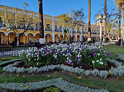
The Spanish presence in the valley began in 1542 with Garci Ruiz de Orellana, who purchased land from local tribal chiefs. The city was formally founded in January 1571 as Villa de Oropesa by order of Viceroy Francisco de Toledo. Its primary purpose was to serve as an agricultural production center, providing food and timber for the wealthy mining towns of the Altiplano, most notably Potosí.
During the 16th and 17th centuries, Cochabamba thrived due to the silver boom in Potosí. However, the city faced a decline in the 18th century as mining activity waned. In 1786, King Charles III of Spain renamed it the "loyal and valiant" Villa of Cochabamba to honor its role in suppressing indigenous rebellions in Oruro. By the late 19th century, the city reclaimed its success as Bolivia's premier agricultural center.
Geography and Climate
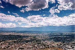
Cochabamba is situated in a mesothermal valley—a valley with a moderate temperature range. The basin floor averages 2,600 meters in elevation, while the surrounding peaks reach much higher, with Mount Tunari peaking at 5,023 meters. The city is built on Quaternary sedimentary fill, surrounded by ancient Paleozoic and Cretaceous rock formations.
The climate is remarkably stable, which earned the city its "Eternal Spring" nickname. While it experiences a rainy season from November to March, the temperatures remain mild year-round, making it an ideal environment for the agriculture that sustains the region.
| Metric | Warmest Month (Oct/Nov) | Coolest Month (Jun/Jul) | Annual Average/Total |
|---|---|---|---|
| Mean Daily Max Temp | 27.8°C (82.0°F) | 24.8°C (76.6°F) | ~25-26°C |
| Mean Daily Min Temp | 10.3°C (50.5°F) | 1.9°C (35.4°F) | ~8.3°C |
| Average Precipitation | 45.8 mm (Nov) | 1.8 mm (Jul) | 469.5 mm |
Urban Life and Infrastructure
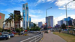
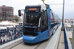
Modern Cochabamba is a bustling municipality with a diverse economy spanning commerce, services, and agriculture. The city has invested heavily in infrastructure to manage its growing population. A notable recent addition is Mi Tren, an interurban light rail network that opened its Red Line and first phase of the Green Line on September 13, 2022, connecting the city with Suticollo, El Castillo, and San Simón University.
Transport and Connectivity
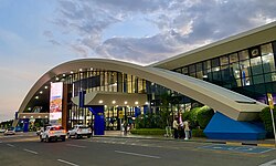
Beyond the light rail, the city relies on a vast network of nearly 70 bus and minibus lines, as well as over 60 trufis (fixed-route taxis). For international travel, the Jorge Wilstermann International Airport serves as the primary gateway to the region.
Education and Culture
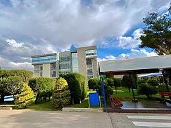
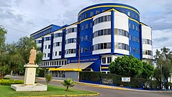
Cochabamba is a center for higher learning, hosting institutions such as San Simón University, the Bolivian Private University, the Private University of Valle, and the Bolivian Catholic University of San Pablo. Culturally, the city is known for the BAU (Bienal de Arte Urbano), an international street art festival held every two years since 2011, which transforms neighborhoods like Villa Coronilla and Esperanza into open-air galleries.
Notable Neighborhoods and Landmarks
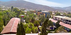
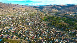
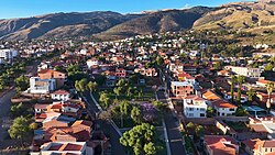
The city is divided into several distinct zones, each with its own character. The northern areas include Cala Cala, La Recoleta, and Queru Queru, while the northeast is marked by the Muyurina area. The south zone, viewed from the Alalay Lake, continues to expand as the city grows.
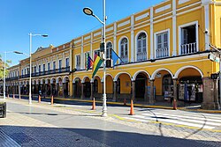
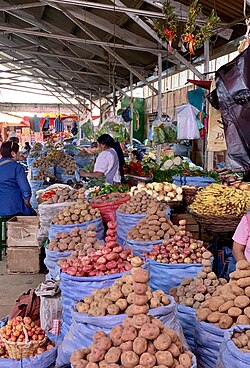
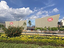
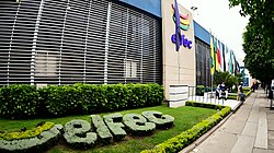
Key administrative and social landmarks include the Departmental Government of Cochabamba, the City Hall, and the ELFEC Headquarters. For entertainment, the Megacenter complex provides movie theaters and family activities, while the Calatayud Market remains a central spot for local commerce, particularly for potato vendors.
Frequently Asked Questions
What does the name Cochabamba mean?
The name comes from the Quechua words qucha, meaning "lake," and pampa, meaning "open plain."
Why is it called the "City of Eternal Spring"?
It earned this nickname due to its mesothermal valley location, which provides mild, pleasant temperatures throughout the year.
What is Mi Tren?
Mi Tren is an interurban light rail system launched in 2022 to improve connectivity between Cochabamba and surrounding areas like San Simón University and Suticollo.
Who are some famous people from Cochabamba?
Notable residents include the folk music group Los Kjarkas, educator Jaime Escalante, and author Adela Zamudio.
What was the original name of the city?
The city was founded in 1571 as Villa de Oropesa before being renamed the Villa of Cochabamba in 1786.