British ColumbiaBC geographyVancouverVictoriaCanadian provinces

British Columbia: Canada's Pacific Powerhouse

British Columbia: Canada's Pacific Powerhouse Located on the westernmost edge of Canada, British Columbia (BC) is a province defined by its breathtaking physical relief and strategic posi...

British Columbia: Canada's Pacific Powerhouse

Located on the westernmost edge of Canada, British Columbia (BC) is a province defined by its breathtaking physical relief and strategic position on the Pacific coast. From the rugged peaks of the Rockies to the temperate rainforests of the coast, BC offers a diverse landscape that has shaped its industry, settlement patterns, and cultural identity since its entry into the Canadian Confederation on July 20, 1871.

As the third most populous province in Canada, British Columbia balances a high-tech urban economy in its major cities with a deep-rooted connection to the natural world. Its motto, Splendor sine occasu ("Splendour without diminishment"), reflects the enduring beauty and wealth of its natural resources.
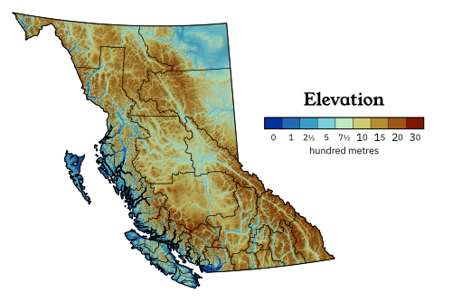
British Columbia's geography is epitomized by the variety and intensity of its physical relief, which has defined patterns of settlement and industry since colonization.

Key Facts

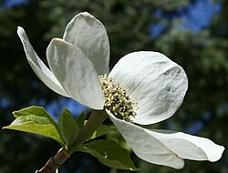
The flower of the Pacific dogwood is often associated with British Columbia.
  • Capital: Victoria
  • Largest City: Vancouver
  • Population: 5,000,879 (2021 Census)
  • Total Area: 944,735 km² (5th largest in Canada)
  • GDP: CA$ 429.089 billion (2024)
  • Official Symbols: Pacific dogwood (flower), Western red cedar (tree), and Steller's jay (bird).

Geography and Climate

The geography of British Columbia is characterized by extreme variety. The province is divided into six distinct ecozones: Pacific Marine, Pacific Maritime, Boreal Cordillera, Montane Cordillera, Taiga Plains, and the interior plateaus. This varied terrain creates a wide range of climates, from the mild, wet winters of the coast to the cold, snowy winters of the interior.
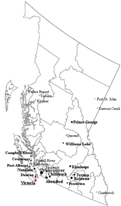
Outline map of British Columbia with significant cities and towns.
Outline map of British Columbia with significant cities and towns

The coastal regions, such as Vancouver and Victoria, experience temperate climates, while the interior regions like the Okanagan Valley are known for warmer summers, making them ideal for vineyards. In contrast, northern regions like Fort Nelson experience severe winters with temperatures frequently dropping below -20°C.
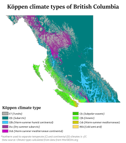
Köppen climate types in British Columbia

Water and Landscapes

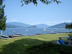
Water is central to the province's identity. The Strait of Georgia serves as a vital maritime corridor, while the interior is dotted with massive lakes like Shuswap Lake. The province's mountainous terrain is dominated by the Canadian Rockies and the Coast Mountains, featuring iconic peaks such as Mount Robson.
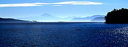
The Strait of Georgia, near Vancouver

Shuswap Lake as seen from Sorrento

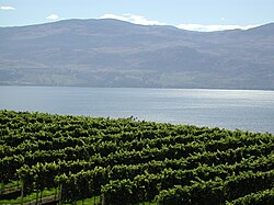
The Okanagan region has a climate suitable for vineyards.

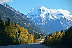
Mount Robson, Canadian Rockies

Nature and Conservation

British Columbia is a global biodiversity hotspot. It is home to a vast array of species, including 465 bird species and 29 marine mammal species. The province manages several critical habitats through its network of protected areas, including seven national parks and reserves.

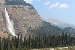
Notable protected areas include Yoho National Park, Glacier National Park, and the Pacific Rim National Park Reserve. These areas protect everything from alpine tundra to ancient rainforests.
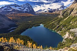
Odaray Mountain and Lake O'Hara

Yoho National Park
Yoho National Park

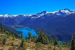
Cheakamus Lake in Garibaldi Provincial Park

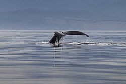
Humpback whale in Sooke coast

Biodiversity Overview of British Columbia
Organism Type Total Species Red-listed (At Risk)
Plants 2,333 257
Birds 465 34
Freshwater Fish 80 24
Marine Mammals 29 3
Butterflies 187 19

History and Culture

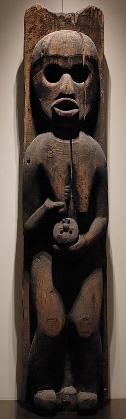
Long before European colonization, the region was inhabited by diverse Indigenous societies. The artistic heritage of these peoples is evident in the intricate Thunderbird masks and house poles of the Kwakwaka'wakw and other First Nations.
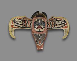
ʼNamgis Thunderbird Transformation Mask, 19th century

Kwakwaka'wakw house pole depicting a woman holding an infant, second half of the 19th century

The colonial era began with the establishment of trading posts like Fort Victoria in 1845. The province's growth was accelerated by gold rushes and the eventual completion of the Canadian Pacific Railway in 1885, which linked the Pacific coast to the rest of Canada.
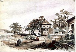
Fort Victoria in 1845

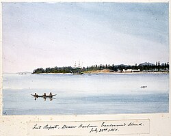
Fort Rupert, Vancouver Island, 1851

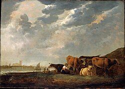
Cattle near the Maas by Dutch painter Aelbert Cuyp. Moody likened his vision of the nascent Colony of British Columbia to the pastoral scenes painted by Cuyp.

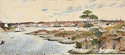
Victoria, 1864
Victoria, 1864

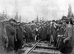
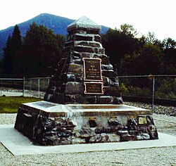
Lord Strathcona drives the Last Spike of the Canadian Pacific Railway, at Craigellachie, November 7, 1885. Completion of the transcontinental railroad was a condition of British Columbia's entry into Confederation.

Memorial to the "last spike" in Craigellachie

Modern Society and Demographics

Today, British Columbia is a multicultural hub. While English is the de facto official language, the province has significant Punjabi, Cantonese, and Mandarin speaking populations. The 2021 census indicates a diverse ethnic makeup, with strong English, Canadian, Scottish, and Chinese roots.
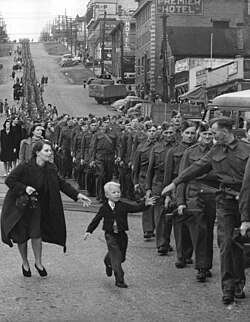
Wait for Me, Daddy, a photo taken by Claude P. Dettloff of the British Columbia Regiment marching in New Westminster, October 1940

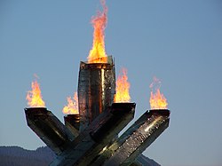
The cauldron of the 2010 Winter Olympics in Vancouver

Government and Economy

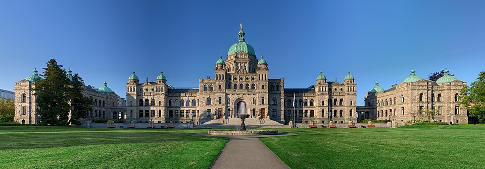
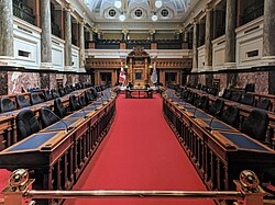
British Columbia operates as a parliamentary constitutional monarchy. The head of government is the Premier, currently David Eby, and the representative of the Crown is the Lieutenant Governor. The Legislative Assembly meets in Victoria to govern the province.
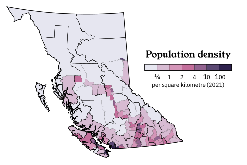
Population density map of British Columbia

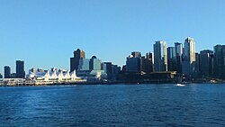
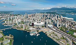
The Vancouver skyline

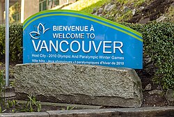
A Vancouver welcome sign in both English and French

Canada Place in Downtown Vancouver

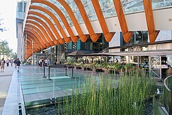
Entrance to Telus Garden

The British Columbia Parliament Buildings in Victoria

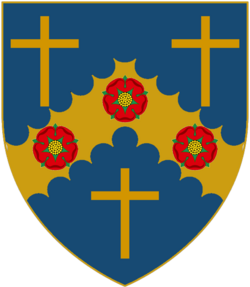
Coat of arms' escutcheon of the current lieutenant governor

David Eby is premier, BC's head of government.

The meeting chamber of the Legislative Assembly

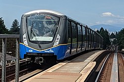
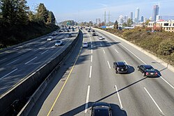
The economy is robust, ranking 4th in Canada by GDP. Key drivers include natural resources, tourism, and a growing technology sector. The province's infrastructure is supported by a comprehensive network of highways and public transit, including the SkyTrain in Metro Vancouver.
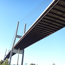
The Alex Fraser Bridge on Highway 91 between Richmond and Delta

British Columbia Highway 1 near Brentwood, Burnaby

SkyTrain is the rail rapid transit system that serves Metro Vancouver.

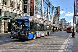
Trolley buses in Vancouver

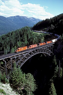
CPR train traversing the Stoney Creek Bridge

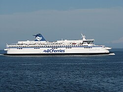
Spirit of Vancouver Island S-class ferry

Arts, Education, and Lifestyle

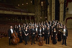
BC is renowned for its vibrant arts scene, from the paintings of Emily Carr to the performances of the Vancouver Symphony Orchestra. The province's culinary identity is equally diverse, featuring local specialties like the Nanaimo bar and the BC roll (sushi with barbecued salmon and cucumber).
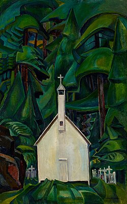
Church at Yuquot Village by Emily Carr (1929)

The Vancouver Symphony Orchestra at the Orpheum concert hall (2019)

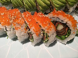
The BC roll is a kind of sushi containing barbecued salmon and cucumber

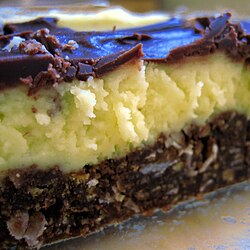
Nanaimo bars originate from the city of Nanaimo and consist of a crumb and nut base, custard middle, and ganache top layer

Education is a priority, with world-class institutions such as the University of British Columbia (UBC) and Simon Fraser University (SFU) leading research and academic excellence.
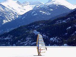
Ice sailing in Whistler

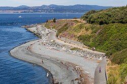
Shoreline Trail in Victoria

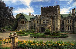
Hatley Castle on the campus of Royal Roads University

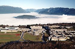
Aerial view of Simon Fraser University in Burnaby

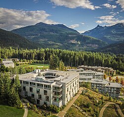
Quest University Canada Academic Building, aerial view

Frequently Asked Questions

What is the largest city in British Columbia?

Vancouver is the largest city in the province and the center of the Greater Vancouver metropolitan area.

When did British Columbia join the Canadian Confederation?

British Columbia became the seventh province to join Canada on July 20, 1871.

What are the official symbols of the province?

The official symbols include the Pacific dogwood (flower), the Western red cedar (tree), the Steller's jay (bird), and the Kermode bear (mammal).

Which national parks are located in BC?

BC contains seven national parks and reserves, including Yoho, Glacier, Kootenay, Mount Revelstoke, Gulf Islands, Gwaii Haanas, and Pacific Rim.

What is a Nanaimo bar?

A Nanaimo bar is a regional dessert originating from the city of Nanaimo, consisting of a crumb and nut base, a custard middle, and a ganache top layer.