Bremen: A Comprehensive Guide to the Hanseatic City
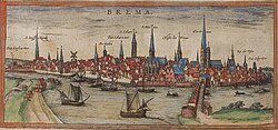
Bremen, known in Low German as Breem or Bräm, is a historic city-state in northern Germany. Situated along the Weser River, it blends a rich maritime heritage with modern urban development. From its opulent Renaissance architecture to its role as a center for science and education, Bremen offers a unique glimpse into the evolution of a German trade hub.
The city is characterized by its flat landscape and strategic location, serving as a vital link between the interior of Germany and the North Sea. Its identity is deeply tied to the Hanseatic League, a medieval commercial and defensive confederation of merchant guilds and market towns.
Key Facts
- State Status: Bremen is one of Germany's city-states.
- Population: Approximately 586,271 in the city (as of 2024) and 2.8 million in the metro area.
- UNESCO Site: The Town Hall and the Bremen Roland are recognized World Heritage Sites.
- Geography: It holds the lowest high point of all German states, with its highest natural feature reaching only 32.5 meters.
- Economy: GDP per capita was reported at $53,379 in 2013, exceeding the national average.
Geography and Climate
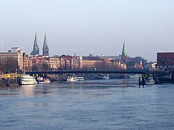
Bremen is located approximately 50 kilometers east of Oldenburg and 110 kilometers southwest of Hamburg. The inner city is built upon a Weser dune, with the Bremen Cathedral sitting at a natural height of 10.5 meters above sea level. The city's highest natural point is found in Friedehorst Park in the Burglesum borough.
The region experiences a maritime climate. Summers are mild, with average highs between 20.2°C and 22.6°C from June to August. Winters are cold, with average lows ranging from -1.1°C to 0.3°C between December and February. Due to its coastal influence, spring typically arrives later here than in southwestern Germany, while autumn remains mild into October.
Demographics and Population Growth
Bremen has seen significant population shifts over the centuries. From a population of 10,000 in 1350, it grew steadily, reaching over 500,000 by the mid-20th century. The city experienced an economic boom during the Wirtschaftswunder (Economic Miracle) of the 1950s and 60s, which attracted a large migrant workforce, primarily from Southern Europe and Turkey.
More recent immigration waves have included citizens from Poland, Bulgaria, and other former East Bloc countries following EU expansion, as well as refugees from Syria and other conflict zones since 2015. As of late 2024, the largest minority populations in Bremen are from Turkey, Syria, and Ukraine.
| Category | Detail |
|---|---|
| Mayor | Andreas Bovenschulte (SPD) |
| City Area | 326.73 km² |
| Metro Population | 2,800,000 |
| Elevation | 12 m (Average) |
| Time Zone | CET (UTC+1) / CEST (UTC+2) |
Administrative Structure
The city is divided into five main boroughs (Stadtbezirke), each containing various districts and subdistricts:
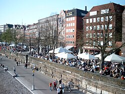
- Mitte (Central): Includes the Altstadt (Old City), the historic Schnoor quarter, and the ports.
- Süd (South): Encompasses Neustadt, the airport, and the Huchting area.
- Ost (East): Home to the University of Bremen, the Weserstadion, and the Vahr district.
- West: Includes Blockland, Findorff, and Gröpelingen.
- Nord (North): Comprises Vegesack, Blumenthal, and Farge.
Main Sights and Landmarks
The heart of the city is the Marktplatz (Market Square), dominated by the Bremen Town Hall. Originally built in the Gothic style between 1405 and 1410, its facade was updated to the Renaissance style between 1609 and 1612. The building houses the Ratskeller, a restaurant famous for its original decor and massive wine barrels.
Other notable attractions include:
- Universum Science Center: A modern museum dedicated to scientific exploration.
- Rhododendron-Park Bremen: A botanical garden featuring a vast collection of azaleas and rhododendrons.
- Beck's Brewery: A popular destination for public tours and beer tasting.
- Focke Museum: A center for art and cultural history.
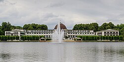
Education, Science, and Infrastructure
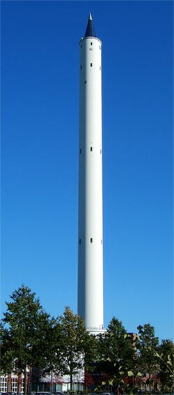
Bremen is a hub for academic and scientific research. The University of Bremen is a prominent institution, featuring specialized structures such as the Fallturm (Drop Tower) for microgravity research.
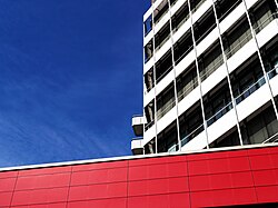
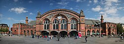
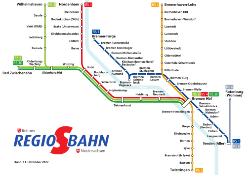
The city's transport infrastructure is centered around the Bremen Central Station and a comprehensive S-Bahn (suburban train) network that connects the city to its surrounding regions.
Sports and Culture
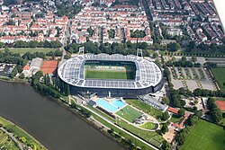
Sports play a significant role in the city's social fabric, most notably through football. The Weserstadion serves as the home ground for Werder Bremen, one of Germany's most recognized football clubs.
Frequently Asked Questions
What is the highest point in Bremen?
The highest natural feature in the city of Bremen is 32.5 meters above sea level, located in Friedehorst Park in the northwestern borough of Burglesum.
Which landmarks in Bremen are UNESCO World Heritage Sites?
The Bremen Town Hall and the Bremen Roland statue were added to the UNESCO World Heritage list in July 2004.
What is the climate like in Bremen?
Bremen has a maritime climate with mild summers (average highs of 20.2 to 22.6°C) and cold winters (average lows of -1.1 to 0.3°C), with precipitation spread throughout the year.
How is the city of Bremen administratively divided?
Bremen is divided into five boroughs: Mitte, Süd, Ost, West, and Nord, which are further subdivided into urban districts and subdistricts.
What is the economic status of Bremen compared to Germany?
According to 2013 OECD data, Bremen's GDP per capita was $53,379, which was higher than the overall German average of $46,268 for the same year.