Bernal: A Key Urban Center in the Partido of Quilmes
Located in the heart of the Buenos Aires Province, Bernal is a vibrant city that serves as a vital residential and commercial hub. Situated approximately 10 miles south of the capital city of Buenos Aires, it stands as the second largest and most populated city within the Partido of Quilmes (the administrative district or municipality of Quilmes).
Founded in 1850 by Pedro Bernal, the settlement evolved over more than a century before being officially declared a city in 1970. Today, it is a densely populated urban area characterized by its strategic location and diverse neighborhoods.
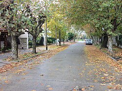
Geography and Boundaries
Bernal is positioned in the northeast of the Quilmes district. Its geography is defined by a mix of urban sprawl and natural boundaries. To the northeast, the city is bordered by the Río de la Plata, one of the widest rivers in the world. Its other boundaries include the city of Quilmes to the southeast, and the districts of Almirante Brown and Lomas de Zamora to the southwest. To the northwest, Bernal borders the districts of Avellaneda and Lanús.
Urban Structure and Neighborhoods
The city is physically and socially divided by the Railway General Roca, a major train line that splits the urban landscape into two primary sections. This infrastructure is central to the city's connectivity within the Greater Buenos Aires metropolitan area.
Bernal is composed of several distinct neighborhoods, including:
- Bernal Centre: The commercial and administrative heart of the city.
- Barrio Parque: A residential area known for its layout.
- Villa Cramer: One of the established residential sectors.
- Villa Alcira: Another key neighborhood contributing to the city's population density.
Key Facts
- Founded: 1850 by Pedro Bernal.
- City Status: Officially declared a city in 1970.
- Population: 130,790 (as of 2001 census).
- Total Area: 23.62 square kilometers.
- Population Density: 5,537.26 people per square kilometer.
- Elevation: 16 meters above sea level.
- Current Government: Led by Mayor Mayra Mendoza.
City Overview Summary
| Category | Detail |
|---|---|
| Province | Buenos Aires Province |
| Partido | Quilmes |
| Postal Code | B1876 |
| Time Zone | UTC-3 (Standard) / UTC-2 (DST) |
| Coordinates | 34°42′00″S 58°17′00″W |
Frequently Asked Questions
Who founded the city of Bernal?
The city was founded in 1850 by Pedro Bernal.
Where is Bernal located in relation to Buenos Aires?
Bernal is located in the northeast of the Partido of Quilmes, approximately 10 miles south of the city of Buenos Aires.
What are the main neighborhoods in Bernal?
The city consists of several neighborhoods, most notably Bernal Centre, Barrio Parque, Villa Cramer, and Villa Alcira.
What major landmark divides the city?
The Railway General Roca divides the city of Bernal into two sections.
What is the population density of Bernal?
Based on 2001 data, the population density is 5,537.26 people per square kilometer.