Beardmore Glacier Left Tributaries: Mapping the Queen Alexandra Range
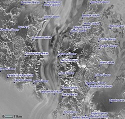
The Beardmore Glacier serves as one of Antarctica's most significant ice streams, acting as a primary conduit for ice flowing from the polar plateau. Along its western flank, the Queen Alexandra Range contributes a series of left tributaries—glaciers that flow from the northwest into the main body of the Beardmore. These ice streams are not only geological features but also historical markers of the Heroic Age of Antarctic Exploration.
The tributaries are generally categorized by their position along the main glacier: the upper head, the central section, and the lower section. Many of these features were first identified and named by the British Antarctic Expedition (BrAE) between 1907 and 1913.
Key Facts
- Geographic Origin: All left tributaries originate from the Queen Alexandra Range.
- Historical Naming: Most features were named by the BrAE (1907–13) or the New Zealand Geological Survey Antarctic Expedition (NZGSAE, 1961–62).
- Naming Anomalies: Table Bay is a glacier, despite its name, and the positions of Swinford and Berwick Glaciers were historically transposed on some maps.
- Memorials: Several glaciers are named after expedition members, such as Edgar Evans and Eric Marshall's mother.
Upper Section Tributaries
Near the head of the Beardmore Glacier, the landscape is defined by rugged peaks and smaller ice flows. Table Bay is a small glacier situated between Mount Augusta and Mount Holloway. Despite its name—a misnomer retained for over fifty years due to uniform usage—it is a glacier that drains eastward into the Beardmore at Lizard Point, a low morainic point (a ridge of debris deposited by a glacier) marking the bay's entrance.
Also in this region is the Swinford Glacier. Stretching 6 nautical miles (11 km), it flows southeast between Mount Holloway and the Marshall Mountains. Named by Ernest Shackleton for his eldest son, Raymond Swinford, this glacier was historically confused with the Berwick Glacier on several maps.
Central Section Tributaries
The central section features a higher density of tributaries, including the Berwick Glacier. This 14-nautical-mile (26 km) glacier flows southeast between the Marshall and Adams Mountains, entering the Beardmore at Willey Point. It was named after HMS Berwick, a vessel served on by Lt. Jameson B. Adams.
Feeding into the Berwick is the Moody Glacier, located between Martin Ridge and the Adams Mountains. It was named by the US-ACAN for Construction Electrician P.R. Moody of the US Navy, who served at McMurdo Station in 1963.
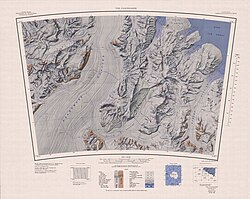
Further east, the Bingley Glacier extends 8 nautical miles (15 km) from the slopes of Mount Kirkpatrick, Mount Dickerson, and Barnes Peak. Shackleton named it after Bingley, England, his family's ancestral home. Nearby is the Cherry Icefall, a steep icefall on the south side of Barnes Peak. Originally called Cherry Glacier after zoologist Apsley Cherry-Garrard, the name was updated by the NZGSAE to better describe the feature's steep topography.
The central region is rounded out by the Hewson Glacier, a 15-nautical-mile (28 km) flow named for surveyor Ronald Hewson, and the Garrard Glacier. The latter drains from the névé (a field of granular snow) between Mount Lockwood and Mount Kirkpatrick, named in honor of Apsley Cherry-Garrard.
Lower Section Tributaries
As the Beardmore Glacier moves toward the coast, it receives final contributions from the Queen Alexandra Range. The Alice Glacier flows 13 nautical miles (24 km) east to Sirohi Point; it was named for the mother of Dr. Eric Marshall.
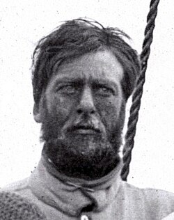
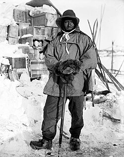
The Evans Glacier flows east just south of the Owen Hills. It serves as a poignant memorial to Petty Officer Edgar Evans, a member of Robert Falcon Scott's South Pole Party, who perished in this vicinity.
Finally, the Socks Glacier is a small ice flow north of the Owen Hills. It is named after one of the expedition ponies. Socks was the last surviving pony of the South Pole Party, eventually falling into a crevasse on December 7, 1908.
Summary of Left Tributaries
| Glacier Name | Length / Size | Key Landmark / Connection | Named After |
|---|---|---|---|
| Swinford | 6 nmi (11 km) | Marshall Mountains | Raymond Swinford |
| Berwick | 14 nmi (26 km) | Willey Point | HMS Berwick |
| Bingley | 8 nmi (15 km) | Mount Kirkpatrick | Bingley, England |
| Hewson | 15 nmi (28 km) | The Cloudmaker | Ronald Hewson |
| Alice | 13 nmi (24 km) | Sirohi Point | Mother of Dr. Eric Marshall |
| Evans | N/A | Owen Hills | Petty Officer Edgar Evans |
Frequently Asked Questions
Why is Table Bay called a "Bay" if it is a glacier?
The term is a misnomer based on the original appearance of the feature as observed by the Southern Polar Party of the BrAE (1910–13). The name has been retained for over fifty years due to consistent usage in geographical records.
Which two glaciers were historically confused on maps?
The Swinford Glacier and the Berwick Glacier were transposed on the BrAE map of 1910–13 and some subsequent maps. The Swinford Glacier is actually located 12 nautical miles southwest of the Berwick Glacier.
Who was Socks Glacier named after?
It was named after Socks, a pony used by the South Pole Party. Socks was the last pony to survive the journey before falling into a crevasse on December 7, 1908.
What is the difference between Cherry Glacier and Cherry Icefall?
The feature was originally named Cherry Glacier by the BrAE (1910–13). However, the NZGSAE (1961–62) recommended changing the name to Cherry Icefall to more accurately describe the steep nature of the ice formation.
Which tributary is associated with the death of Edgar Evans?
The Evans Glacier, located just south of the Owen Hills, was named by the NZGSAE for Petty Officer Edgar Evans, who died near that location during the BrAE (1910-13) expedition.